If one accesses the road to Howland Flat from Church Street – the route that passes by the La Porte cemetery – one will pass over the following steel bridge (crossing over Slate Creek) after dropping down into the canyon:

I will discuss this bridge and its surroundings in a future article. I use it here only as a point of reference.
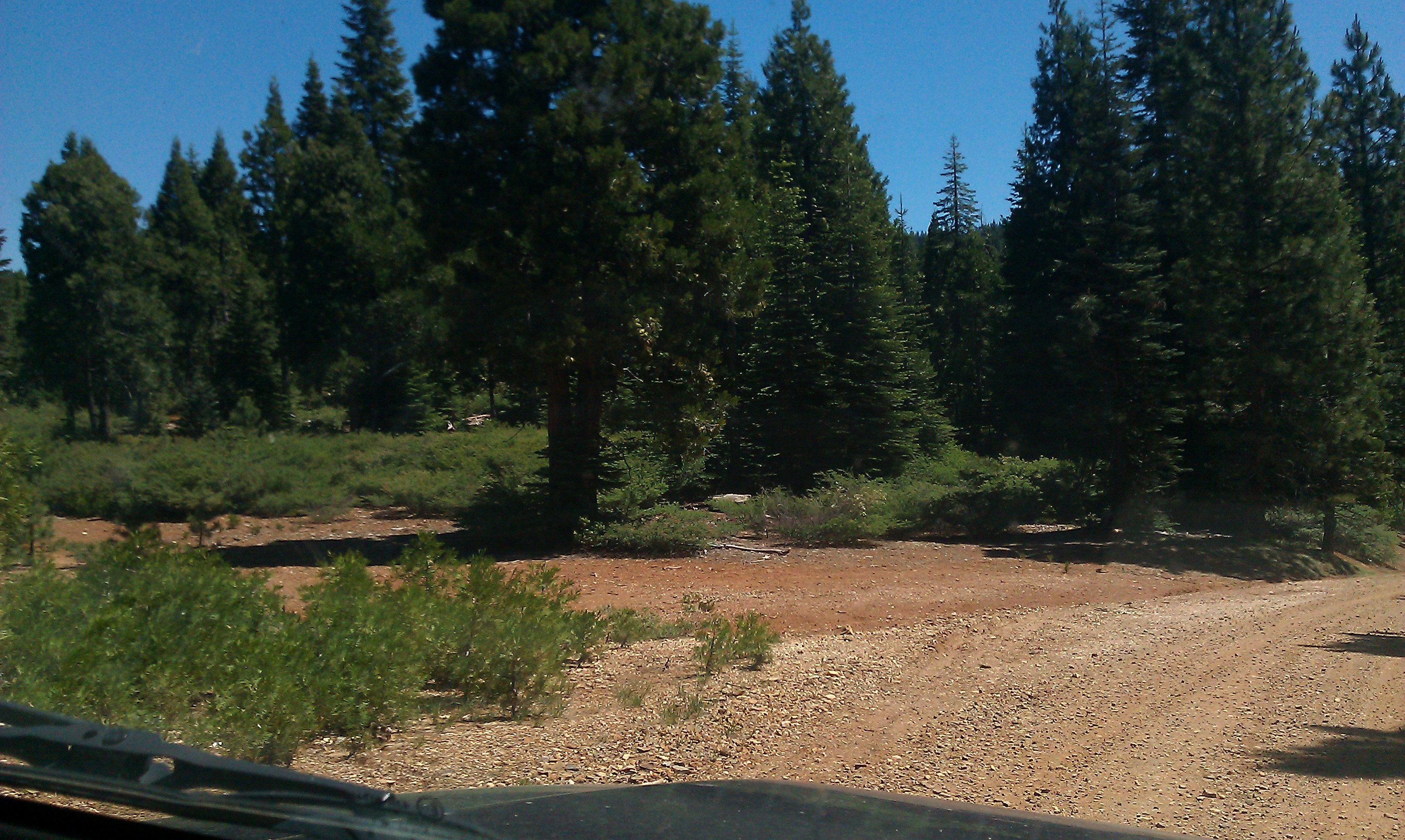
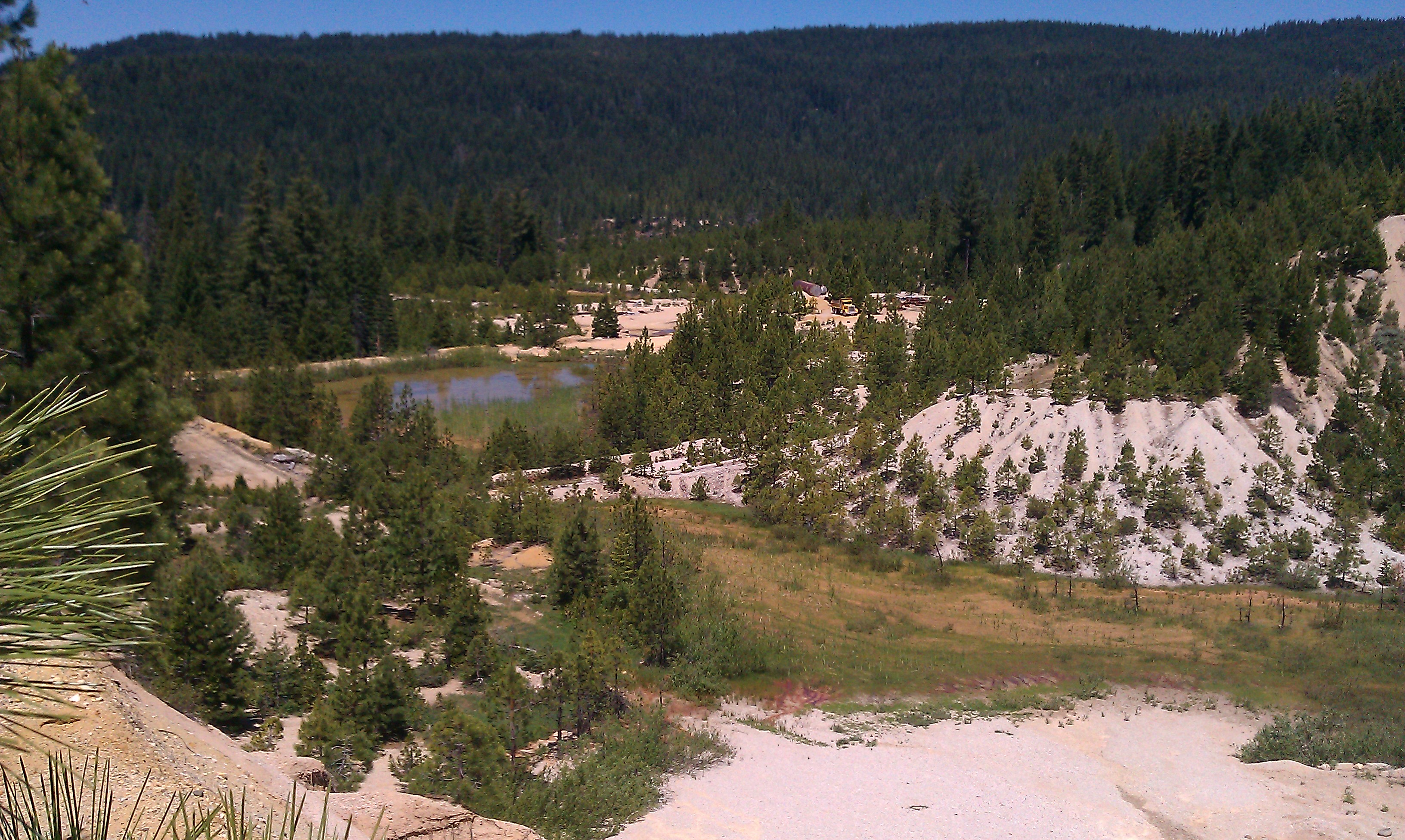
Now, assuming one remains on this route – the Queen City Road to the Port Wine Ridge Road – and continues toward Howland Flat (along the way, one will come to a “T” junction where Queen City used to be and needs to follow the route to the left), one will eventually pass by this area pictured below (on the left if you’re going toward Howland Flat and, of course, on the right if you are returning).

“This area” is Gardner’s Point (also known as the Challenge Mine) and serves as an excellent marker to advise one that they are in the vicinity of where the town of Grass Flat used to be. As you can see, a considerable amount of hydraulic mining took place here. This had the unfortunate effect of “piping away” most of the evidence of Grass Flat’s existence.
But, permit me to back up for a moment because some of the area where the town of Grass Flat used to be found is still undisturbed. After one has turned left at the Queen City “T” junction described above and has passed by the road to the former town site of Wahoo that branches off to the right, the road will level out a little at the top of a hill before branching down to the right to descend into the Deacon Long Ravine.
This area at the top of the hill are where the undisturbed remains of Grass Flat can be found… The buildings of the town once ran along both sides of the road:
Contrary to the image it conjures, Grass Flat was actually named for a prominent member of the Sons of Temperance, Mr. S.S. Grass, who lived in the area by 1860. At its height, the town was home to a general store, two boarding houses – one for white miners and another for Chinese – a sawmill, saloon, hotel, Chinese store and, of course, a number of homes. The town even had a baseball team and a band.
Unfortunately, on this particular day, I just had my phone with me and so the image quality is not up to our normal standards. There are plans to revisit this site in the future and the post shall be updated at that time.
*****
Back to Gardner’s Point, which is past the undisturbed remains of Grass Flat pictured above… Gardner’s Point was active up until the 1980s and during the 1980s, it was running 24 hours a day. Trucks were continuously picking up loads of dirt and would deliver that dirt to a massive trommel. With the whole scene lit up and the trucks operating with all of their lights on, I’m told it was quite a site at nighttime. The miners would sleep at the hotel in La Porte and then come in for their shifts each day.
The gravel in this area is very fine and so the gold found here is almost like a powder. I was told by an informed source that the largest piece of gold to ever come out of here was about the size of a grain of rice. So, the process of separating out the gold was obviously quite important.
This the road (on the left if you are headed toward Howland Flat) leading down to Gardner’s Point:
Jann Garvis (author of Roar of the Monitors, which I have discussed elsewhere in this series) leading the way to a view out over the pit at Gardner’s Point:
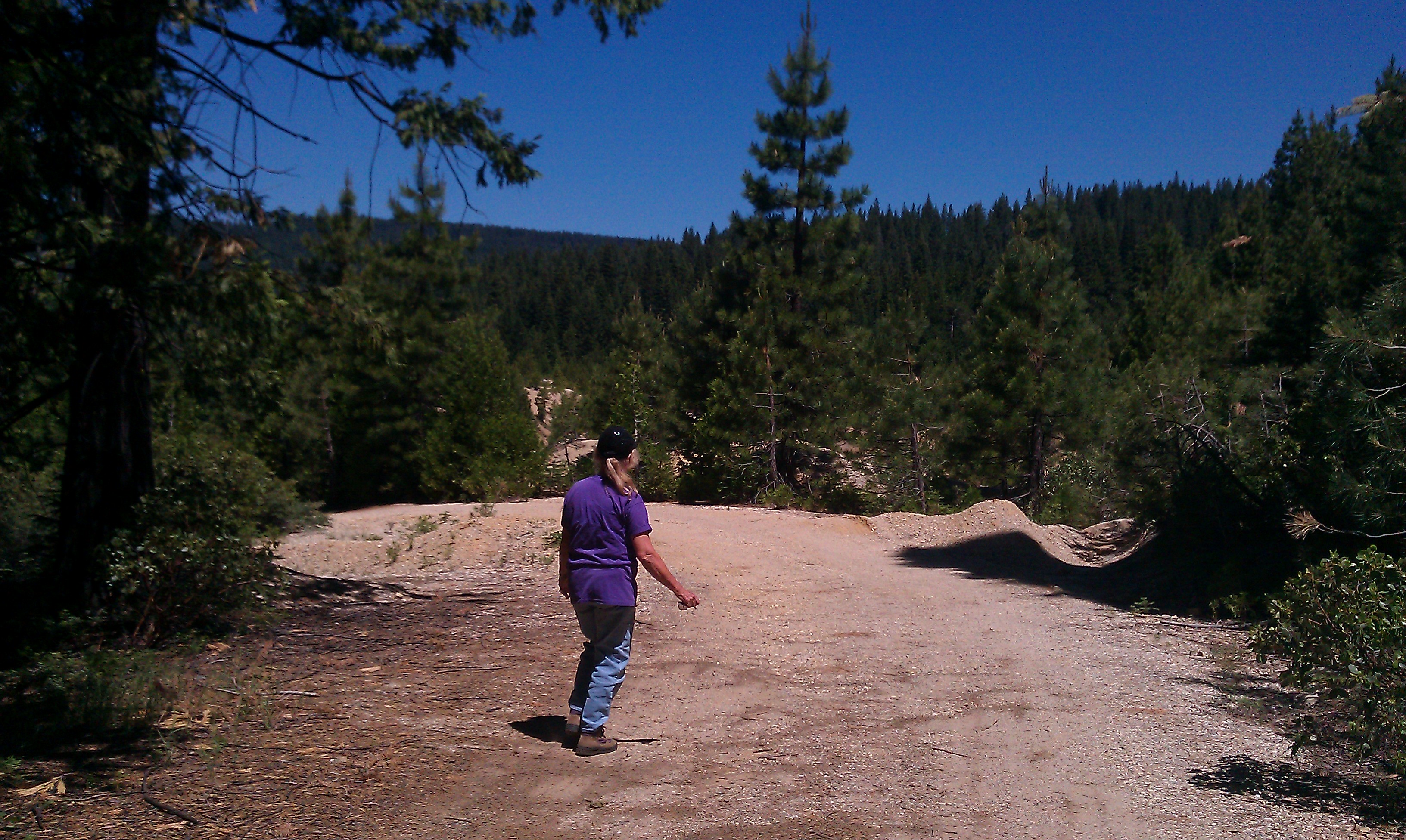
Using my phone, I could not fit the whole mine site into one picture, so below is a sequence to provide you with an idea of the size of Gardner’s Point and what it looks like… This is panning from right to left:
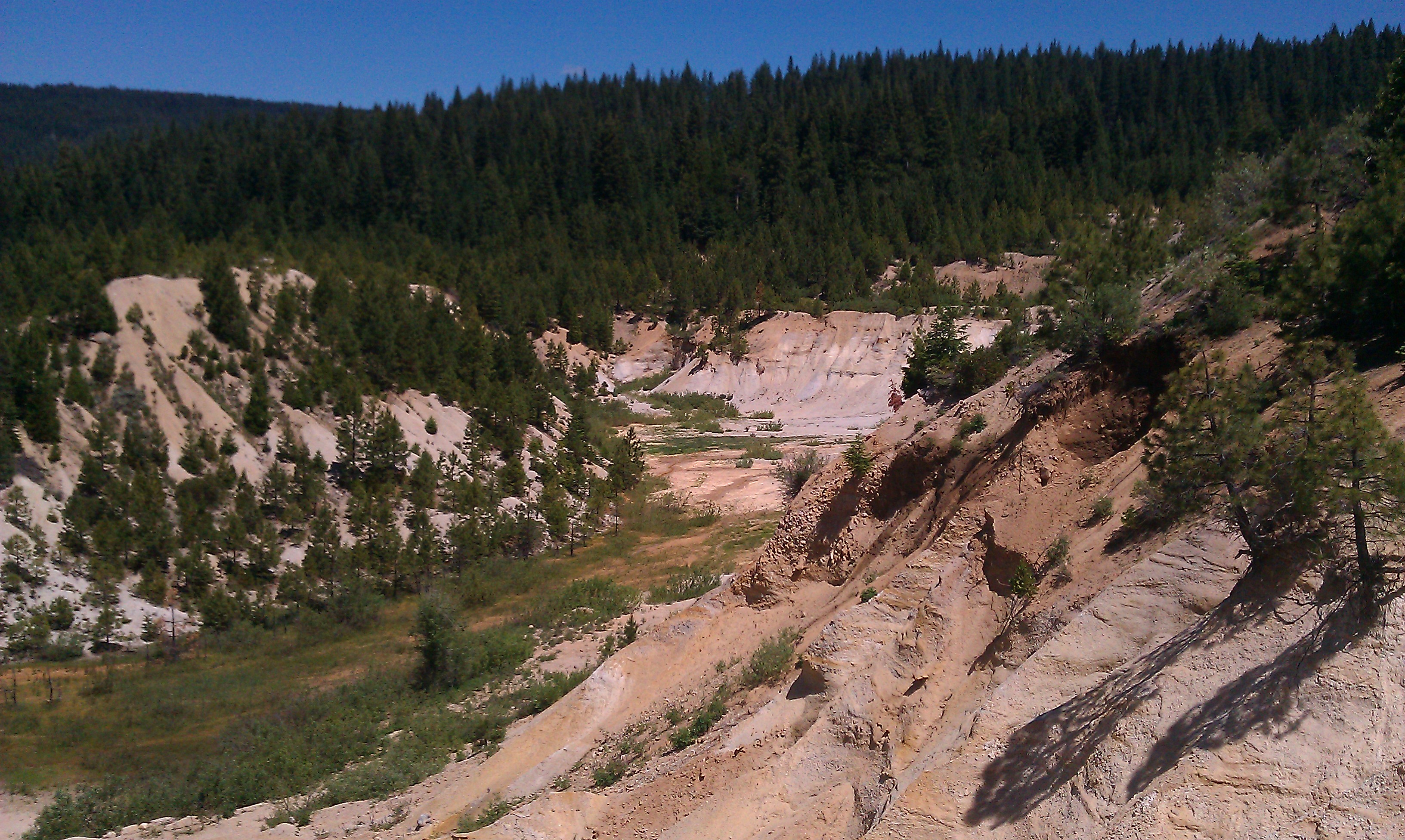

The giant trommel mentioned above, was situated below where the truck in this last picture is parked:
As you can see from the pictures, there is still some equipment down in the pit and there are structures on the site as well that are still occupied from time to time.
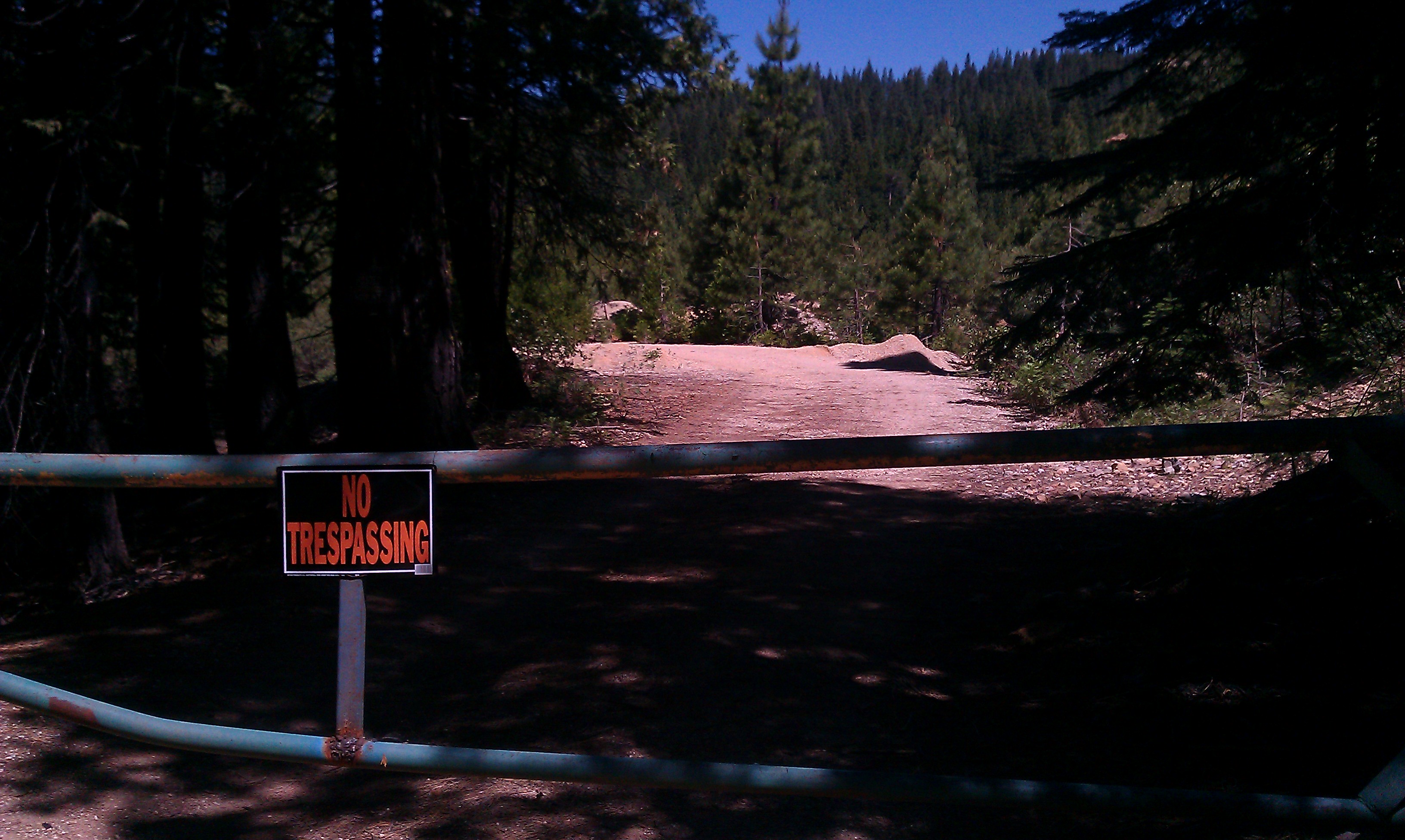
Almost across the street from Gardner’s Point (to the right if one is headed toward Howland Flat), is the Pioneer Mine – also known as the Pioneer Pit. It is difficult to see through the trees and I don’t have any pictures from this visit, but I intend to correct that situation on a future visit (it is similar in appearance to Gardner’s Point). However, the Pioneer Mine was perhaps the most significant mine at the Grass Flat site.
Both the Pioneer Mine and Gardner’s Point are presently owned by the same individual.
I have been advised that there are caretakers on site at the Pioneer Mine.
*****
Mines that are/were present at Grass Flat include the Atkinson (Jack) Claims, Baker Mine (Colonel), Big Channel Mining Company, Chief Company (Chief City, Indian Chief), Comet Tunnel (Iseman & Company), Gardner & Company (Gardner’s Point, Challenge Mine), Grass Flat Company, Hackett & Wagner Claims, Manzanita Mine (Pacific Company), Miller & Company, Mitler & Company, Pioneer, Riffle Placer, Treasure Drift Mine and the Triangle Mining Company (Never Sweat, Jack Cayote).
Water ditches located near Grass Flat were the Burk Ditch , the Old Ditch and the Grass Flat Ditch.

Grass Flat is one more monument to human greed and stupidity; the sloppy, not-too-surgical removal of entire mountains, often irreversible downslope environmental damage, massive mercury poisoning of rivers and streams, and entire landscapes scarred beyond recovery in the span of multiple generations. Places like Grass Flat are often celebrated by local chambers of commerce as historical landmarks to be preserved for our future generation’s appreciation for the hardiness of the region’s pioneers. Or, to be recognized as the gross examples of excess that they are.
Good or bad it’s still history and maybe an important lesson for future generations
To me Hydraulic landscapes are beautiful, the trees may be washed away but mother earth is still there. These areas are so miniscule on the map. Yet the street and town you live on are polluted with man made materials that are continually being constructed on with no plans of it stopping. Even the desert with sand for miles is beautiful. Earth is beautiful right down to it’s core!
Well man… from one person’s point of view, the world ends the moment he/she dies… life’s ending quickly… every minute… every clock tick… every moment… brings THE END closer… that’s the way it is… :)
30 years ago my father used to take us to la porte to a friends cabin, we drove way up the dirt roads near howland flat in his old willys jeep and there was a place somewhere up there where the creek came through a cave and the water fell into a little pond then went downstream I remember the dirt roads getting there were very narrow and steep my dad wanted his ashes spread there and I cant find the cave can anyone help me with directions from la porte thankyou Karen schuberkr@aol.com
Karen, I am from the area. Go past the town of La Porte towards Little Grass Lake and turn right about .5 from town. There should be a sign that says Howland Flat. The hole in the rock is located next to the St. Louis bridge. It’s about an 1/2 hour drive in.
Thank you so much
There was a road that went to right before reaching Laporte that took you into a Hydraulic mined landscape, in the late 80s my dad, his friend and I found a hole that was a drainage and dropped down about 50′. We built a rope and 2×4 ladder and went down, then it came out horizontally about a 120′ through bedrock. We scattered my dad’s ashes on his old gold claim on Lost Creek. He lived 6 miles before Laporte on Laporte Rd, in the round house on the right coming from Brownsville. We had a cabin there previously that burned.