I present this post to you in the interest of public service…
When trying to research the Henness Pass Road, one will stumble across a few internet forums that contain vague and sometimes contradictory information or websites from various government agencies that just loosely mention the Henness Pass Road. Every one of these websites from the government agencies references a detailed brochure about the Henness Pass Road and yet not a single one has a copy that can be viewed online. Nor has anyone else taken the time to make one available online. Until now…
I have photographed each section of the brochure and uploaded it to assist with your planning (see the bottom of this post to cut straight to it). Unfortunately, the numbers in the brochure correspond to very few easily identifiable locations on the ground as most of the markers are no longer to be found. However, presumably, with the assistance of the brochure, one can identify these sites before departing. For example, if one utilizes one of the online topographic maps, the GPS coordinates for the sites of interest along the way can be plugged into a GPS unit prior to your departure.
*****
Many readers will, undoubtedly, be unfamiliar with the Henness Pass Road and to try to make this interesting for everyone, I will briefly explain its history and significance:
In the Sierra Nevada mountains, animals such as deer and the extinct California grizzly bear would historically find the easiest routes through the mountains. Native Americans would then capitalize on the trial and error discoveries of the wild animals and further expanded these popular game trails into regular footpaths. Thus, over thousands of years, fairly significant trail systems were developed throughout the Sierra Nevada mountains. As such, contrary to the exciting myth of early Europeans pioneering routes through untamed wilderness, there were already many established trails in the Sierra Nevada mountains for them to make use of. So, although there were no records kept, it is quite likely that large sections of the major routes through the mountains today – such as Interstate 80 – were originally California grizzly bear trails.
Although it is impossible to know for sure, it is also certainly likely that at least part of the Henness Pass Road was one of these ancient routes as well. The first written record of the Henness Pass Road – then still a trail – dates back to 1849 just as the California Gold Rush was blowing up. At just under 6,700 feet, Henness Pass is the lowest mountain pass through the Sierra Nevada mountains. This, combined with its relatively modest grades led the Henness Pass Road to swiftly develop into a major immigrant trail for those on their way to the California gold fields. Later, after the discovery of the Comstock Lode in Virginia City, Nevada, the direction of traffic reversed and the route served as the primary supply road for the mines in Nevada.
The Henness Pass Road continued to be a major transportation route through the Sierra Nevada mountains until the completion of the Transcontinental Railroad in 1869. A portion of the Henness Pass Road was later included in the Lincoln Highway, the country’s first transcontinental highway system and it continued to carry wagon (and later automobile) traffic until the completion of the last portion of the Victory Highway (later Highway 40) through the Truckee River Canyon in 1925.
For additional details one can simply read the brochure at the bottom of this post.
*****
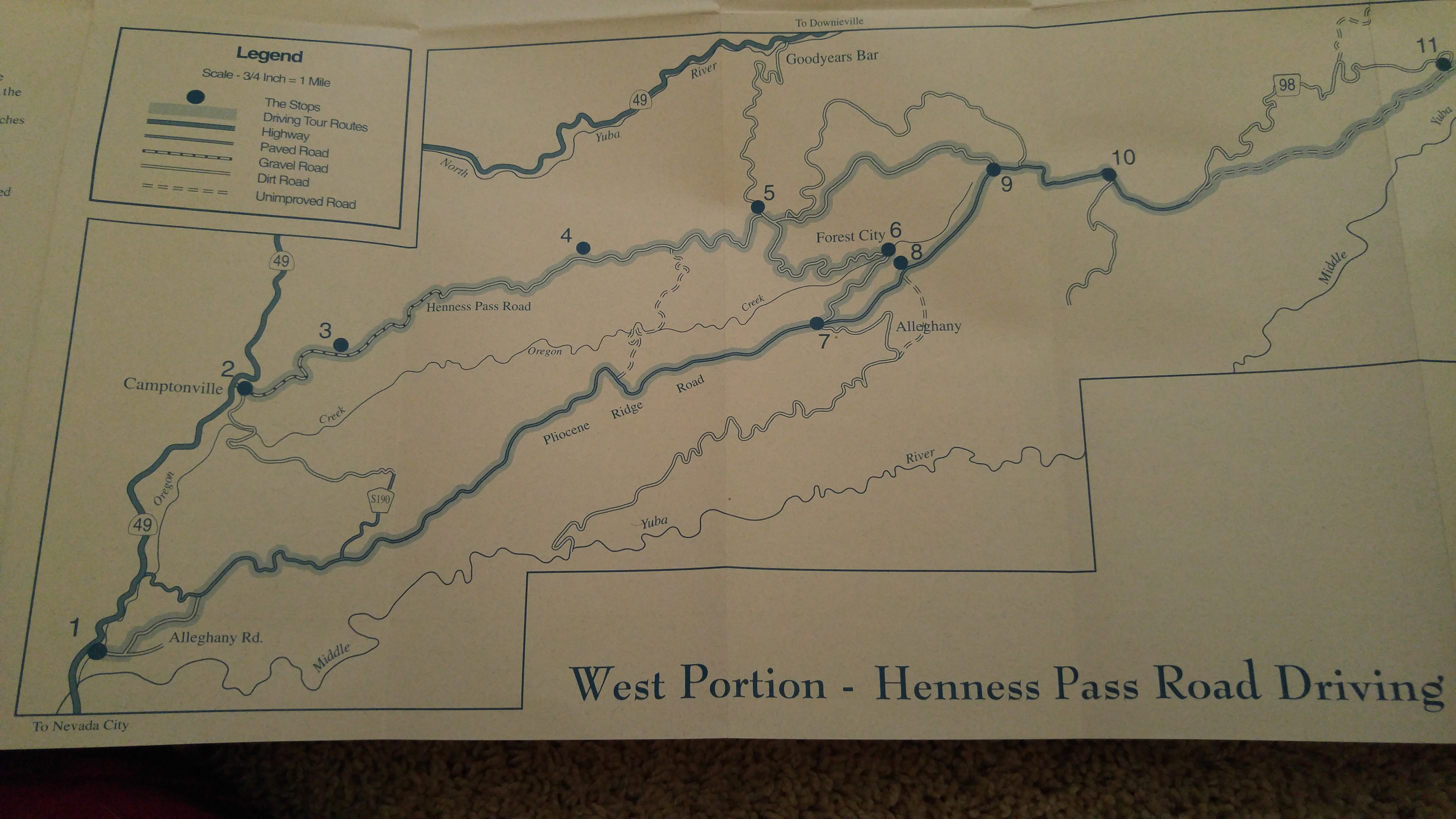
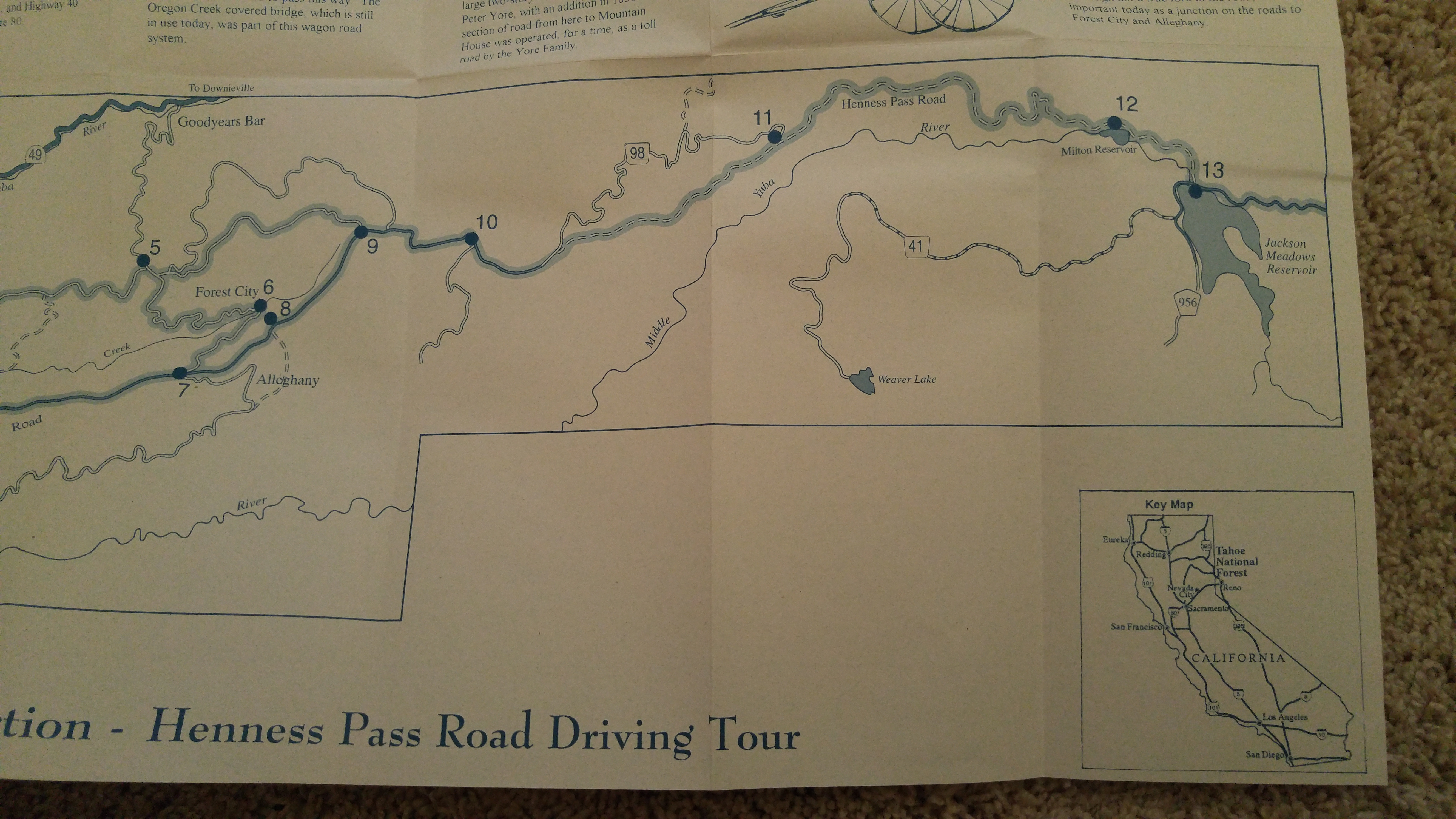
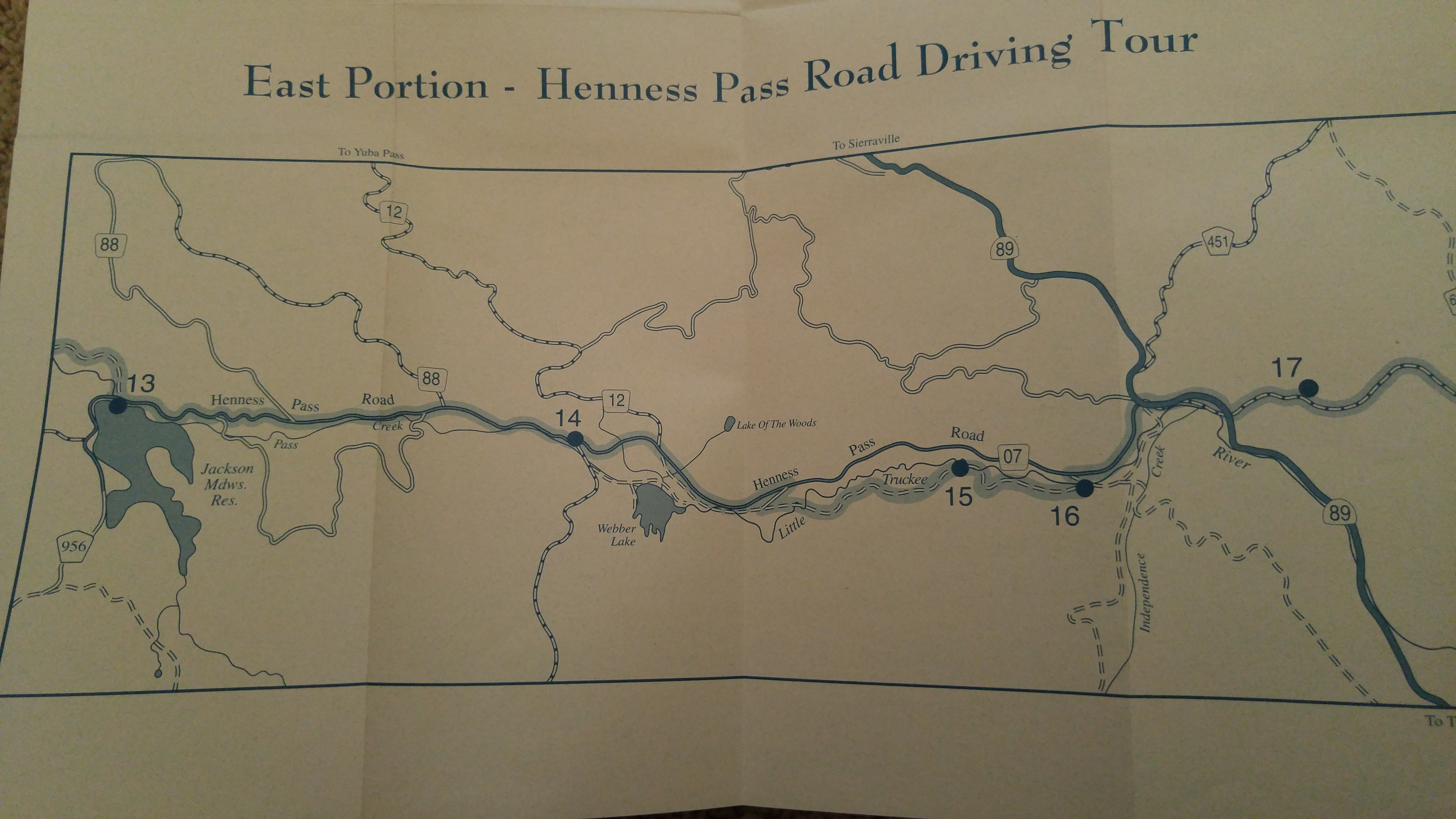
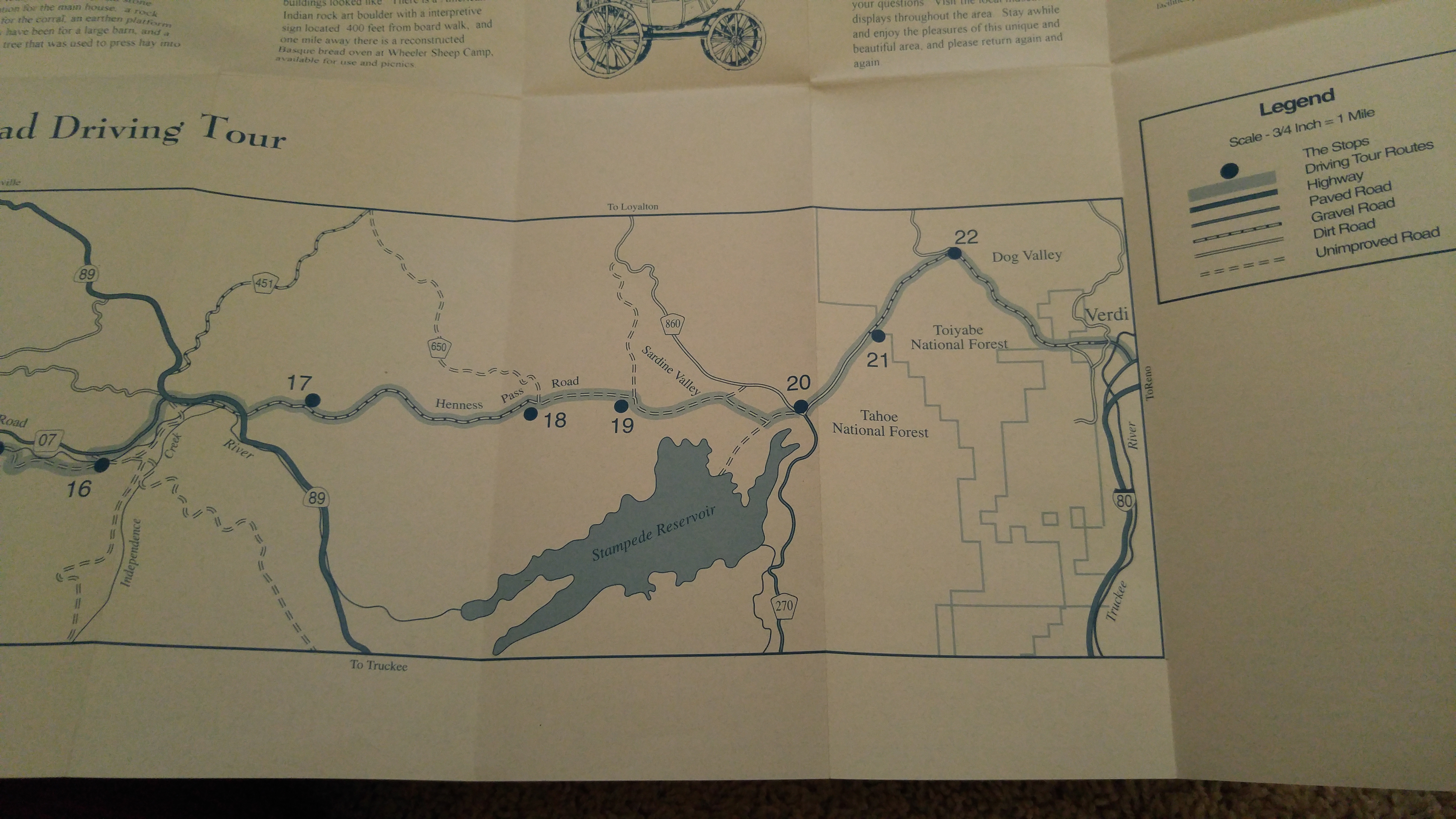
A map of the route taken by those making their way along the Henness Pass Road:
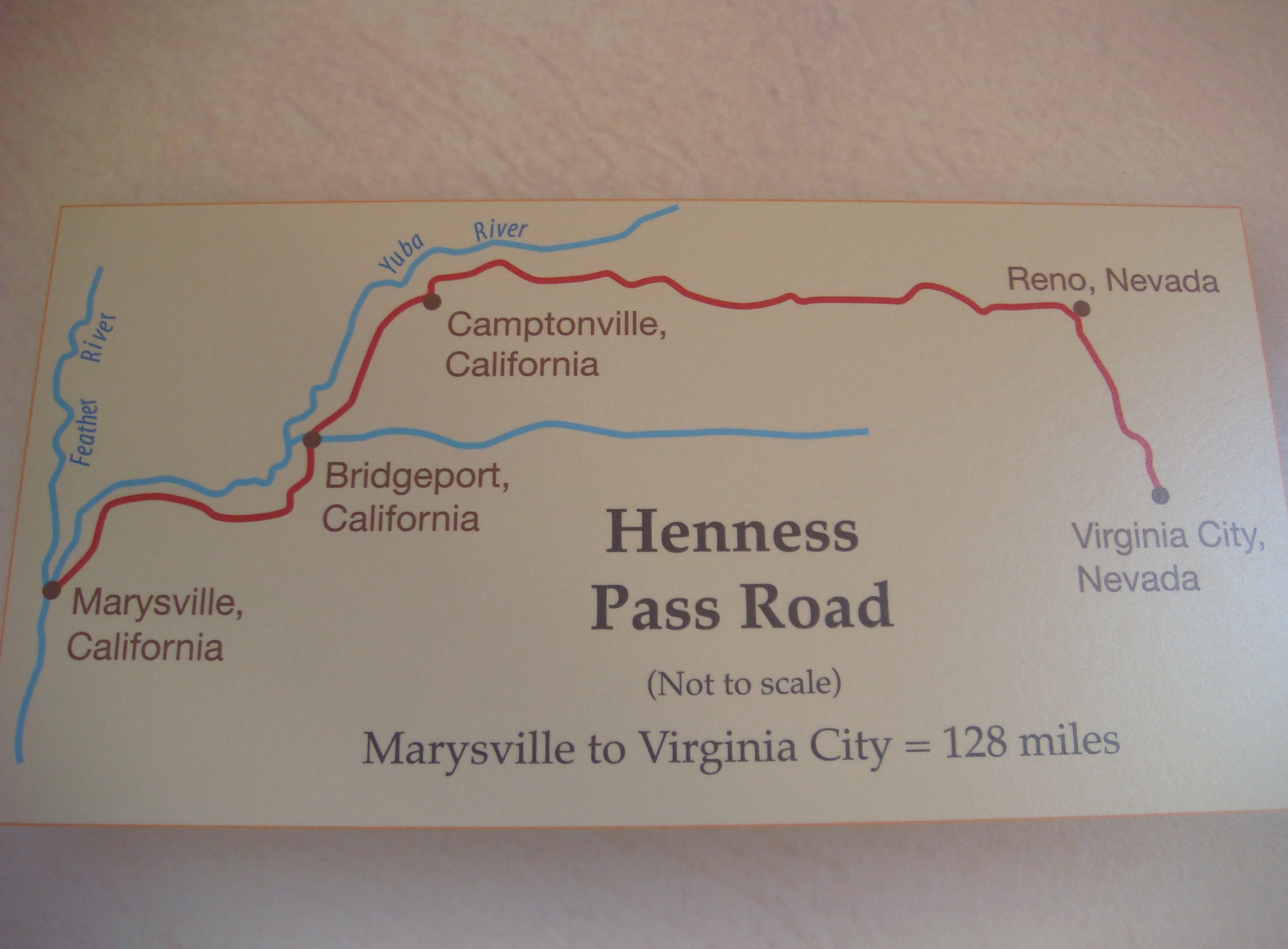
Assuming you wish to stop and check things out along the way, give yourself a day for a drive along the entire road. The Henness Pass Road has some sections that have been incorporated into modern paved roads and other sections that are bumpy dirt roads in the middle of nowhere. However, a 2WD vehicle can easily make the entire trip. No matter which vehicle one chooses to utilize though, fill up your tank and bring some food and water because there are no services along the way.
As I mentioned previously, the full Henness Pass Road brochure is displayed at the bottom of this post. However, before that section, I have uploaded a few pictures that I took on a drive from California to Nevada along the length of the Henness Pass Road that may be of interest to those trying to imagine what this route looks like (they are posted in chronological order).
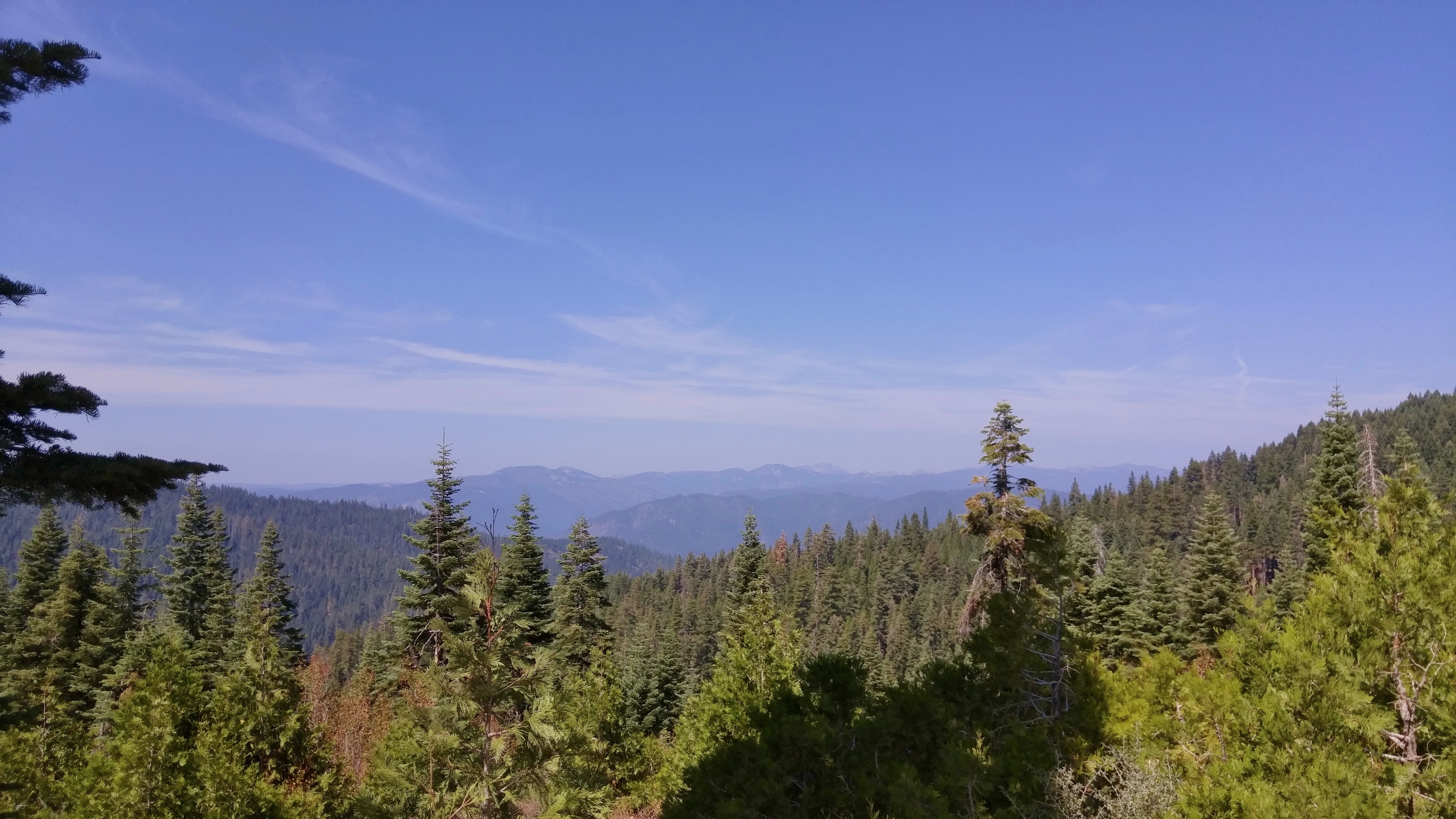
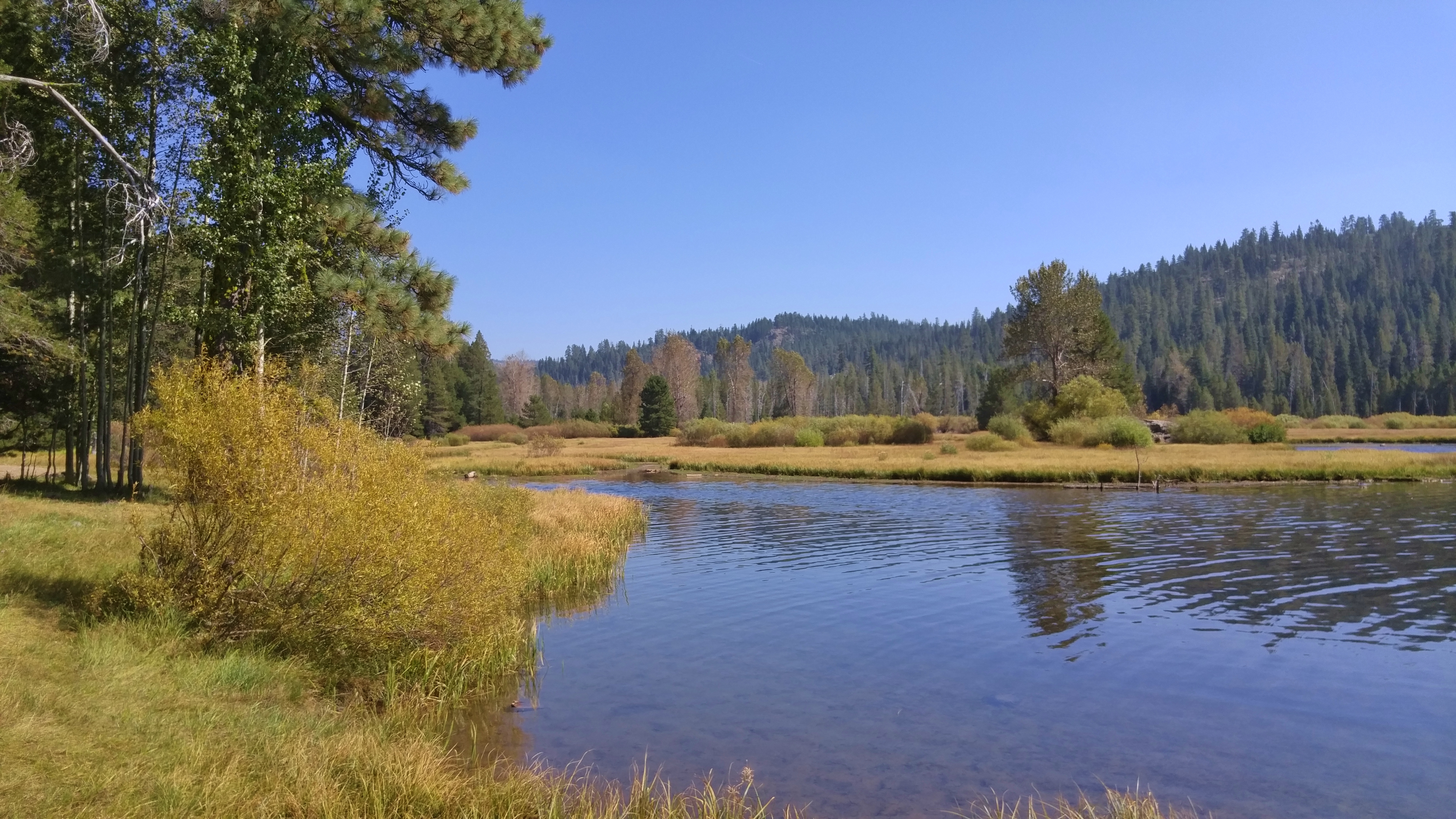
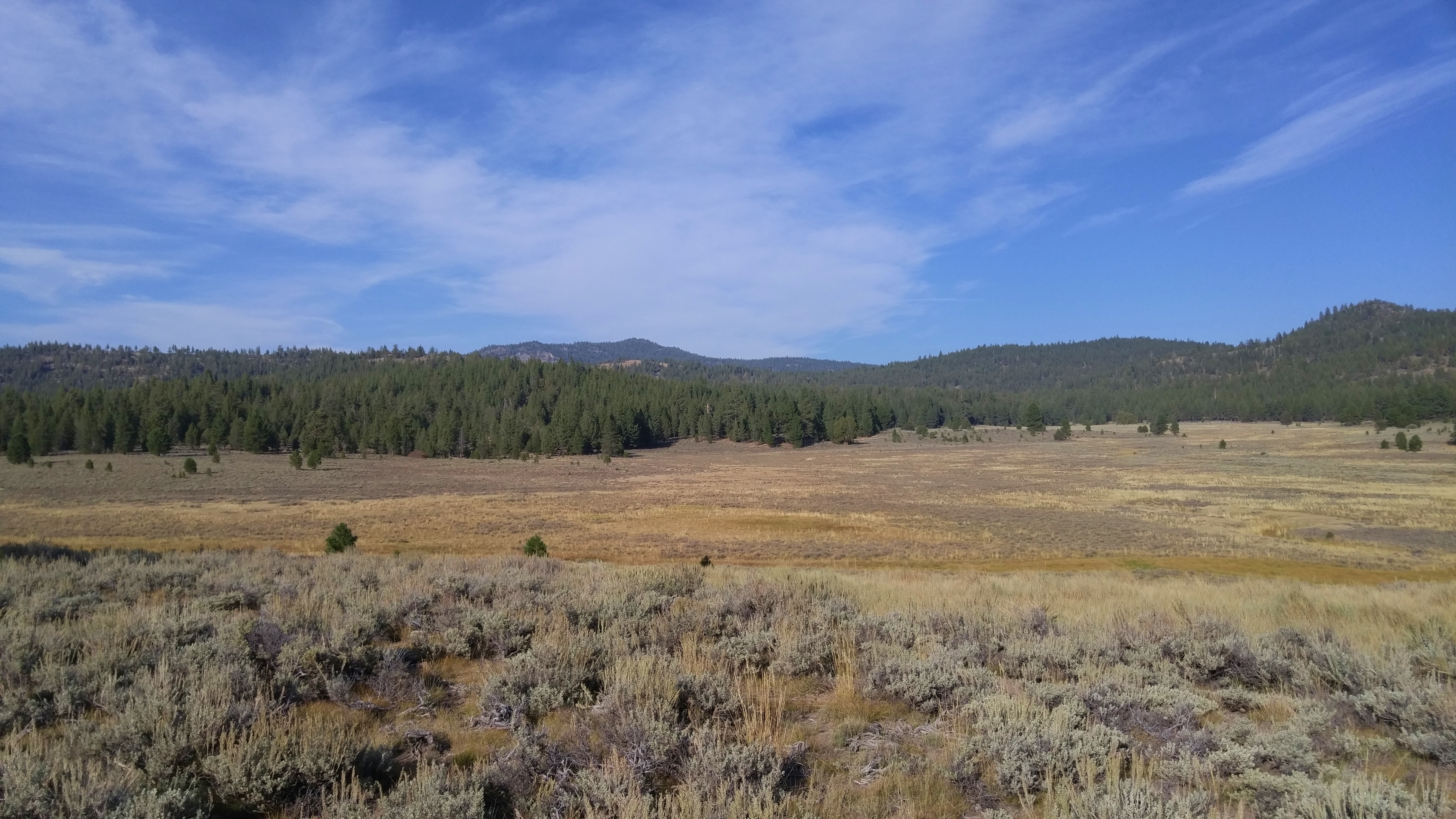
In the initial sections of the road, one is mostly making their way through thick forest and one does not really break out of this until getting into the high Sierras:
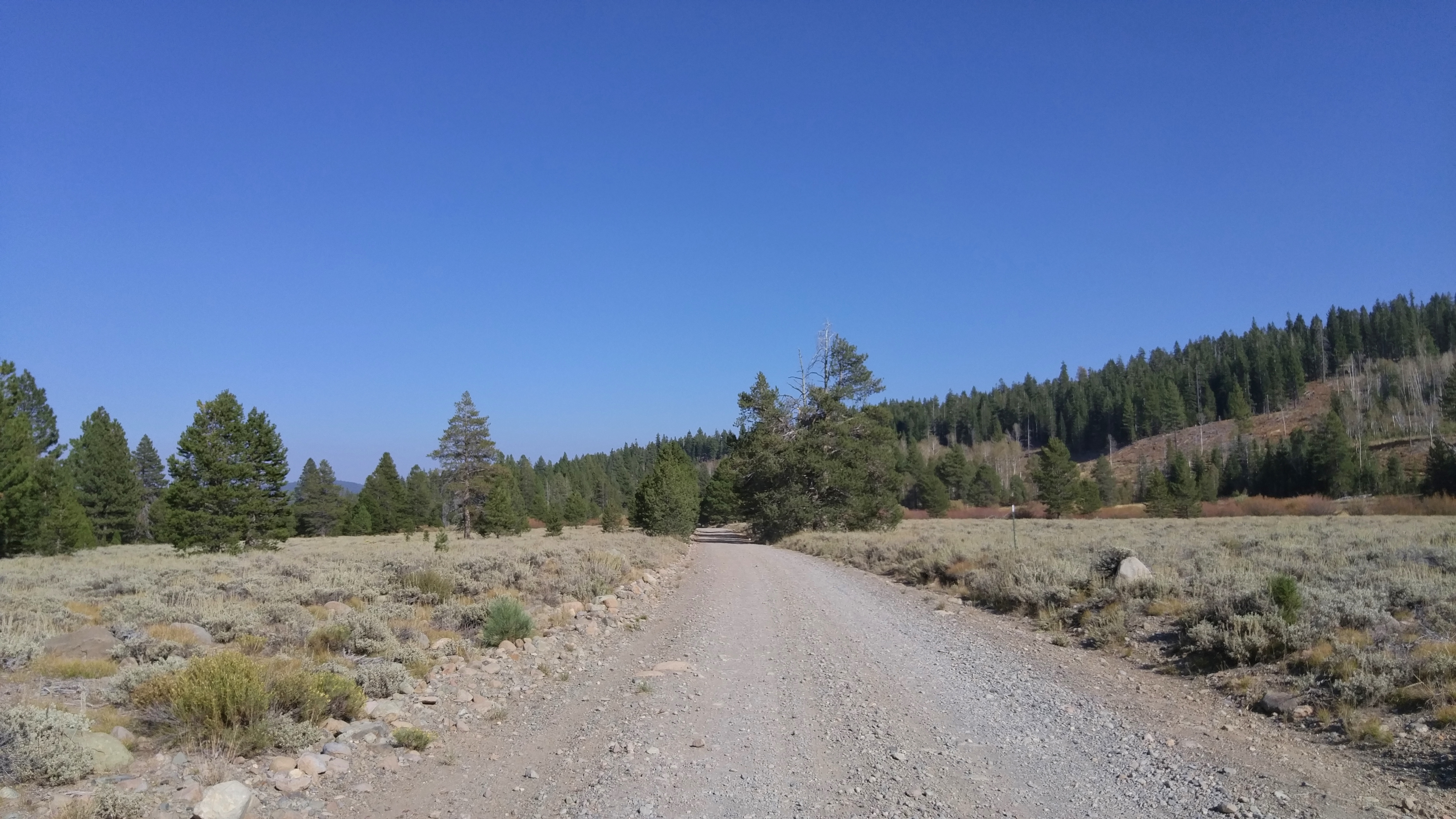
There are, of course, interesting diversions all along the way – such as Forest City or the Wheeler Sheep Camp or any of the myriad roads which twist off mysteriously into the mountains:
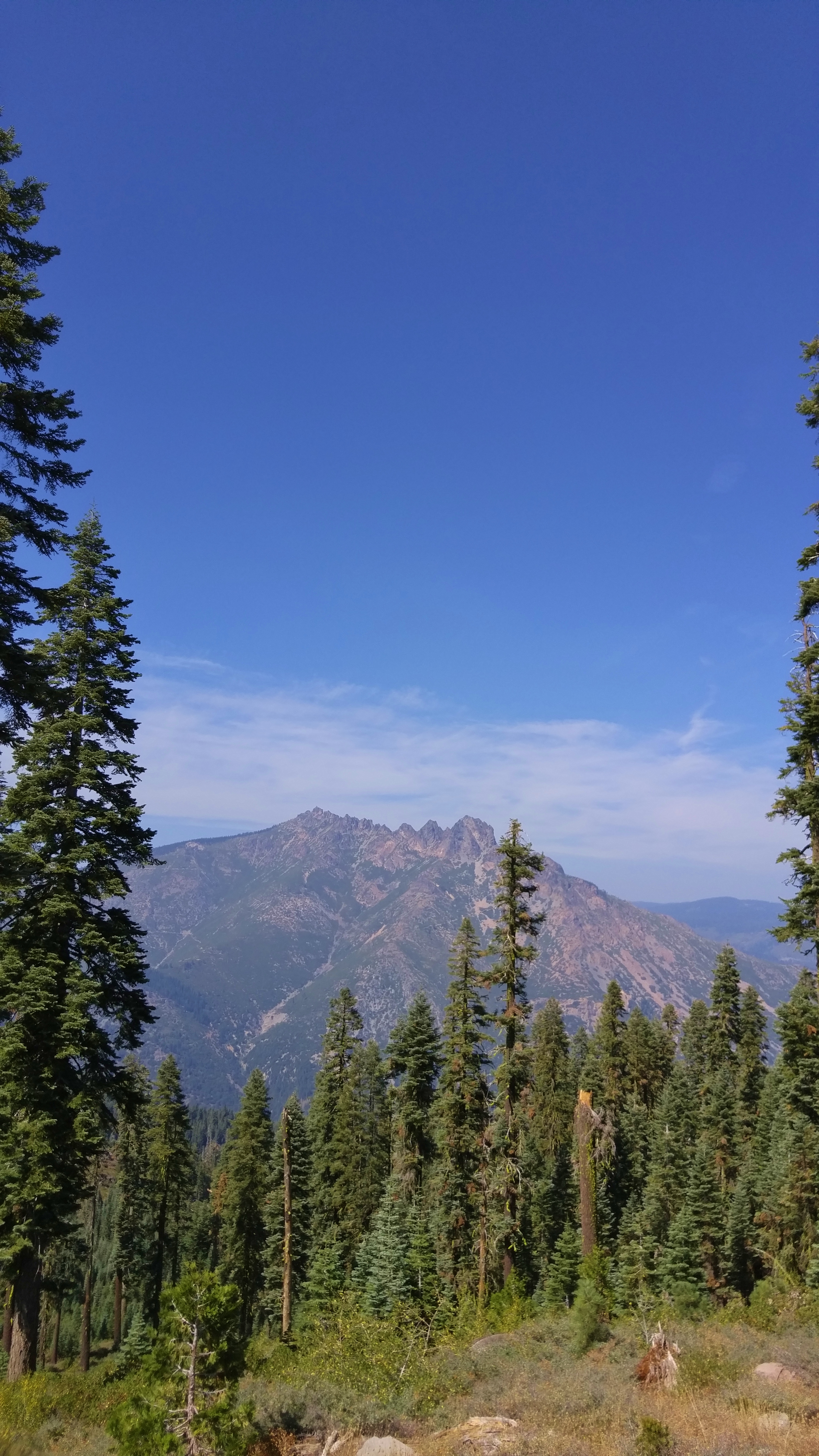
A view of the Sierra Buttes from the Henness Pass Road:
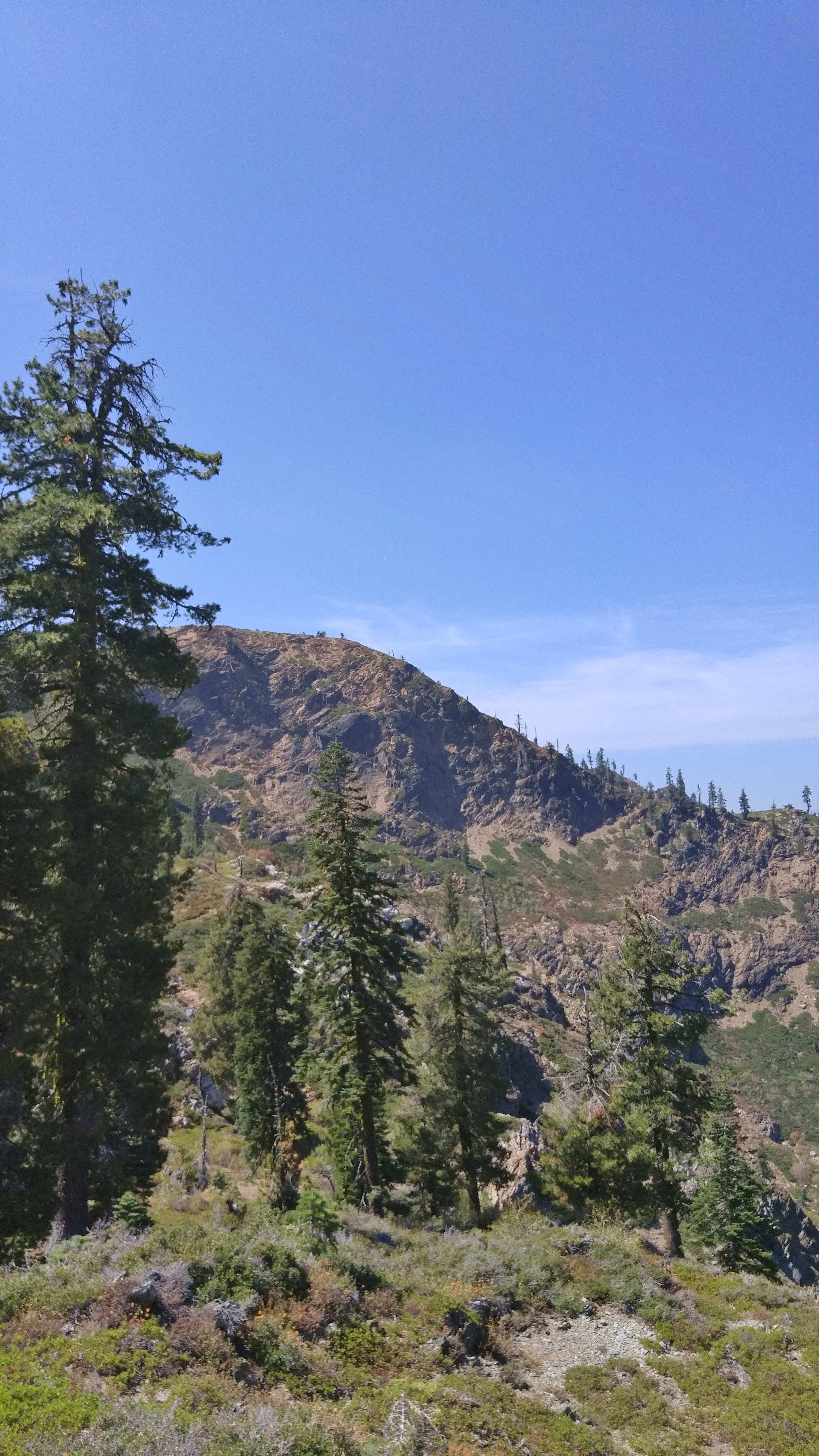
This is the top of the Henness Pass – the highest point on your journey:

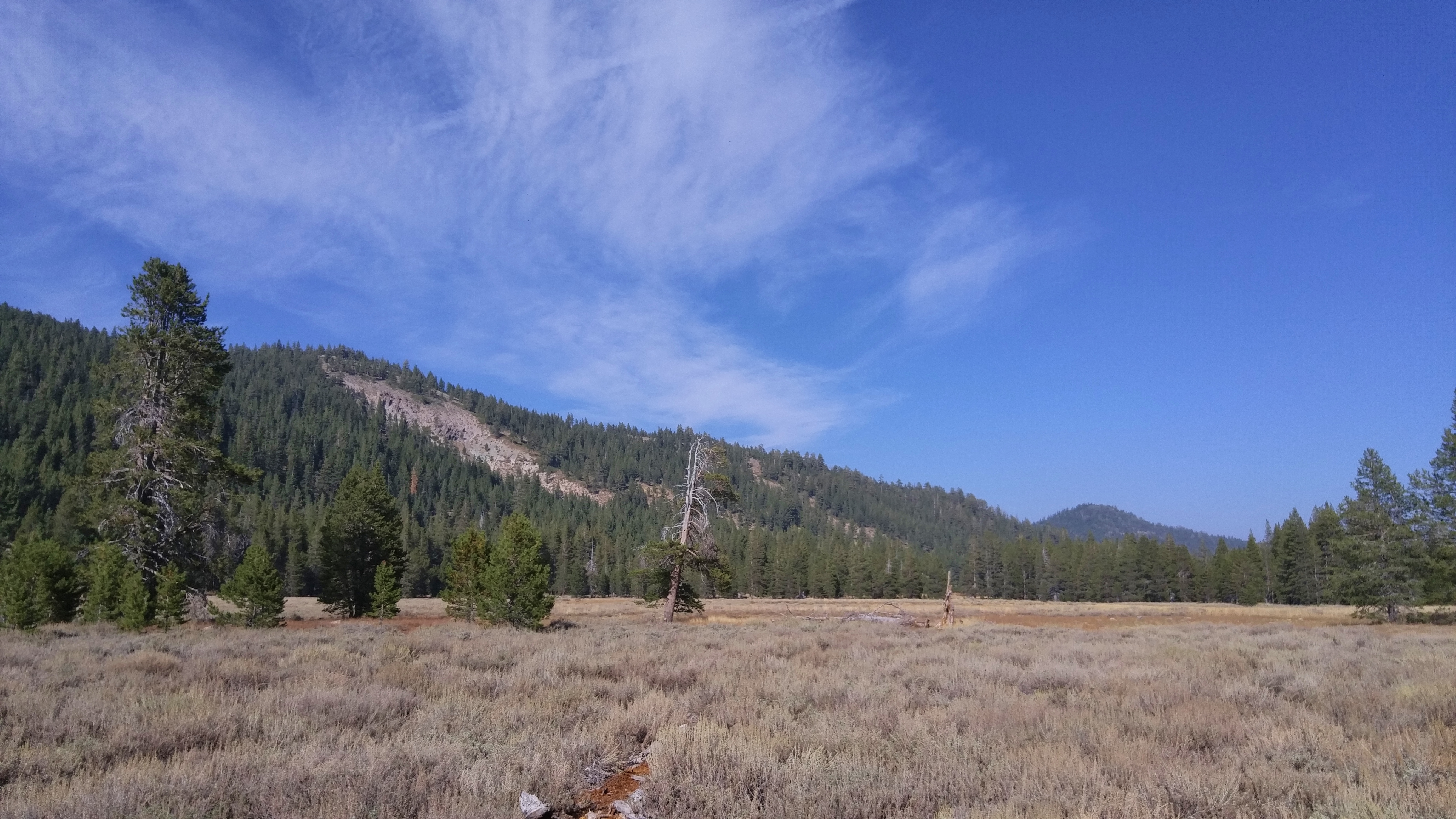
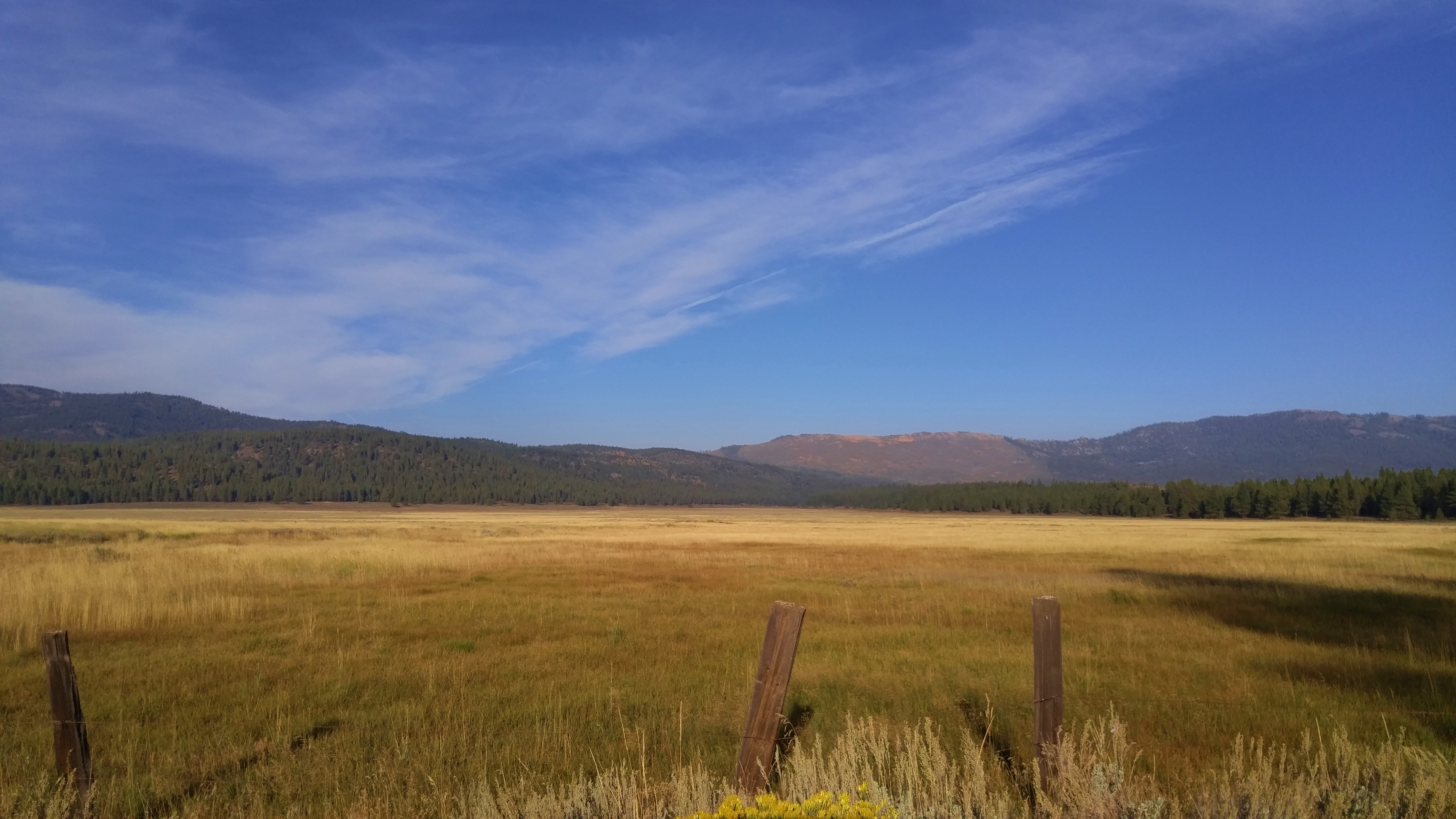
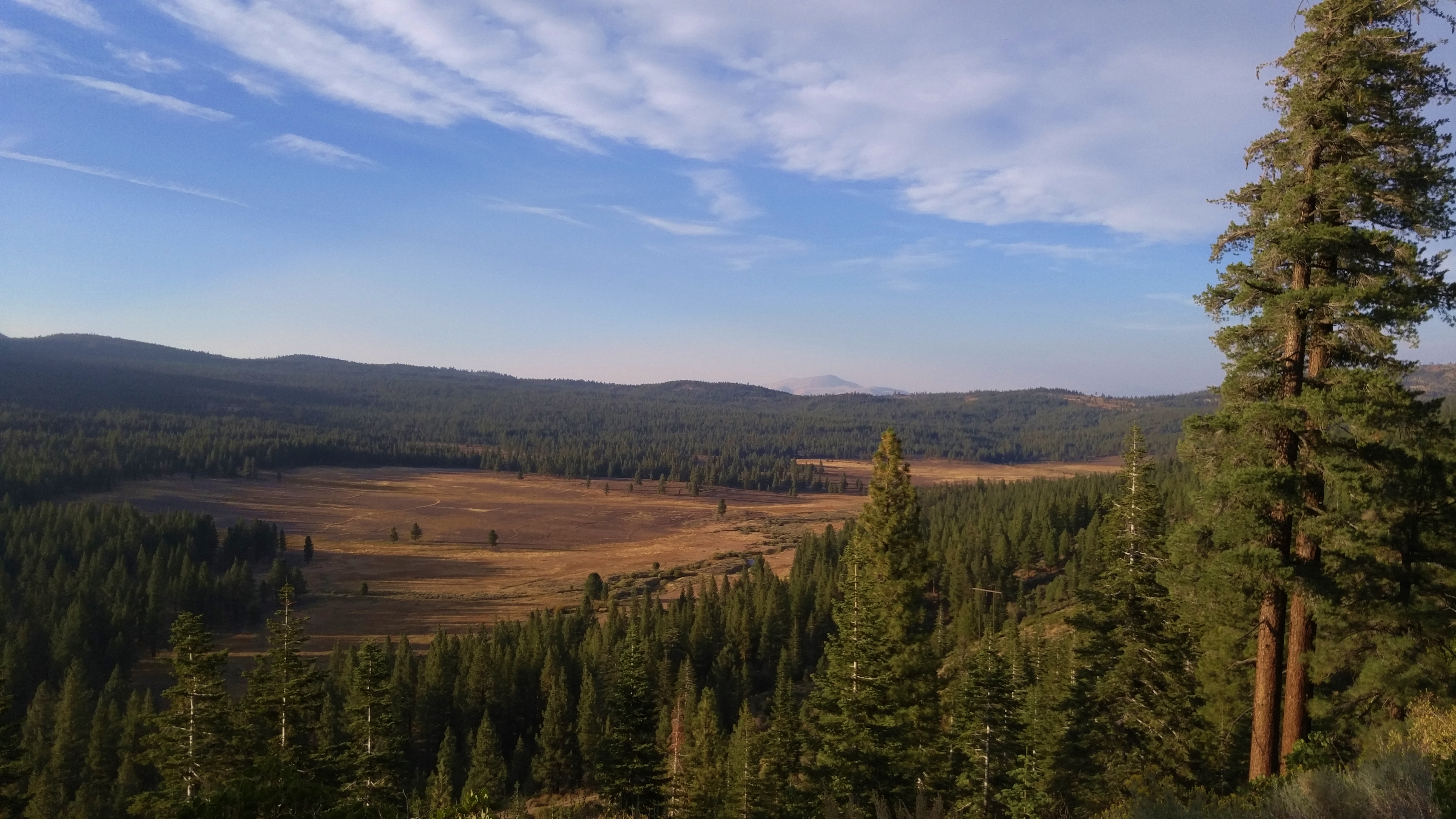
The view from the site of one of the major sheep camps that used to be found along the Henness Pass Route:
Given how empty the Henness Pass Road is today, it may seem difficult to imagine that this route was once extremely congested. One journalist of the time – J. Ross Brown – wrote in 1863: “At calculation we must have passed 2 or 3 hundred teams. Every wagon was heavily freighted, some with merchandise, others with iron castings for the mills, and quite a goodly number with families, fruit, whiskey, and furniture. There were horse teams and mule teams, and ox teams. I never before saw so many teams on one road, no wonder the dust was so deep!”
The Henness Pass Road was so crowded, in fact, that a serious proposal was made to restrict traffic during the day to freight wagons and traffic at night to passenger stagecoaches.
The record travel time from Marysville, California to Virginia City, Nevada by stagecoach was 25 hours and 25 minutes.
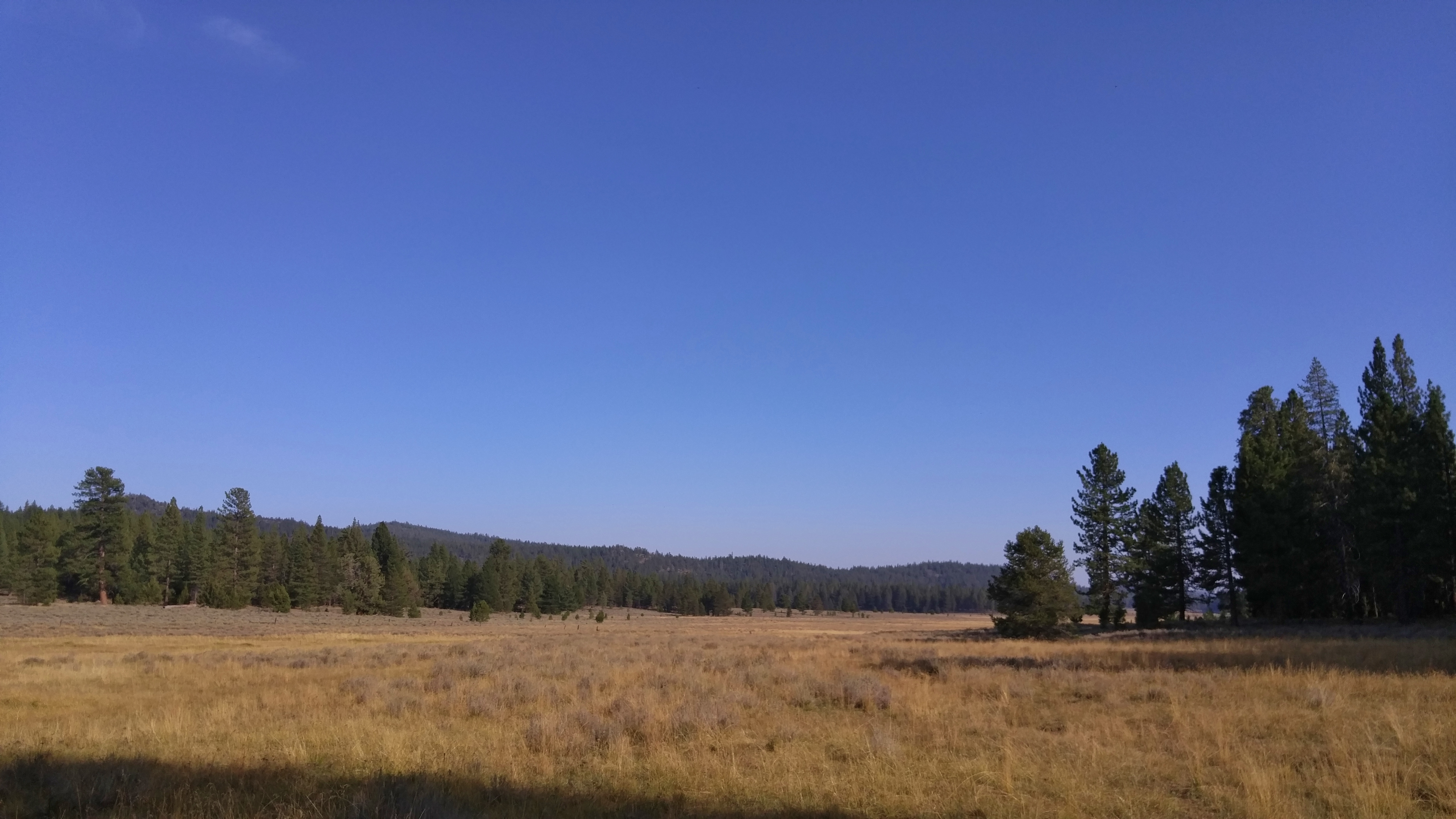
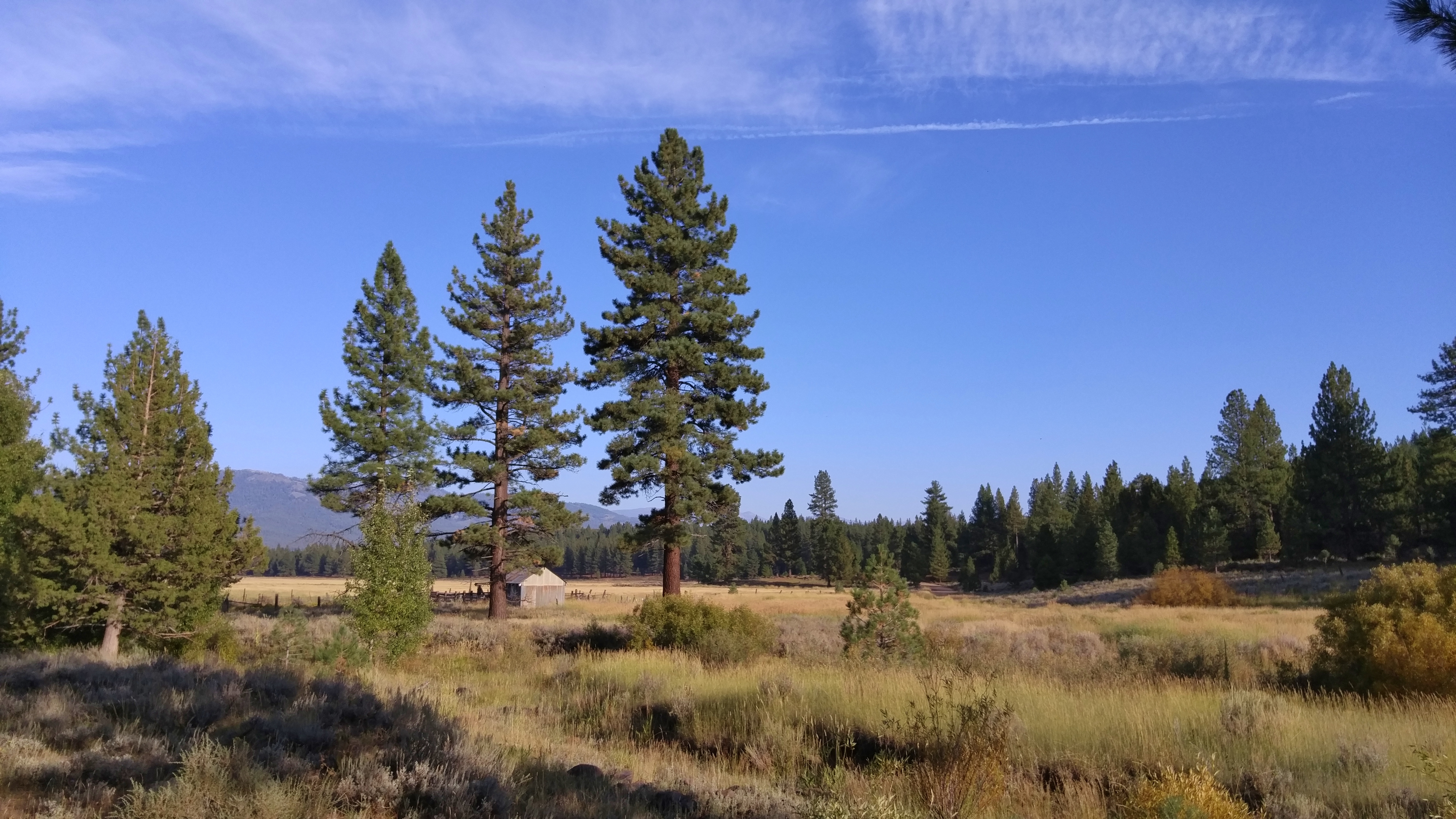
Not much left, but the below was the site of More’s Station – a way station along the Henness Pass Road that included a large hotel, a barn, a corral and a well:
The remains of a ranch along the Henness Pass Road:
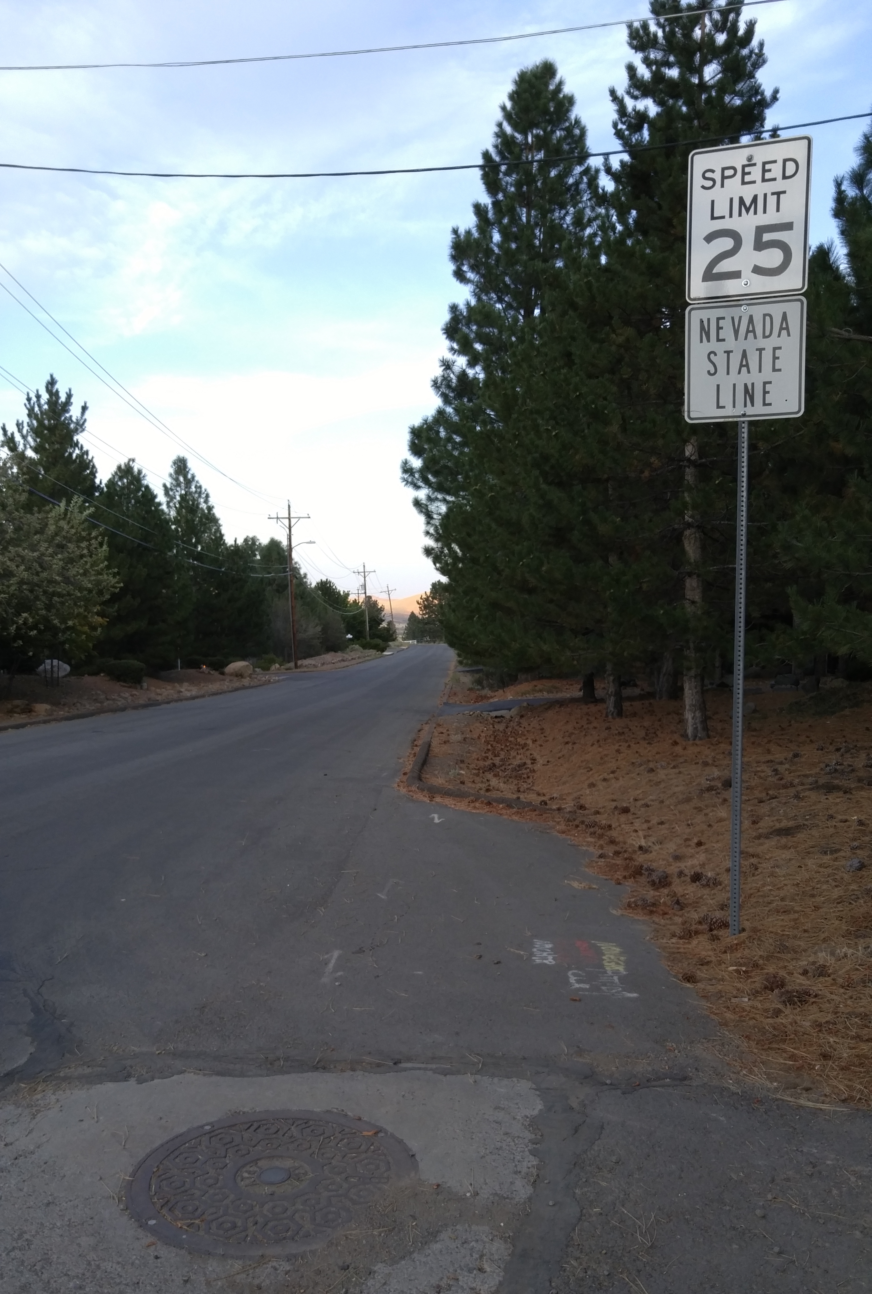
This is the point where the Henness Pass Road drops from the maps and disappears into Verdi, Nevada:
*****
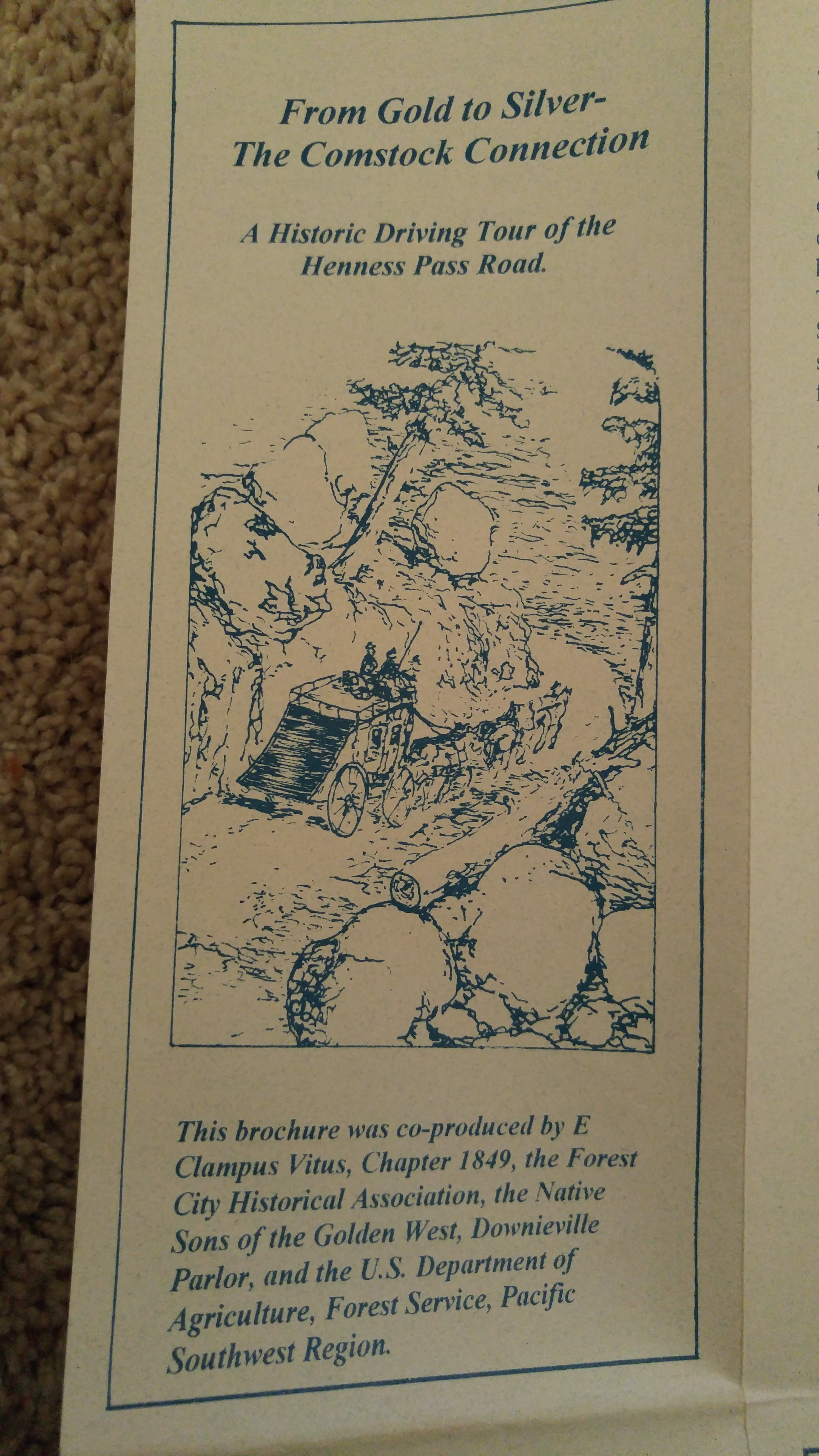
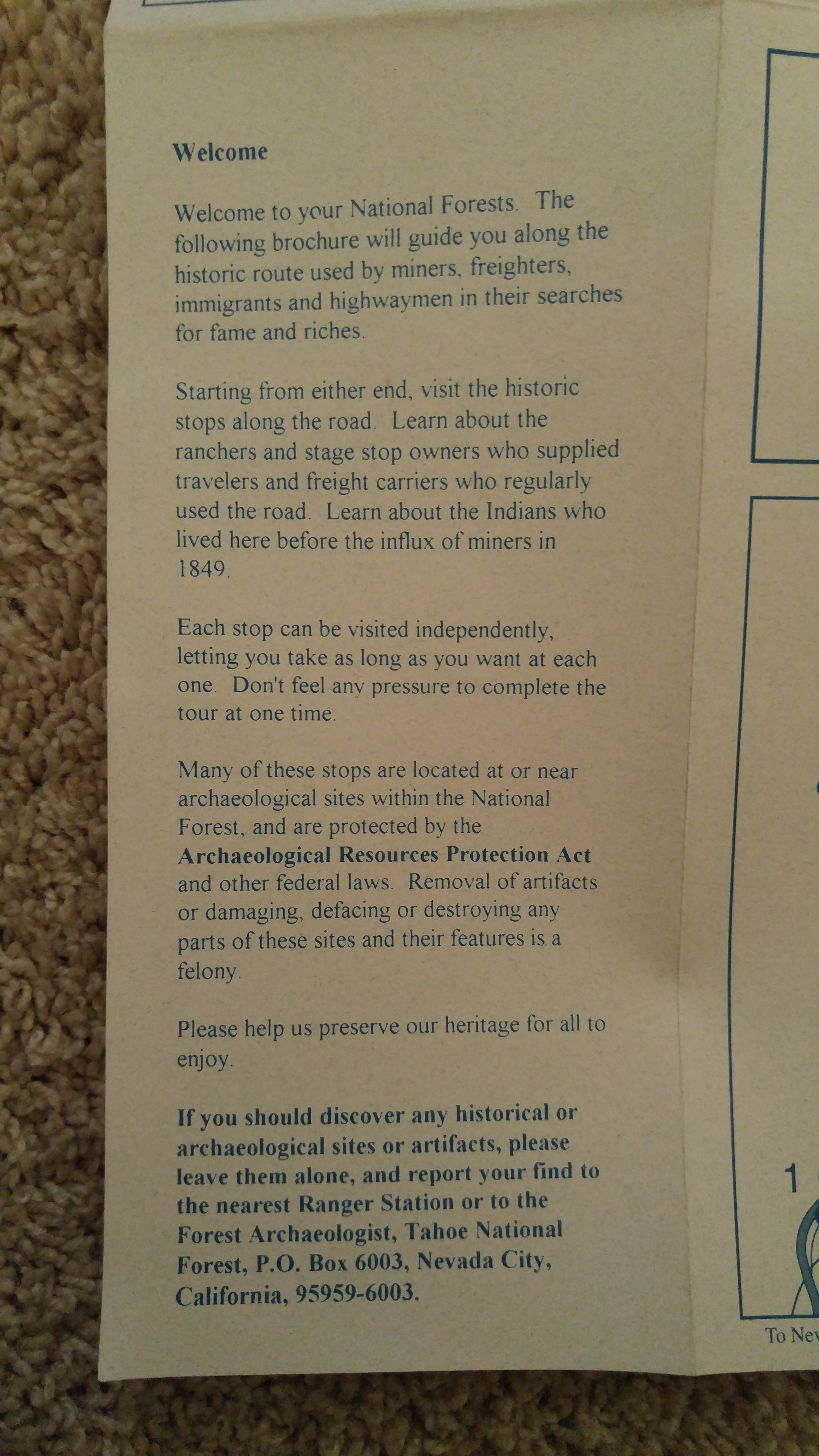
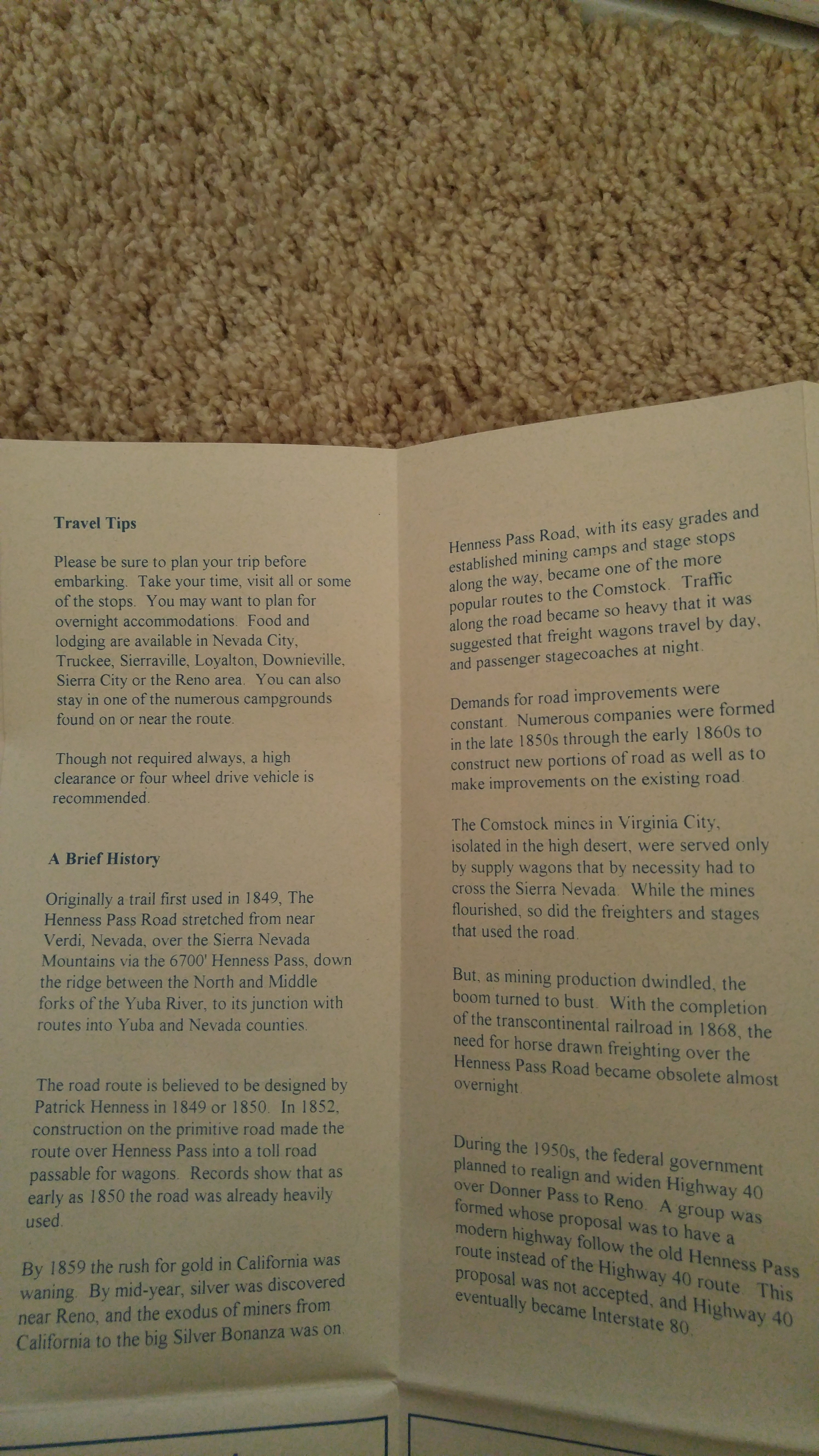
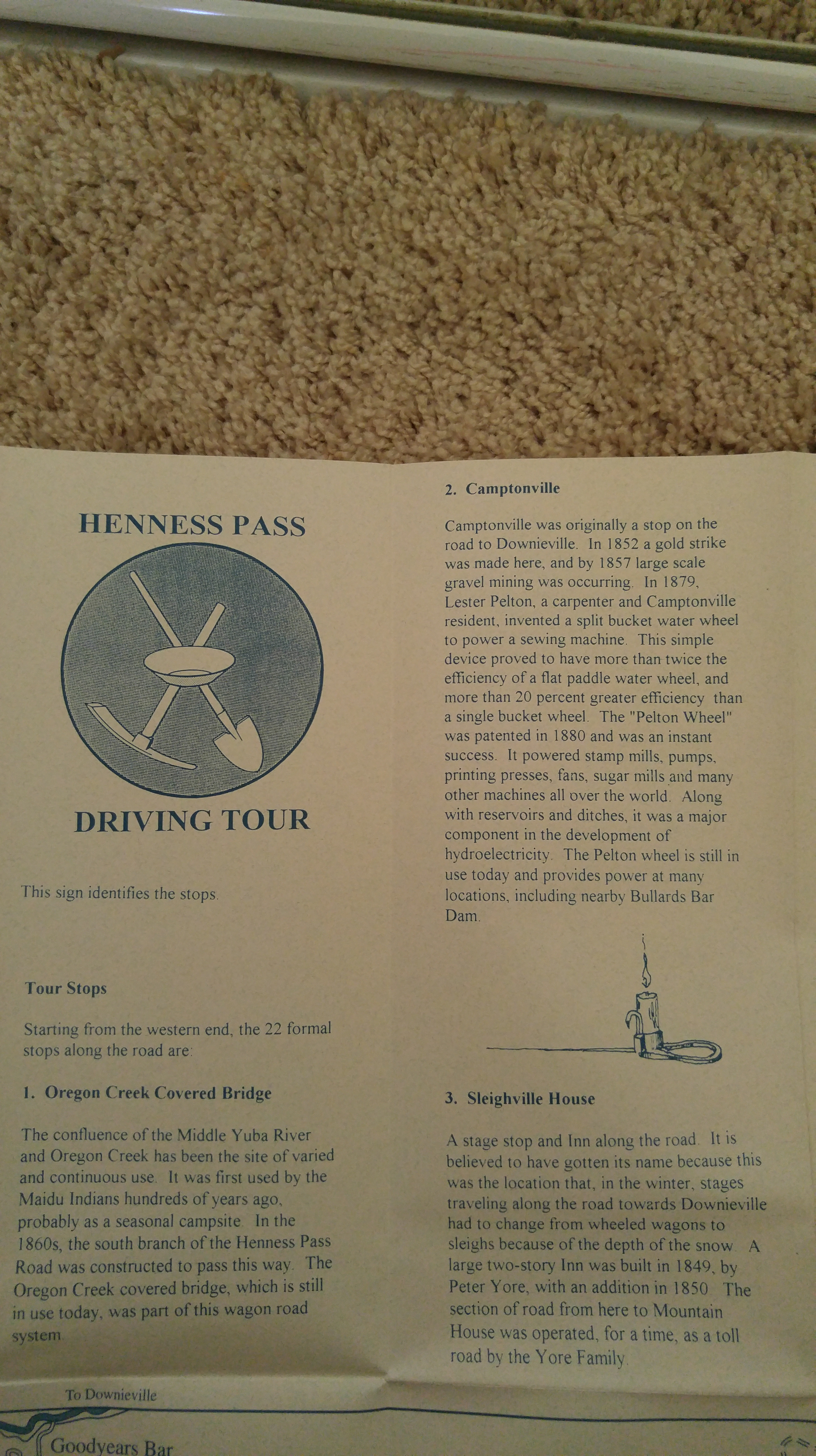
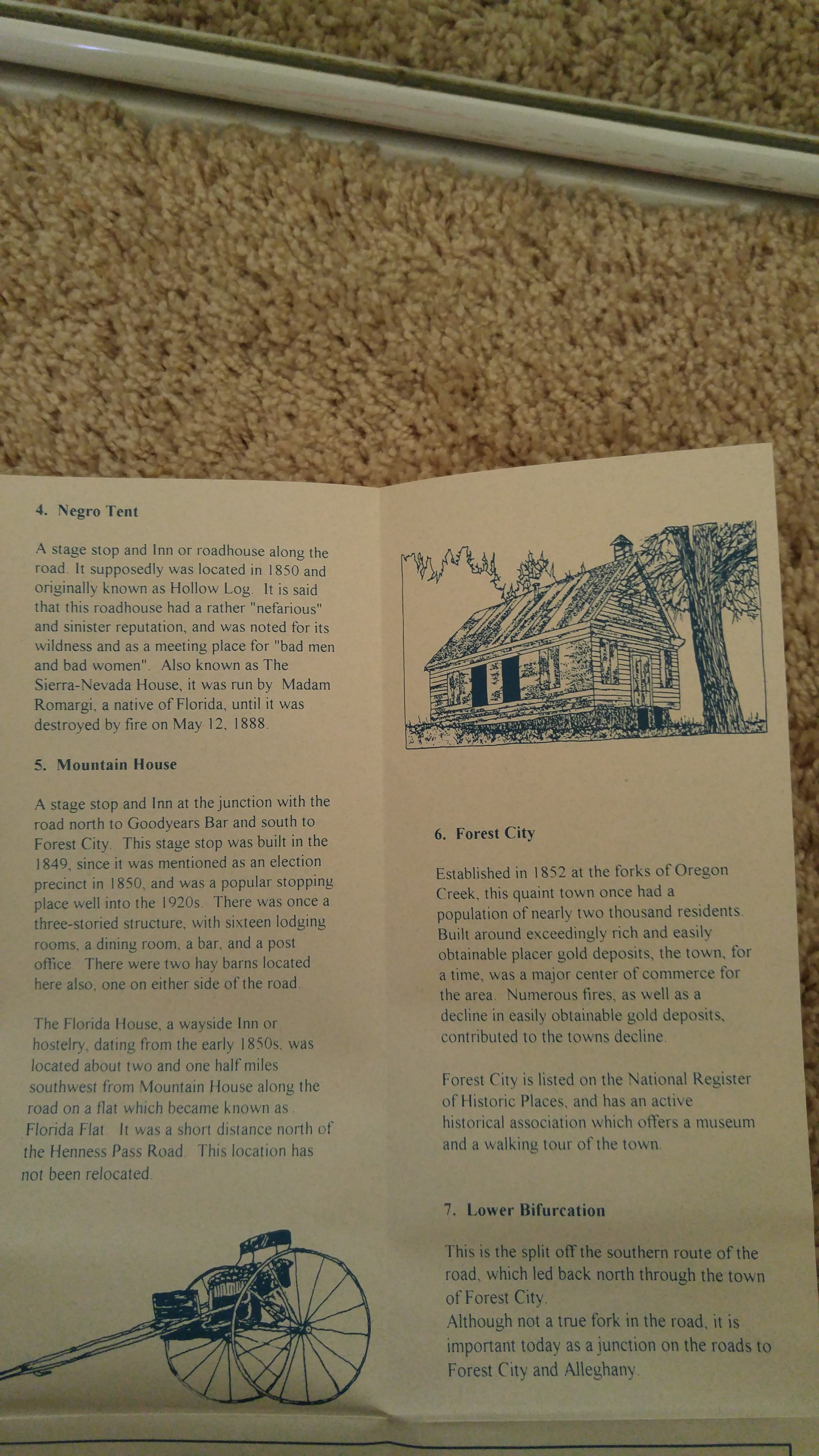
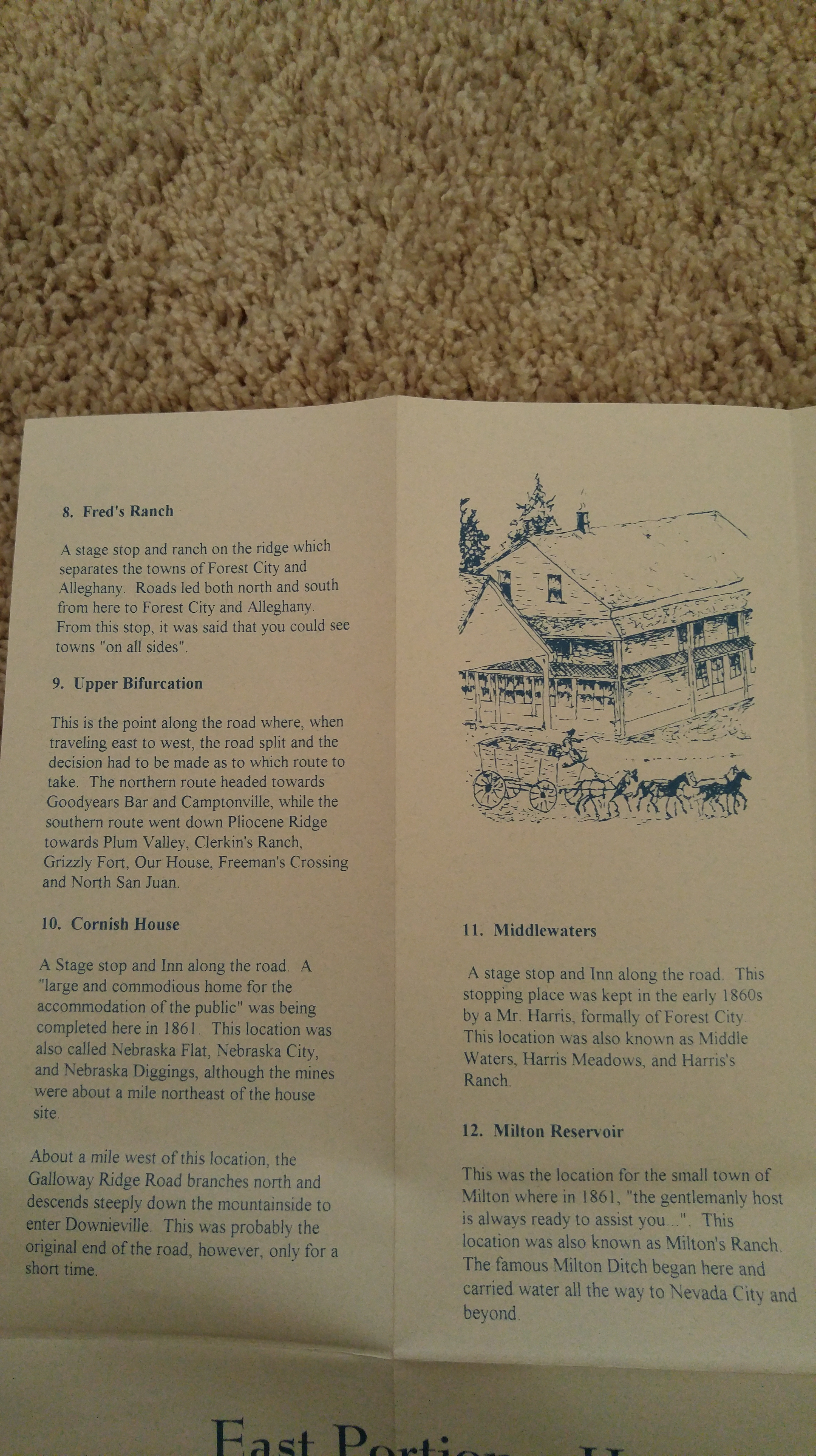
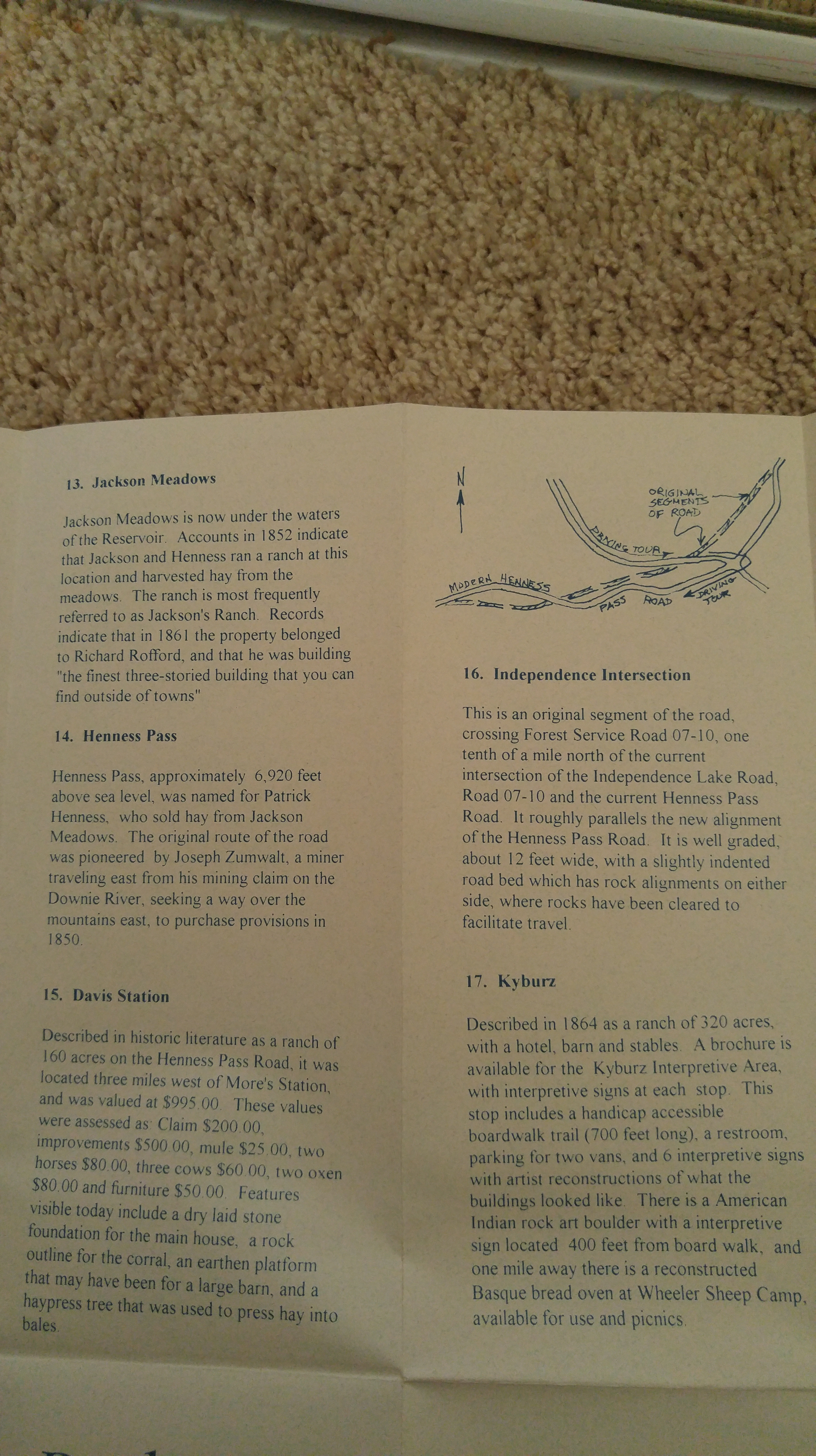
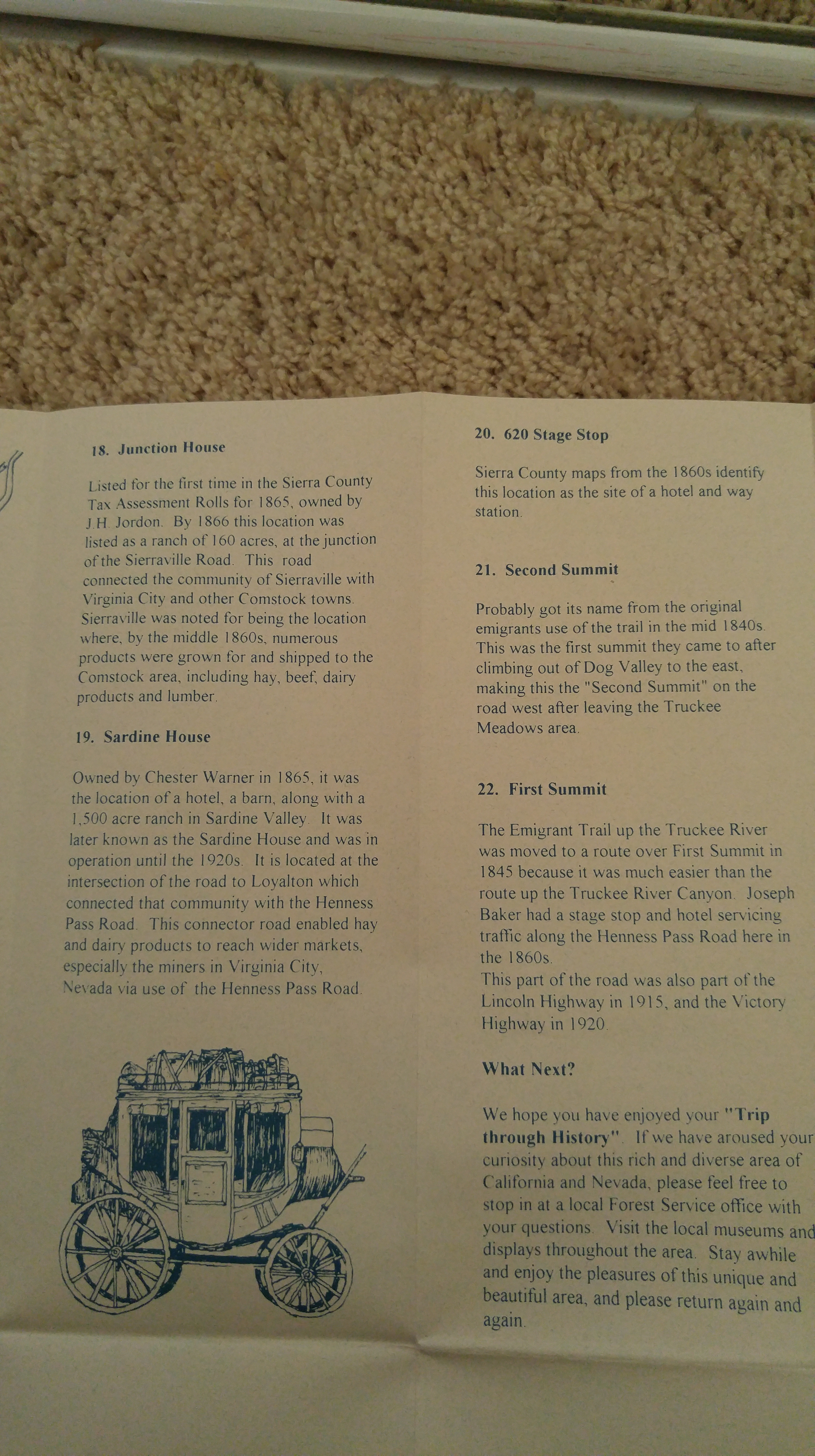
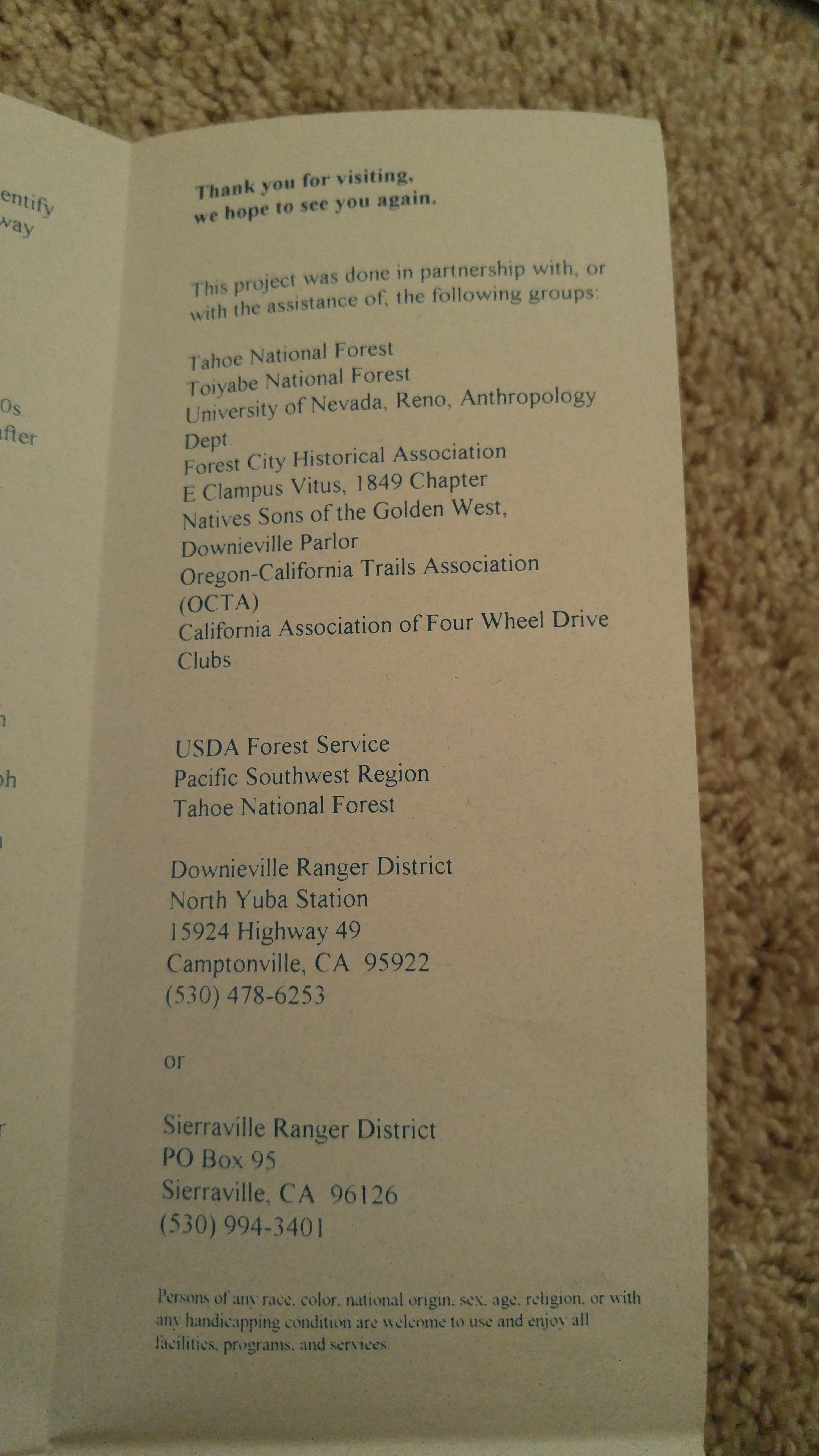
The Brochure

interesting blog, as usual, looks like a good way to spend a day
Nice post. Good information. Thanks for including the informative brochure.
Loved it, we might take this road when we go meet you again this year :)
I’m just sorry to read that the California Grizzly bear is now extinct…
Great article and pics.
The same concept / process occurred in the East also in crossing the Appalachian Mountain range (which roughly stretches from central southeast AL through Maine and just into Newfounland, Canada.
The larger animals (forest bison, deer, black bears, wolves, etcetera) made game trails by finding the lower, easier to navigate, gaps which the Native American Indians took advantage of and widened…. and then the White Man came along and “discovered” them and named them! Sort of like Christopher Columbus – or whoever – “discovering” America. The Indians waiting on the beaches and canoeing out to the ships must have though, “Discovered? What are we? Chopped liver?”
In the East, the larger, more known and used gaps – with the Cumberland Gap clearly being the best known – tended to be more likely to end up being major highways. At some point U. S. Highways, even Interstate Routes. The ones in the East – 35 “Gaps’ altogether – also however seemed to have a lot more “branches” (the Cumberland Gap had several), many which became minor side roads or even just larger dirt roads and even trails.
Rather than get into a lot of details, here some referenced links if one is so inclined:
https://en.wikipedia.org/wiki/Appalachian_Mountains
https://en.wikipedia.org/wiki/Great_Appalachian_Valley
https://en.wikipedia.org/wiki/List_of_mountain_passes#Appalachian_Mountains
https://en.wikipedia.org/wiki/Cumberland_Gap
https://en.wikipedia.org/wiki/Moccasin_Gap
https://en.wikipedia.org/wiki/Wilderness_Road
https://en.wikipedia.org/wiki/Great_Indian_Warpath
https://en.wikipedia.org/wiki/Valley_Pike
https://en.wikipedia.org/wiki/Trading_Path
https://en.wikipedia.org/wiki/Great_Wagon_Road
Of course other routes around the Appalachians existed.
One in the form of smaller ships / larger boats down the Saint Lawrence River and then (with portaging the boats – and cargo – around rapids, waterfalls, etcetera as there were no locks or canals yet) into the Great Lakes. Basically what French explorers and later French Canadians did (however they were little concerned with settlement per se, but more so into trade). Later English colonialists and American settlers also used this route / method. In looking at Ohio, Cleveland, settled by this method, was the first settlement founded in the Connecticut Western Reserve by the Connecticut Land Company. As late as 1800, a company representative reported that only three men lived in Cleveland. Ten years later, there were only fifty-seven residents. During the 1820s, the city experienced growth due to the arrival of new forms of transportation. The Erie Canal connected the city with the Atlantic Ocean during the 1820s. During the 1820s and the 1830s, construction of the Ohio and Erie Canal connected Lake Erie with the Ohio River. Both of these canals bypassed the need to portage in using the St. Lawrence – Great Lakes route (*).
(Another example would be that of Lake Ontario, being furthest east. As the easternmost and nearest lake to the Atlantic seaboard of Canada and the United States, population centres here are among the oldest in the Great Lakes basin, with Kingston, Ontario, formerly the capital of Canada, dating to the 1670s – as Fort Frontenac originally – and Toronto in 1750. Oswego, NY – formed as a trading post / fort – in 1722, Oswego was incorporated as a village on March 14, 1828.)
Another in the process / method of traveling along the Gulf coastline and then down the Mississippi River (and further up the Ohio River, etcetera). That’s where you see Marietta (Ohio) as the first permanent settlement of the new United States in the Territory Northwest of the River Ohio. Marietta is located in southeastern Ohio at the mouth of the Muskingum River at its confluence with the Ohio River.
(*) The initial Saint Lawrence Seaway – allowing passage down the St. Lawrence River and into the Great Lakes and vice versa – was preceded by a number of other canals. In 1871, locks on the Saint Lawrence allowed transit of vessels 186 ft. long, 44 ft 6 in wide, and 9 ft deep. The full route that permitted travel by regular ocean going ships did not conclude until 1959!
https://en.wikipedia.org/wiki/Saint_Lawrence_Seaway
We drove the old wagon route, the Henness Pass Road, from Nevada City, CA., over the Sierras to Verdi, Nevada. Much of it was unpaved and quite rocky. It is quite unimaginable how the ride must have been in a stagecoach or on a buckboard, but easy to understand how the distance that we now cover in about an hour and a quarter took several days. The route follows a ridge line so the scenery was quite beautiful with majestic valleys on both sides. The trip took all day and there were several times when we didn’t see another person or any sigh of human habitation for several hours.
The recognized the pictures in the article; they brought back fond memories.
Yes, it’s a great day trip. It’s amazing how few people one sees given how crowded the Henness Pass Road was in the past… And, yes, I can’t imagine making that trip in a buckboard.
I just discovered Henness Pass road as Waze told me that was the way to get to Independence Lake. It didn’t turn out to be such a great way to get there! Right across 89 from where it goes up to Kyburz Flat, there’s a dirt road entrance with an unlocked gate. I drove down there and paralleled 89 for a mile or two until I got the sign “Road Closed – Bridge Out”. Had to turn around. Decided to head north on 89 to Sierraville just to see what was there and saw the very obvious very paved Jackson Meadows exit to Independence Lake. Got to the lake finally, really spectacular. Now that I know more about HPR and where it goes I might go over the pass to Verdi from Truckee if we go there again some day.
Pingback: Nevada Travel Brochure – VIP Travel Destination
We take HP often. We like Milton res for camping. And a correction: beckwourth pass on SR 70 is the lowest trans Sierra pass at 5221’. Enjoy your page and YouTube videos.