I’ve wanted to go to Pinnacles National Monument for so long that I can’t even remember how I originally became interested. At first I was going to go with my ex-fiance, Katie, over Thanksgiving 2004 or 2005 (I can’t remember which), but something came up. So, the visit was rescheduled. And then something came up again. And again. And again.
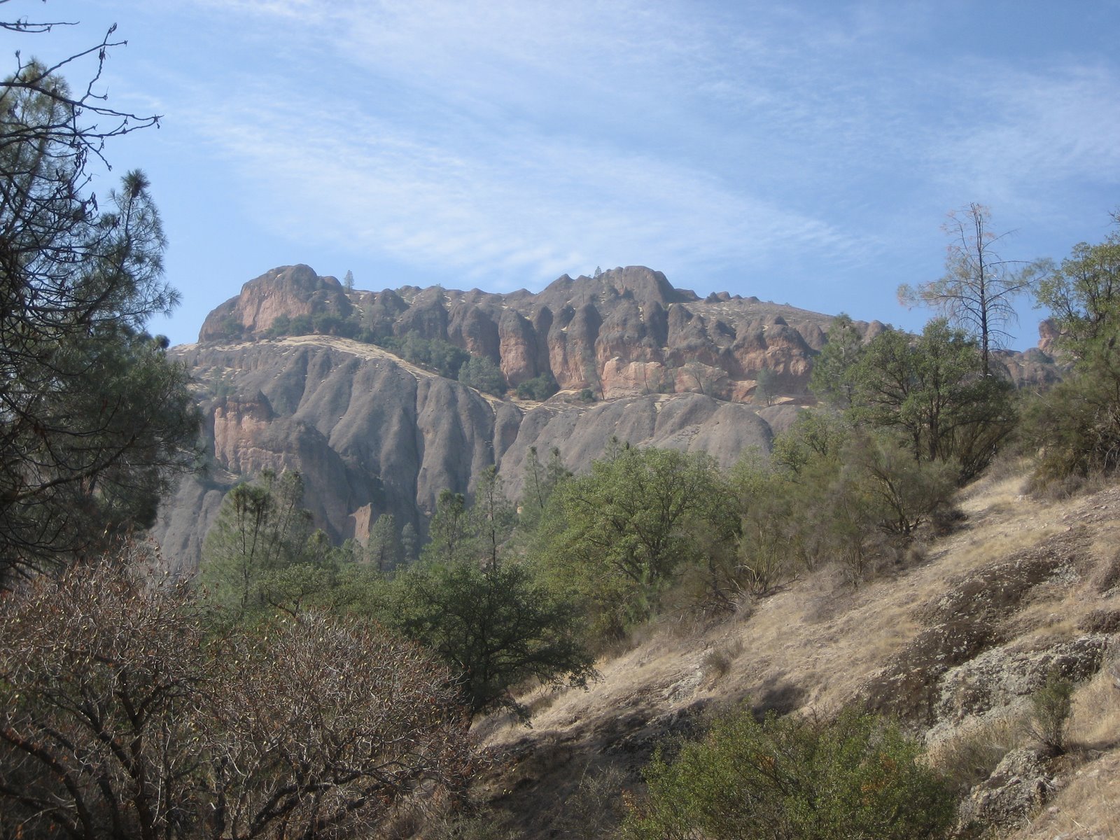
Pinnacles is a protected mountainous area located east of the Salinas Valley. The Monument’s namesake are the leftovers of an ancient extinct volcano. The Monument is divided into East and West Divisions by the rock formations and are only connected by trails, but not by roads.
I was eventually prepared to go by myself if necessary when just prior to my departure, I pitched the idea to my cousin Brandon and his wife Amanda, both of whom are new arrivals to the area. Fortunately, they are almost always down for an adventure and were pumped up to go.
So, we packed up the car and headed out towards Hollister which is pretty much the only town you will pass through on the way to the park once you leave San Jose. Despite what the t-shirts might imply, I can state emphatically that Hollister is not a cool town.
Fortunately, once you get past Hollister you move onto Highway 25 which features a lot of rolling hills with fat cattle and a twisty road interspersed with long straight stretches. It reminded me a lot of the area around Highways 41 and 46 where James Dean was killed. Perhaps needless to say, it is great motorcycle terrain. This is obviously not a secret though given the large numbers of motorcycles we saw. On the way out we passed a group of sport motorcyclists right after one of their members had dumped his bike on a corner. He was okay, but the bike was damaged and was lodged in a wall of poison oak down an embankment. One of their crew suggested trying to turn the bike on to see if it could perhaps be gotten out under its own power, but we did not stick around to see how this resolved itself. The bike may still be there…
We finally arrived at the park (I really shouldn’t use the word “finally” because it is no more than a two hour drive from the Bay Area). For such a spectacular park it is remarkable how few people have heard of it…
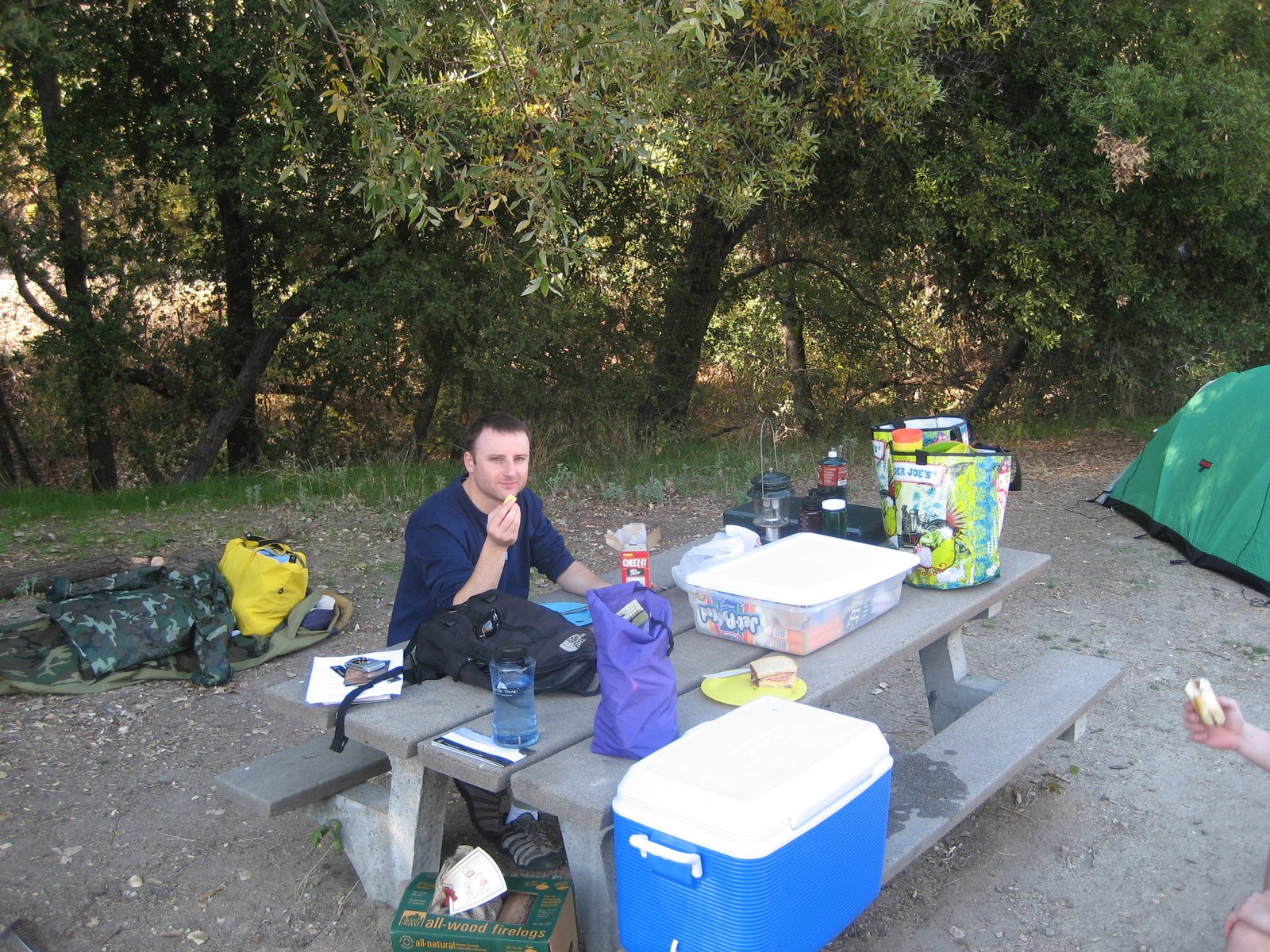
Once arrived, we checked in at the campground, set up camp and secured the perimeter… I just slept in a camo bivy sack (which can be seen on the ground in the behind me) and this proved more than adequate for the duration of our trip even despite a light rain on the second night:
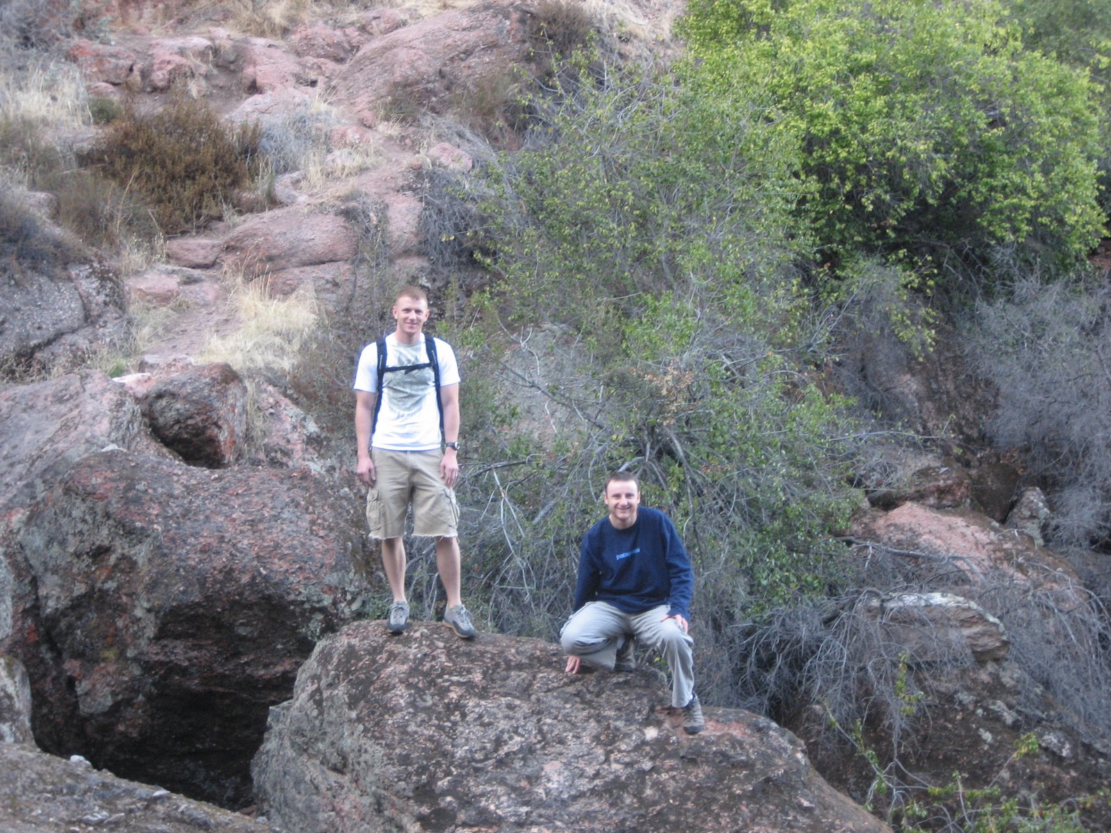
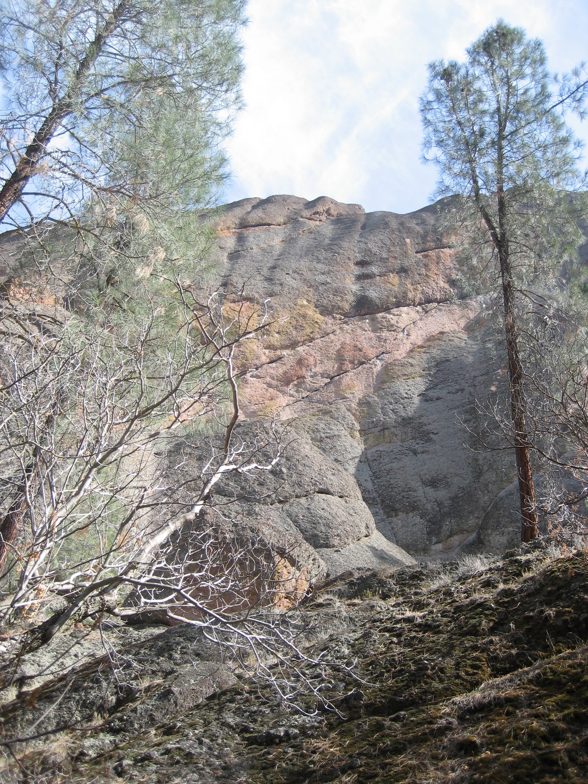
We arrived early enough on the first day to have time to do a little exploring and so we set out for the Bear Gulch Cave which is a little less than a mile in from the Bear Gulch Visitor Center… The trail up to the Bear Gulch Cave is pretty moderate and features plenty of worthy scenery along the way:
Such as this California Buckeye:

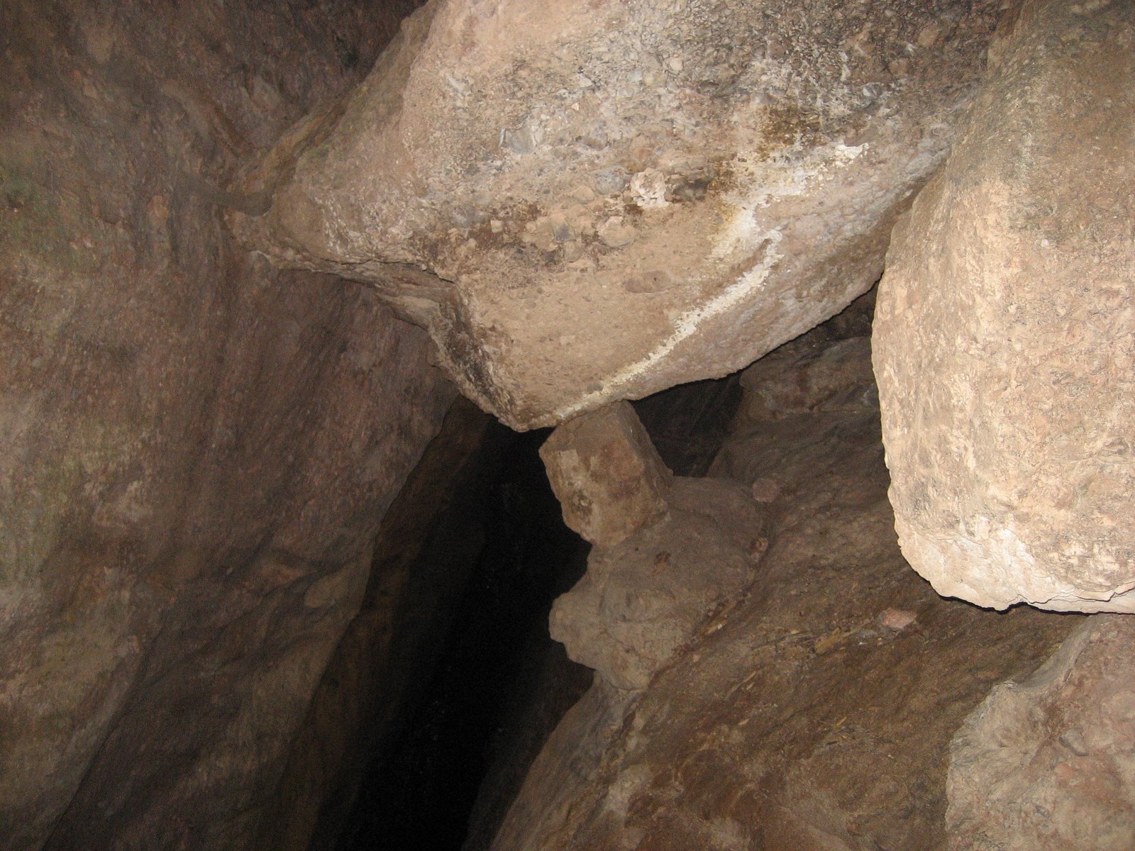
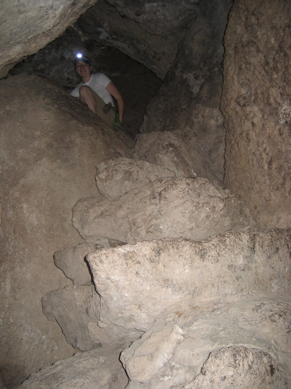
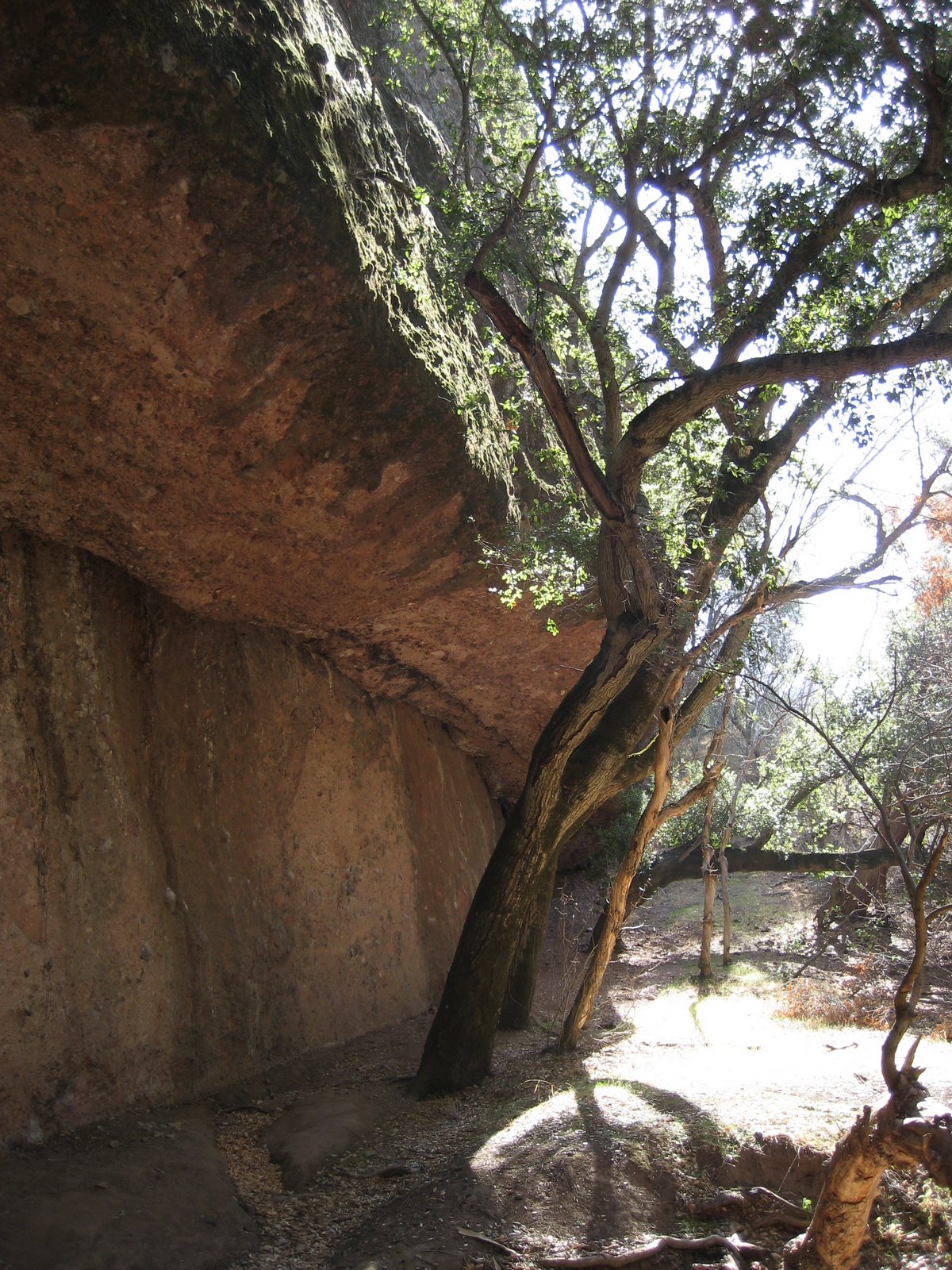
Both sets of caves in the park are “talus caves” which are formed in canyons when boulders and other debris fall into the canyon and form a roof. The Bear Gulch cave is closed seasonally to protect sensitive bat species and the Balconies Cave can be closed due to flooding. Check the park website for a current cave status before planning a trip around visiting one or both of the caves:
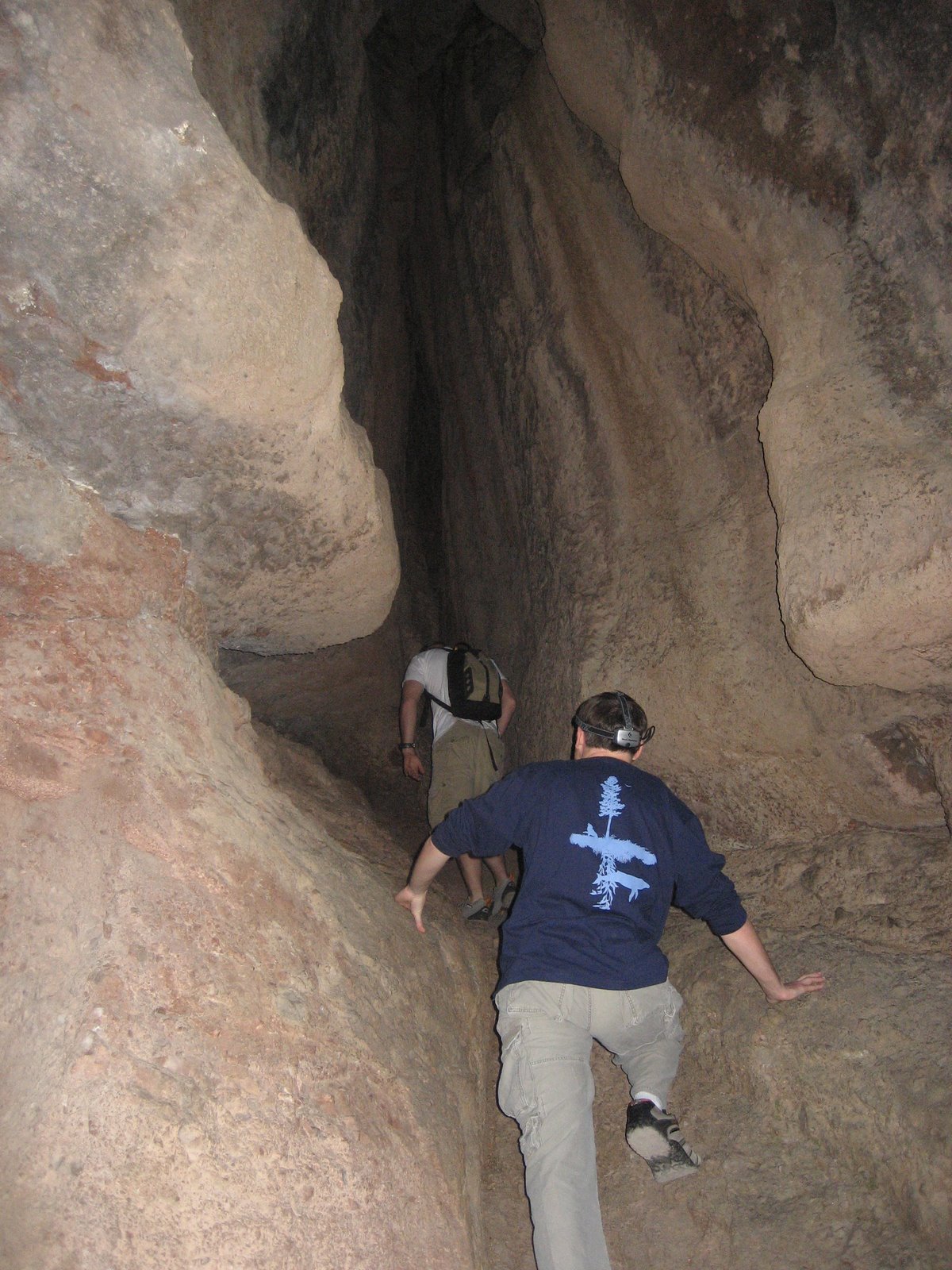
Flashlights, head lamps, candles – some sort of light source is needed to get through the caves:
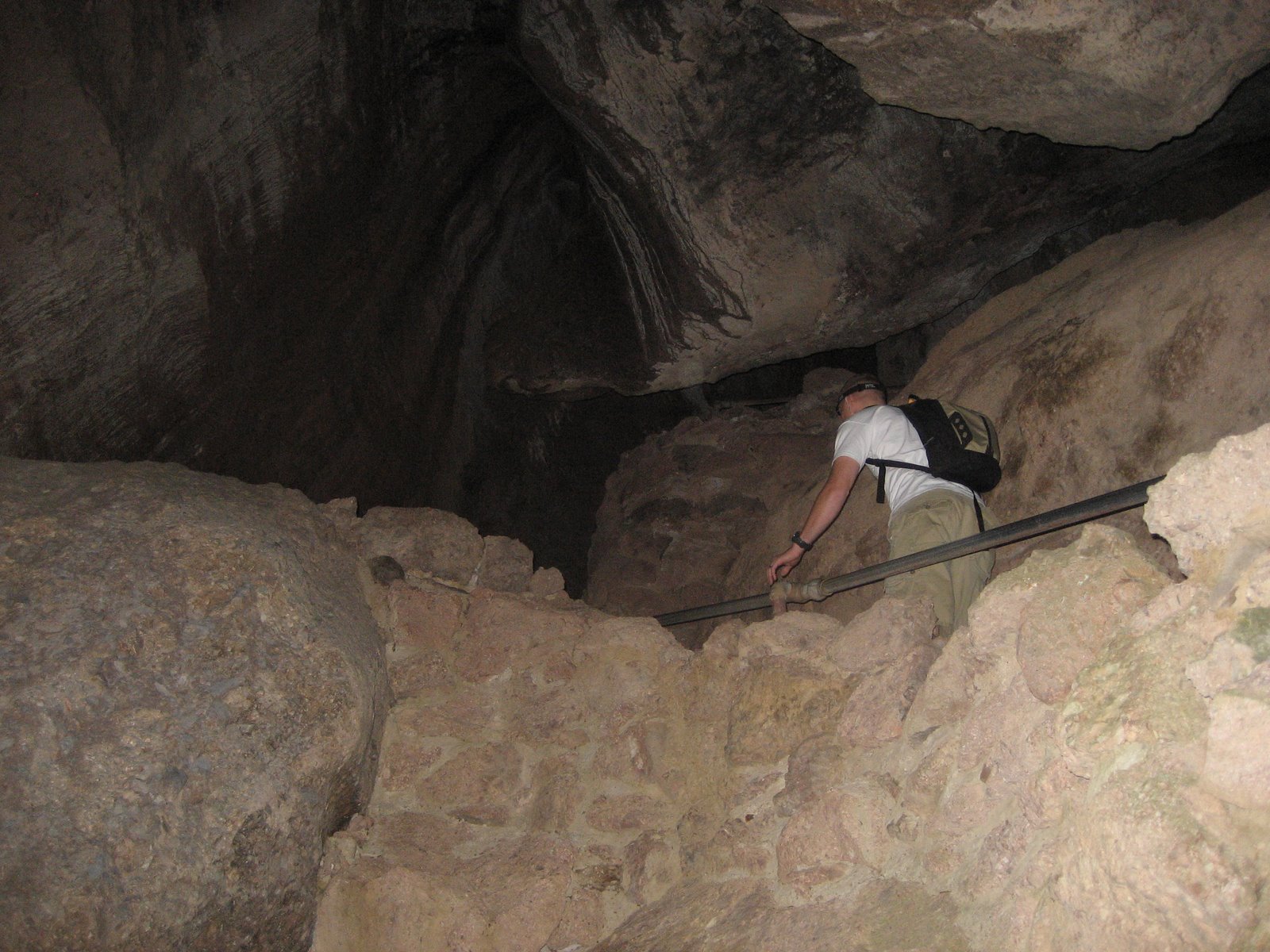
It’s amazing how little is propping up some of the boulders that form the roof of the cave:
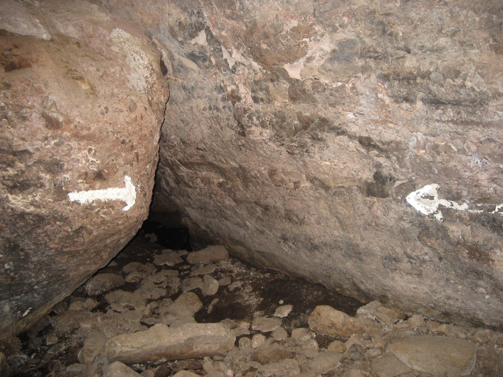
There are plenty of “is that seriously the trail?” moments as one makes their way through the caves… And, yeah, that picture below is of the trail – just as the arrows indicate. You are not going to remain upright while venturing through the caves in the park:
As soon as you exit the Bear Gulch Caves you come across the Bear Gulch Reservoir which was built in the 1930s by the C.C.C. I’m not normally a fan of reservoirs, but I have to admit that this one was quite attractive and provides one of the few remaining habitats for the very endangered red-legged frog (one of which we were fortunate enough to see in a small pool deep inside the Bear Gulch Caves):
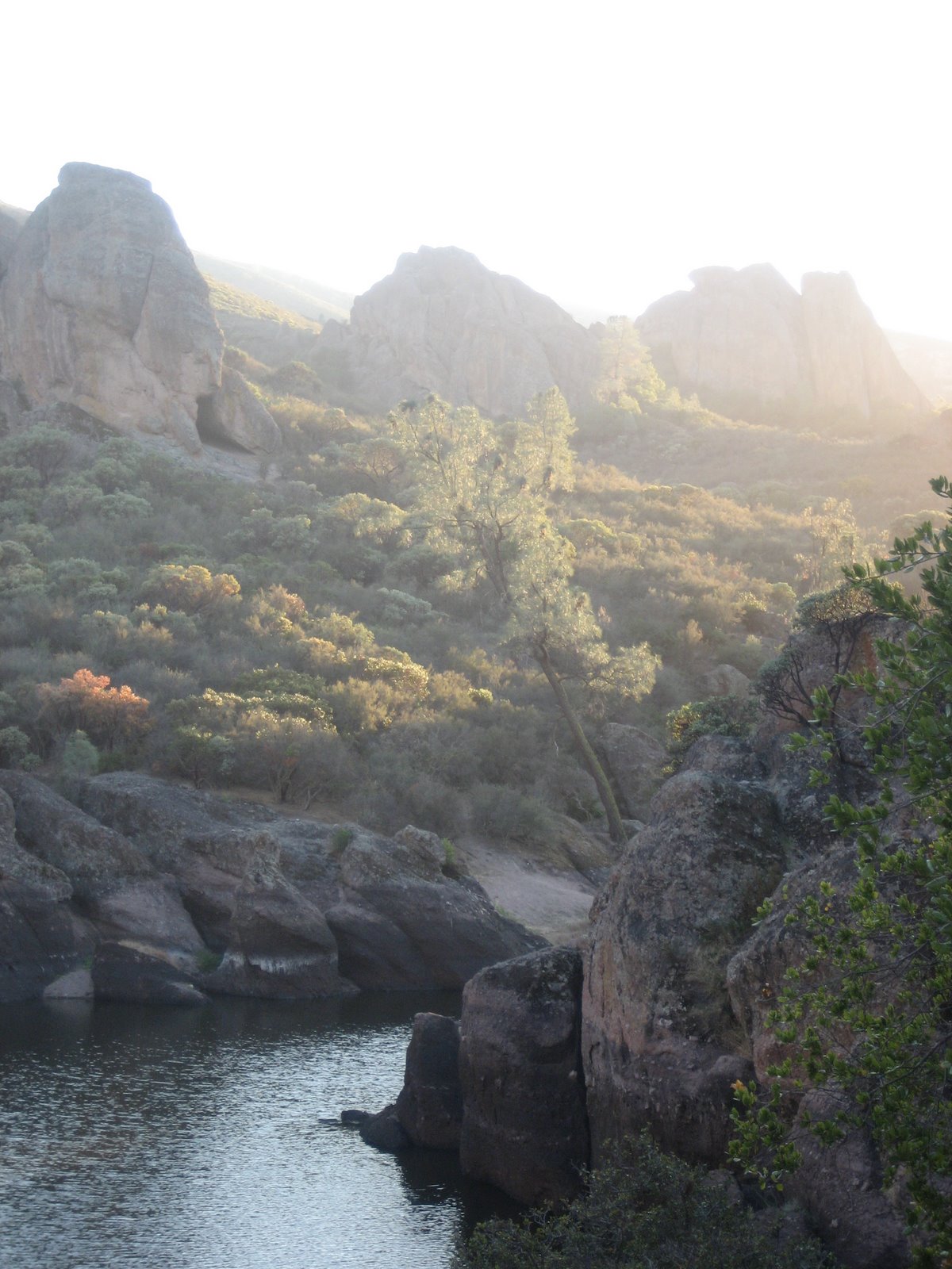
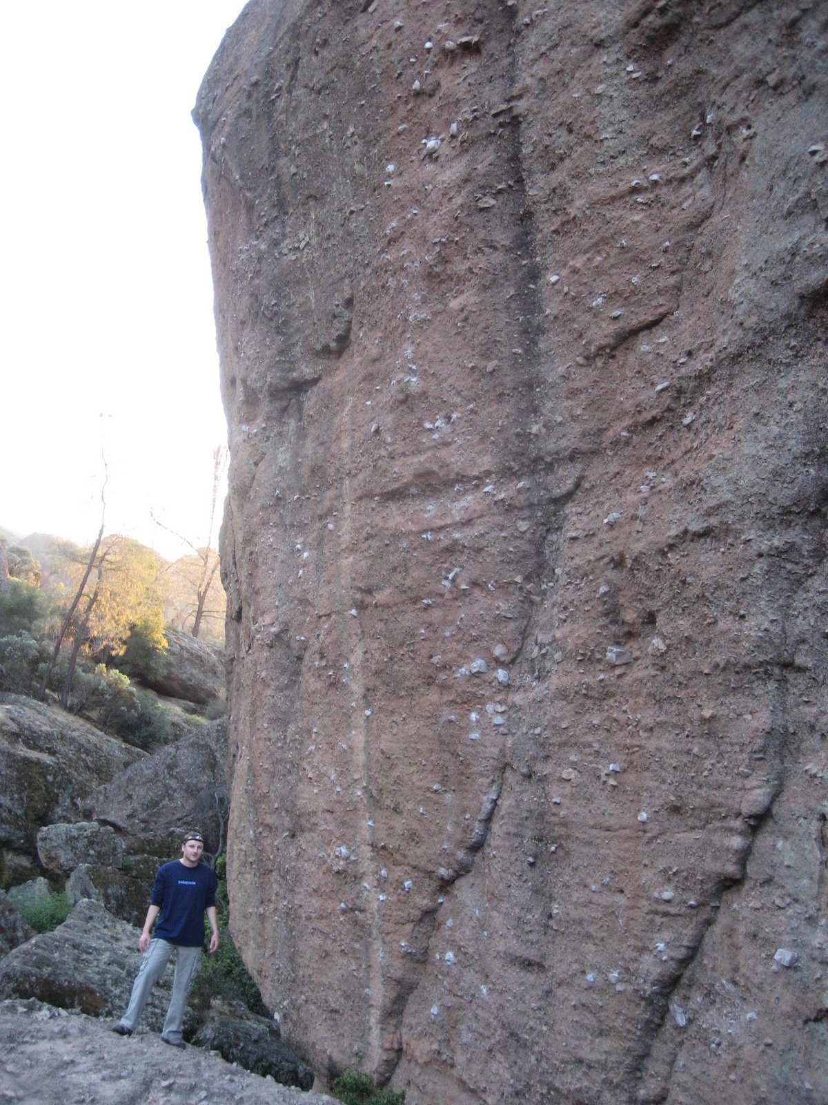
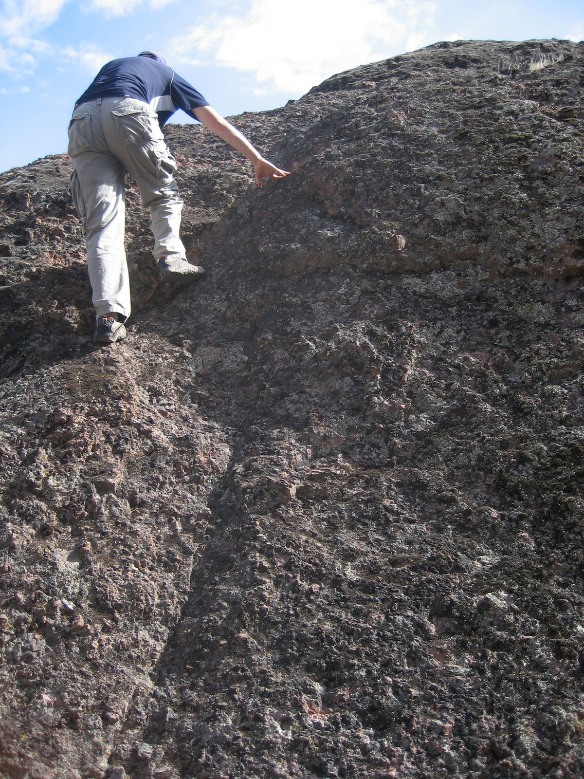
The reservoir is surrounded by cliffs which are great for climbing:
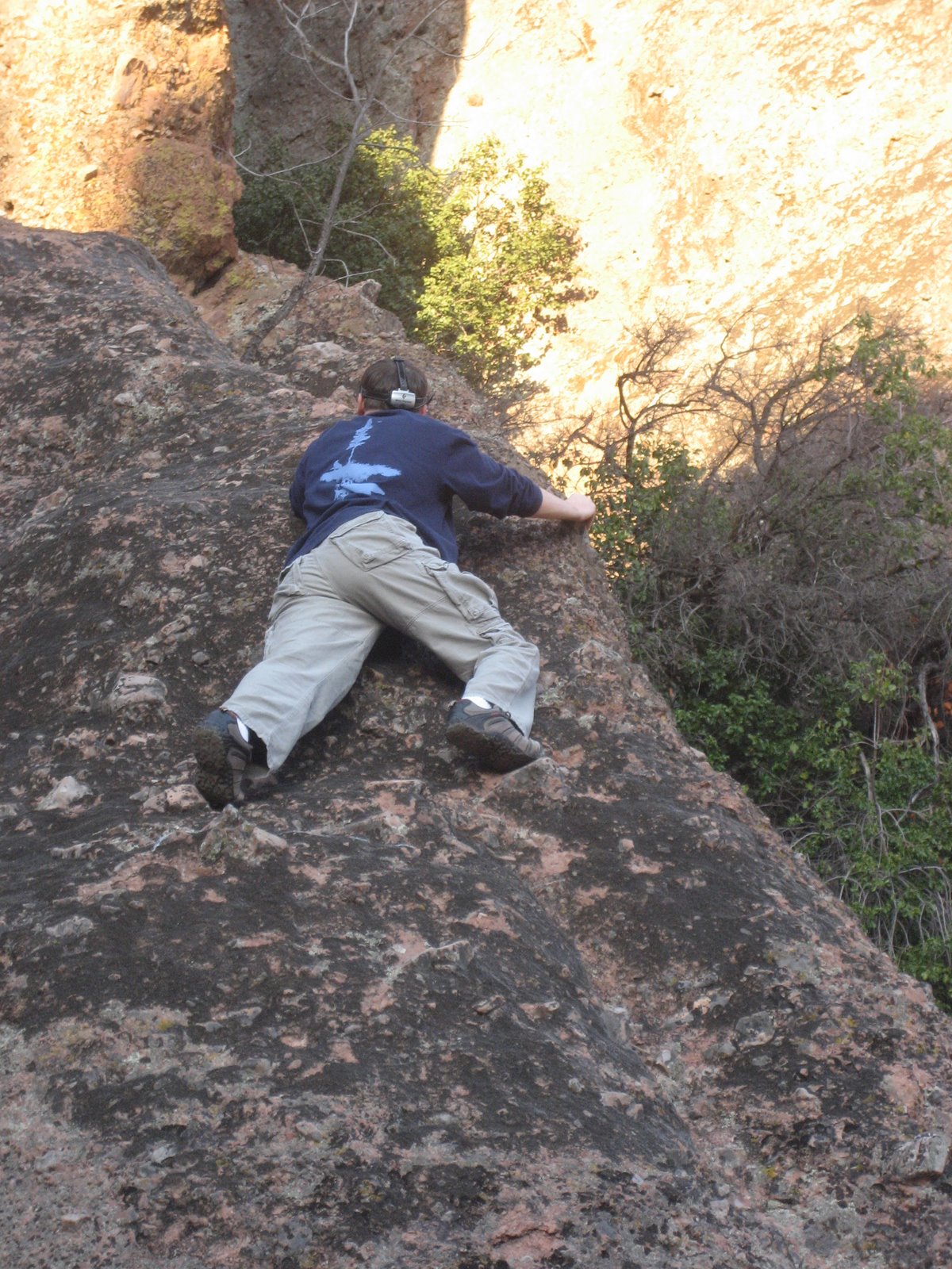
Really, almost all of Pinnacles has great climbing areas. One can see the popularity of this particular wall by the various white spots on the cliff where chalk has accumulated over the years on the popular handholds used by countless climbers:
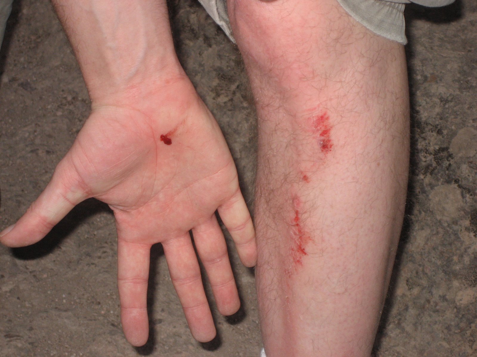
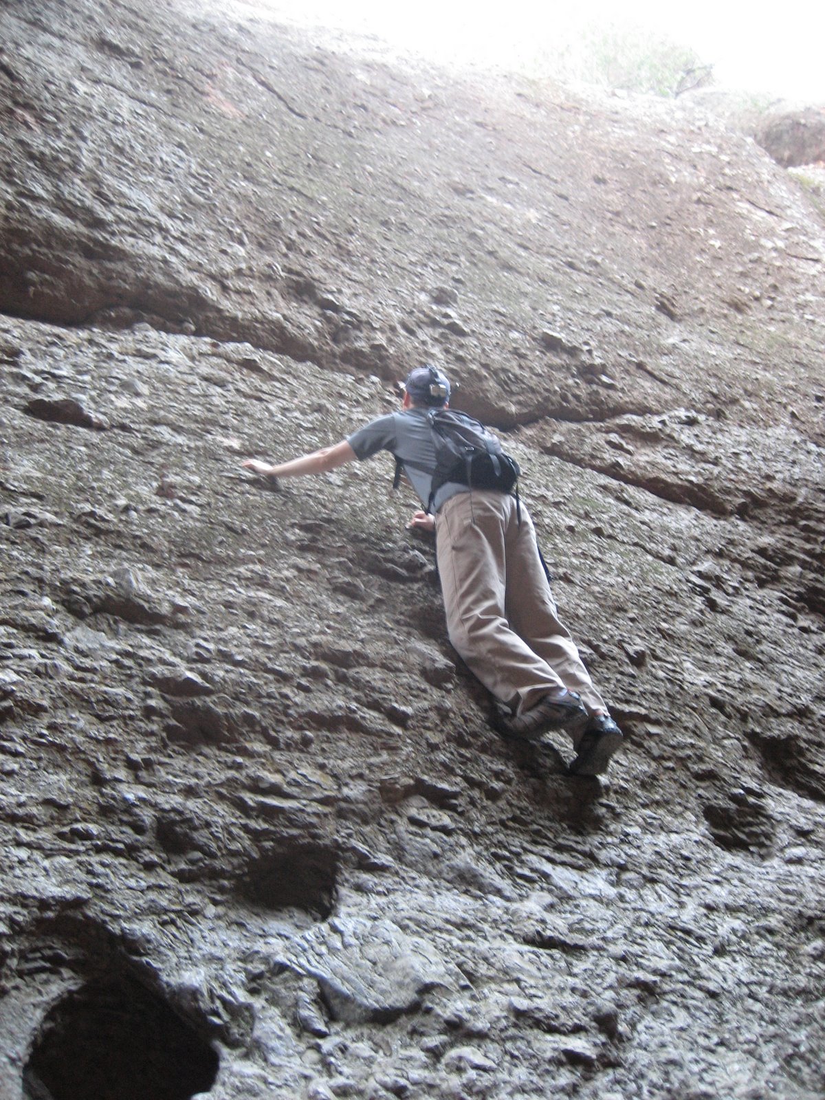
Try not to be a dumbass like me and do this to yourself on the way down the cliff:
We got back as it was getting dark and soon had a nice campfire going:
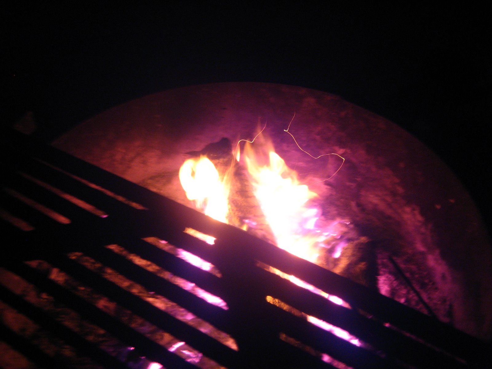
This delightful fire was accompanied by some moist cooters which I can’t recommend highly enough for any camping trip. For the record, a moist cooter is hot chocolate with a splash of peppermint schnapps in it. Absolutely delicious:
At night in the campground you can hear different coyote packs howling. And every morning a large group of turkeys patrols through the campground. Pretty awesome…
On Day 2, we followed the Old Pinnacles Trail over to the west side of the park and the Balconies Caves.
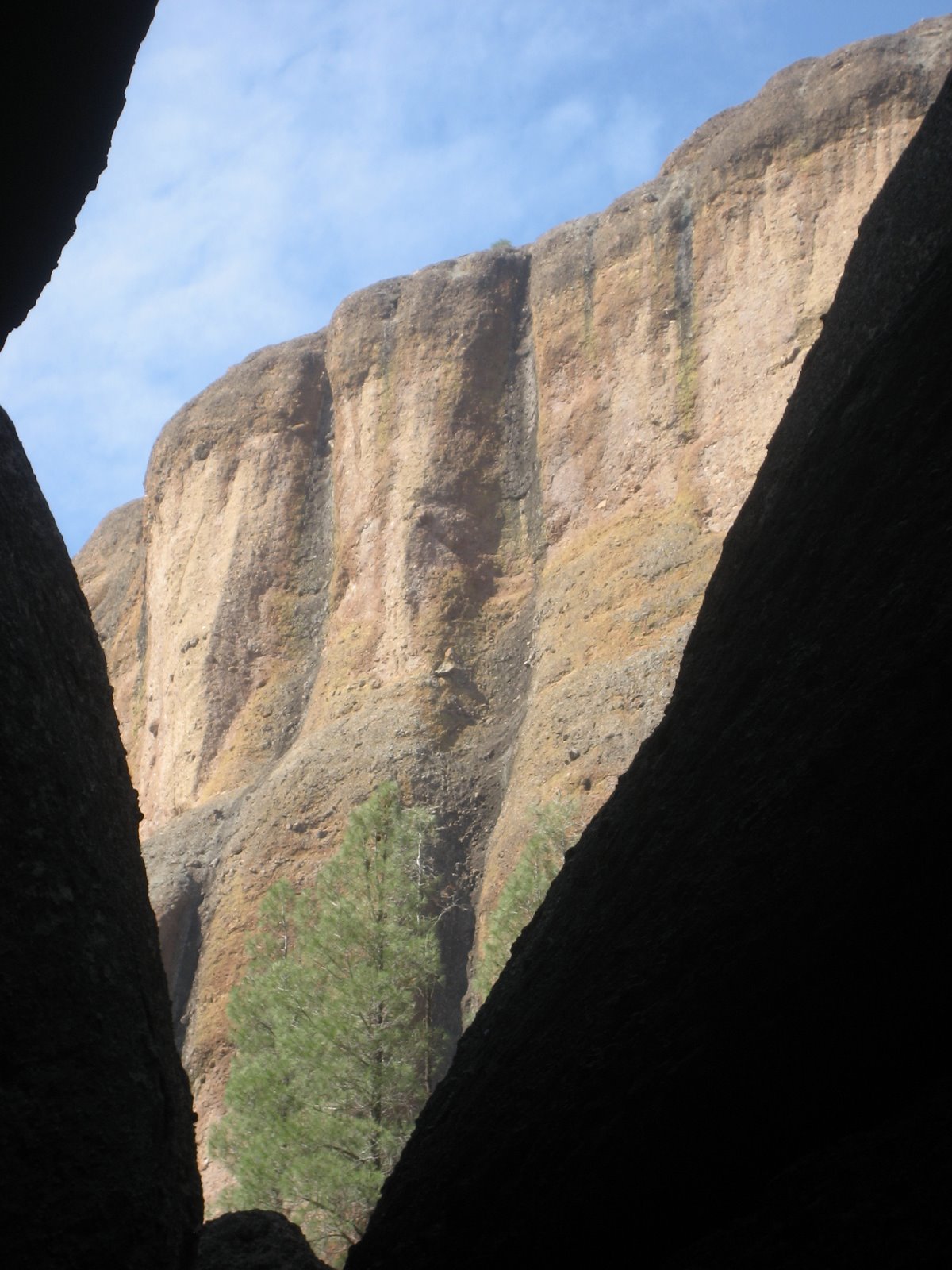
Here is the view you see as you are entering the Balconies area from the east:
The Balconies Cave is shorter than the Bear Gulch Cave, but is steeper as is evidenced by Amanda:
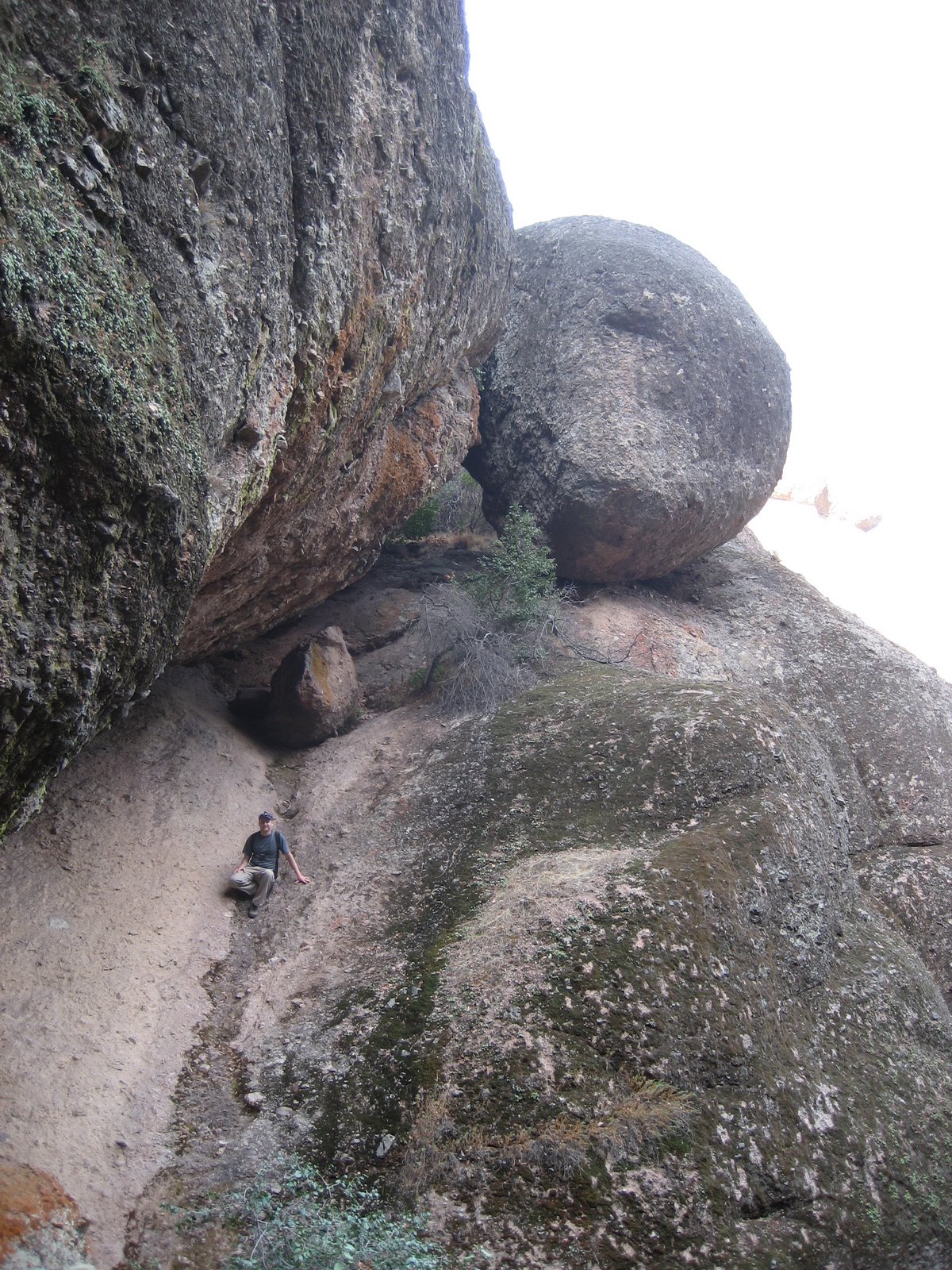
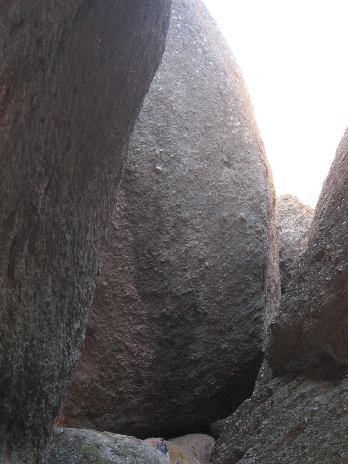
Some of the boulders that have tumbled down from the Balconies are huge as you can see by the boulder to my left in the picture below:
This is another view of the Balconies from the cave itself:
The Balconies Cave features some good climbing walls which we found impossible to resist:
And did I mention the size of the boulders in the area enough? Look how tiny I am compared to the one in the picture below (I’m that speck at the very bottom of the picture). Imagine being around when one of those bad boys comes tumbling down the mountain!
The Balconies area had an abundance of beautiful views:
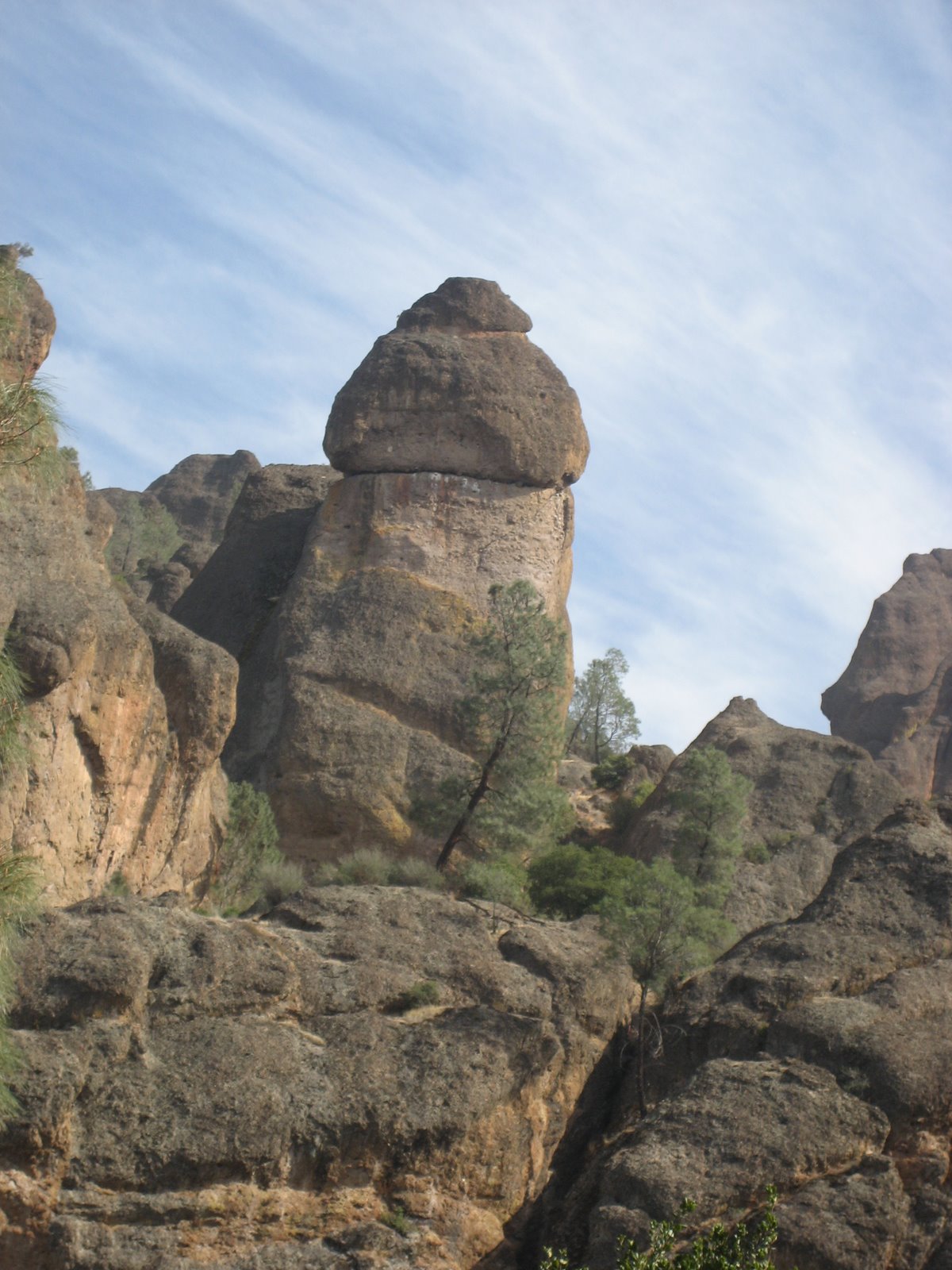
The official name for this rock formation is “Teapot Dome”, but it sure looked an awful lot like something else to us:
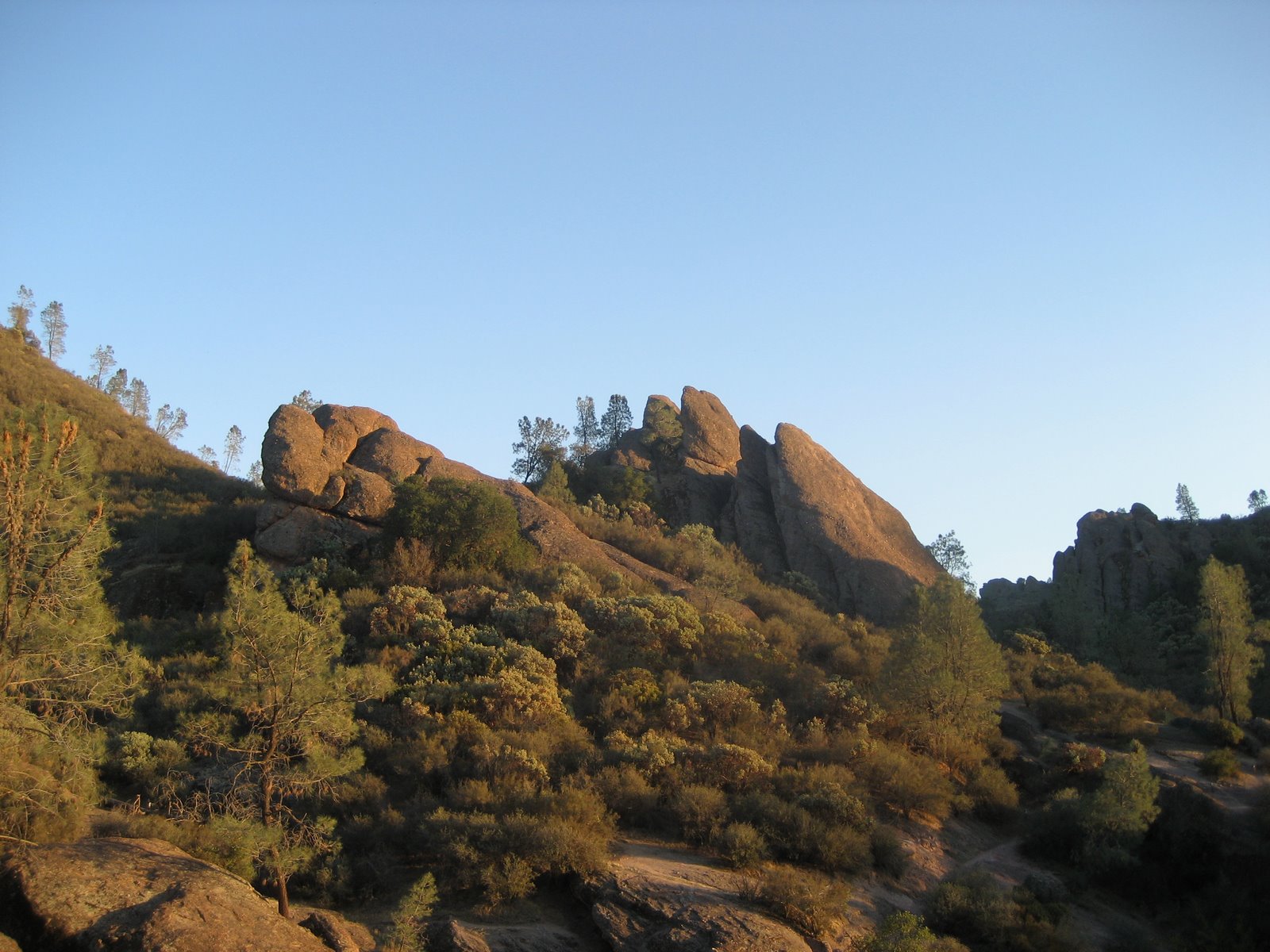
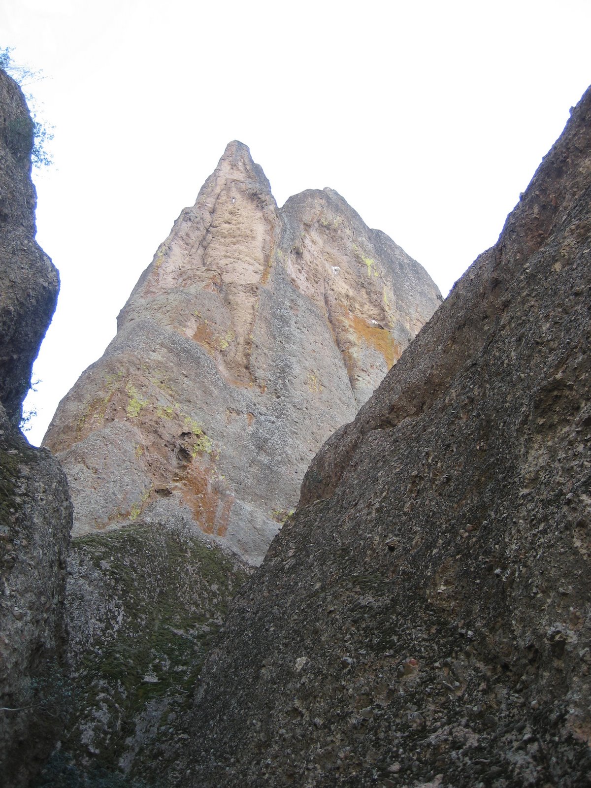
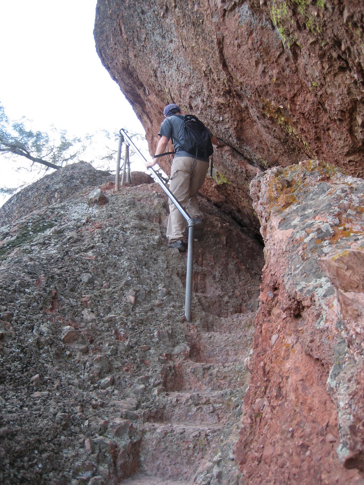
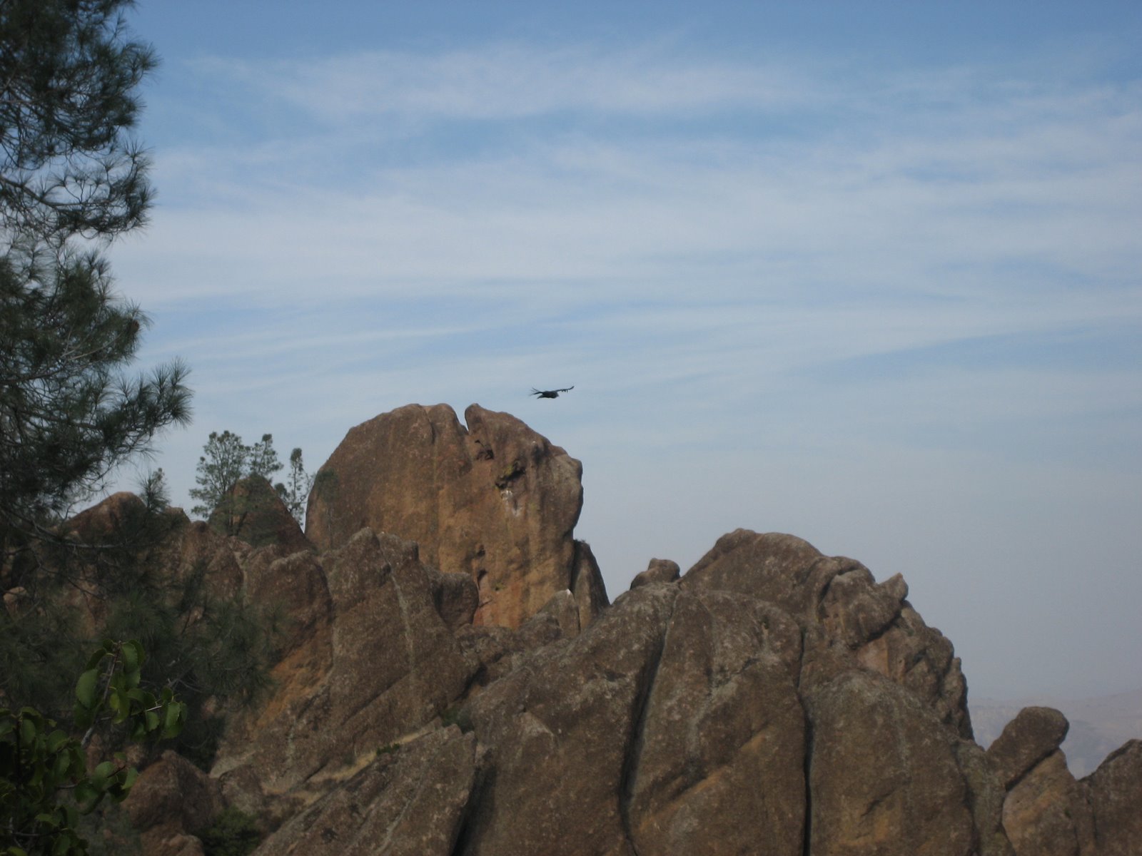
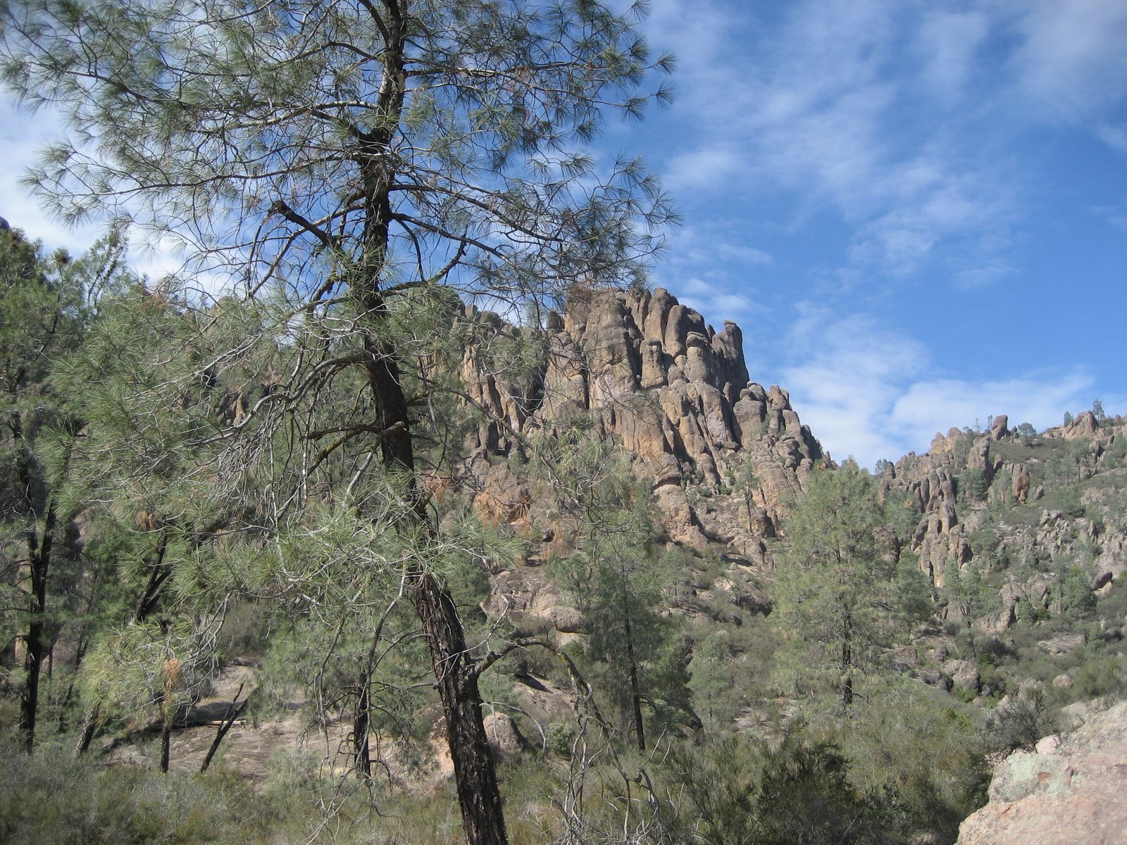
After passing through the Balconies Cave area, we started up Juniper Canyon Trail to the High Peaks area. Below you can see one of the High Peaks:
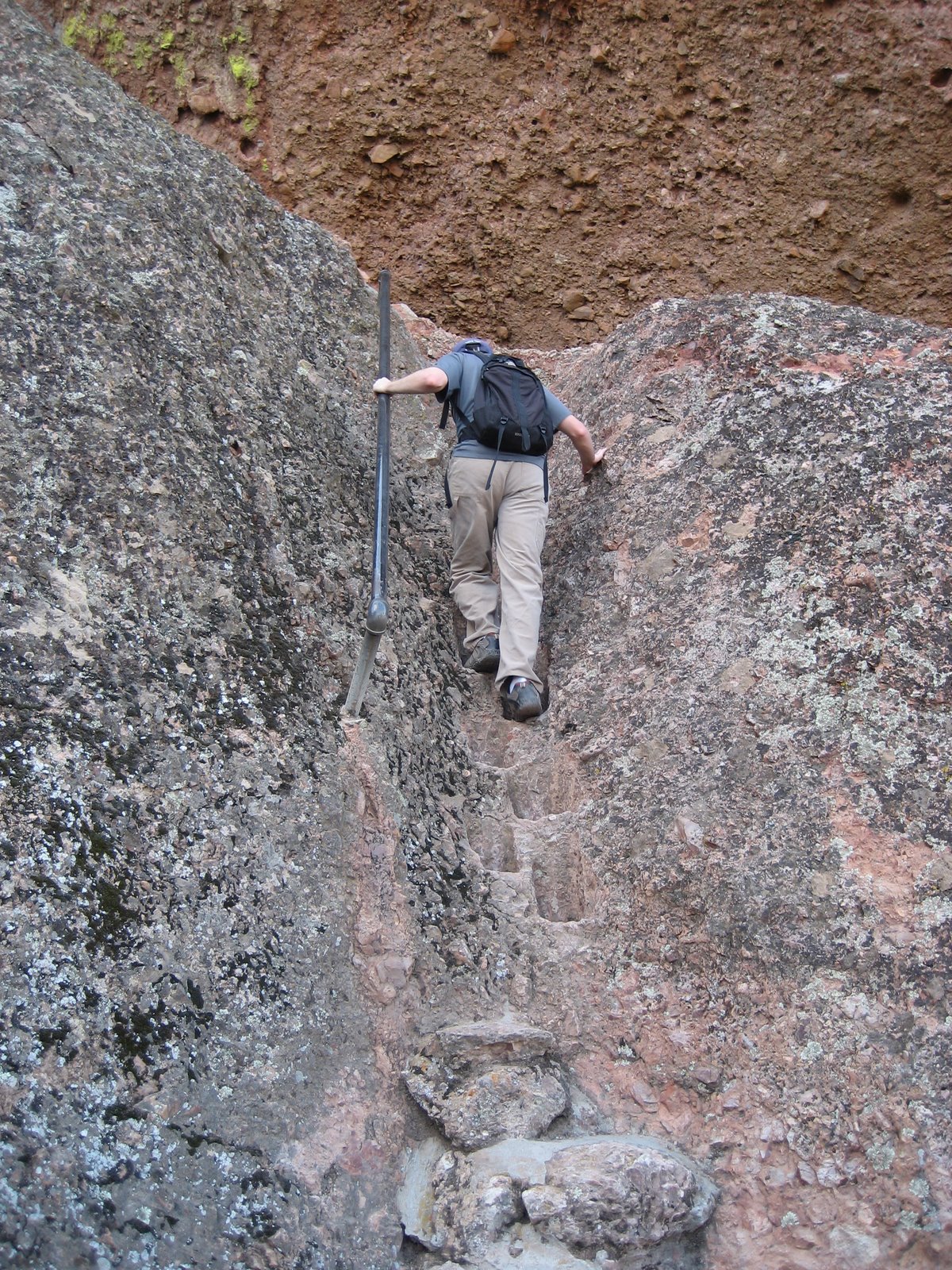
Once you get into the High Peaks area, you will enter the “steep and narrow” section. This is not an exaggeration. It’s somewhat hard to tell from the picture below, but the “trail” is just notches cut into a rock and I am going straight up:
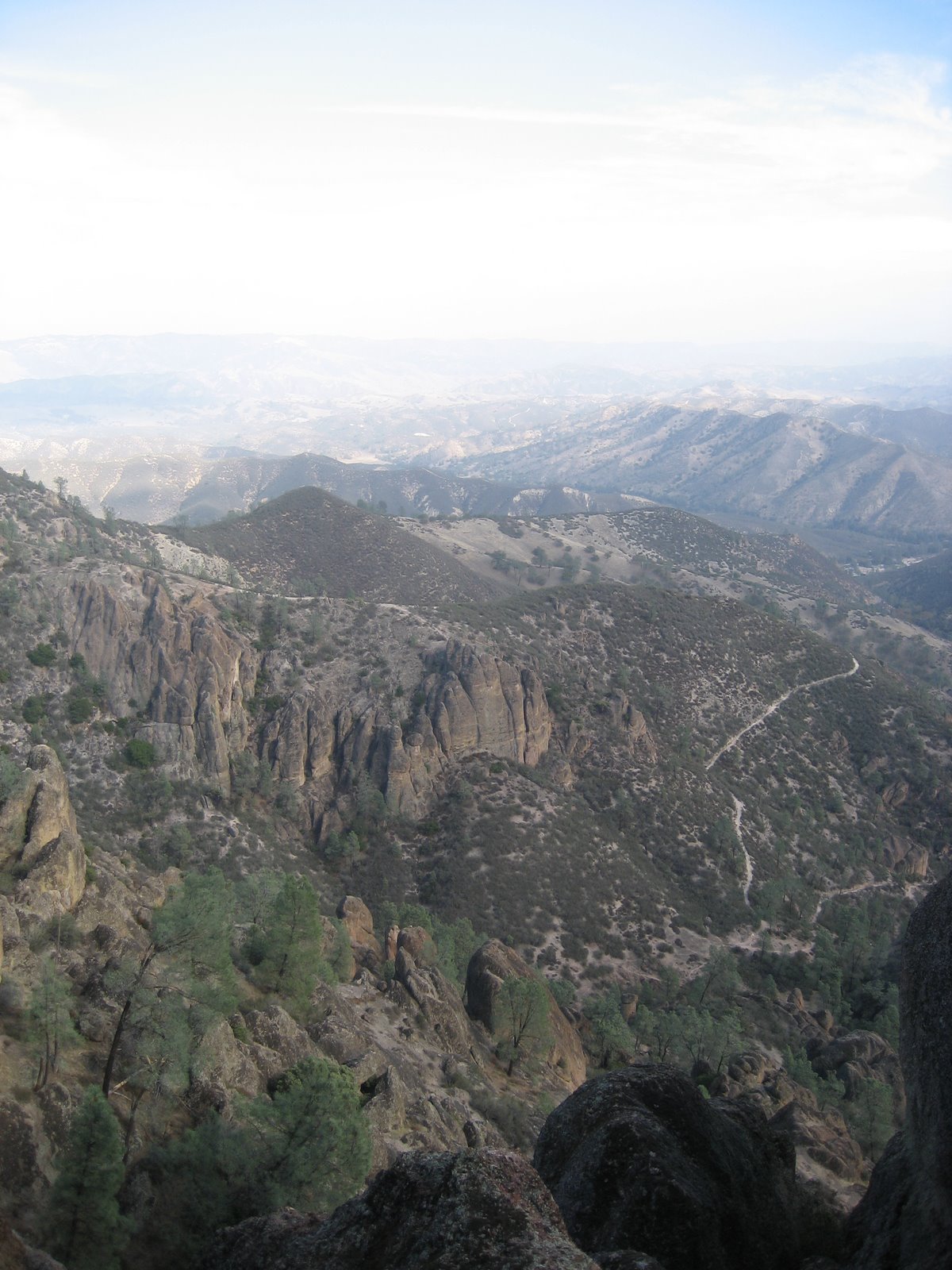
This is the view you can enjoy at the top:
And if you’re lucky, you’ll get to see one of these… The critically endangered California condors like to hang out on the highest points in the High Peaks area:
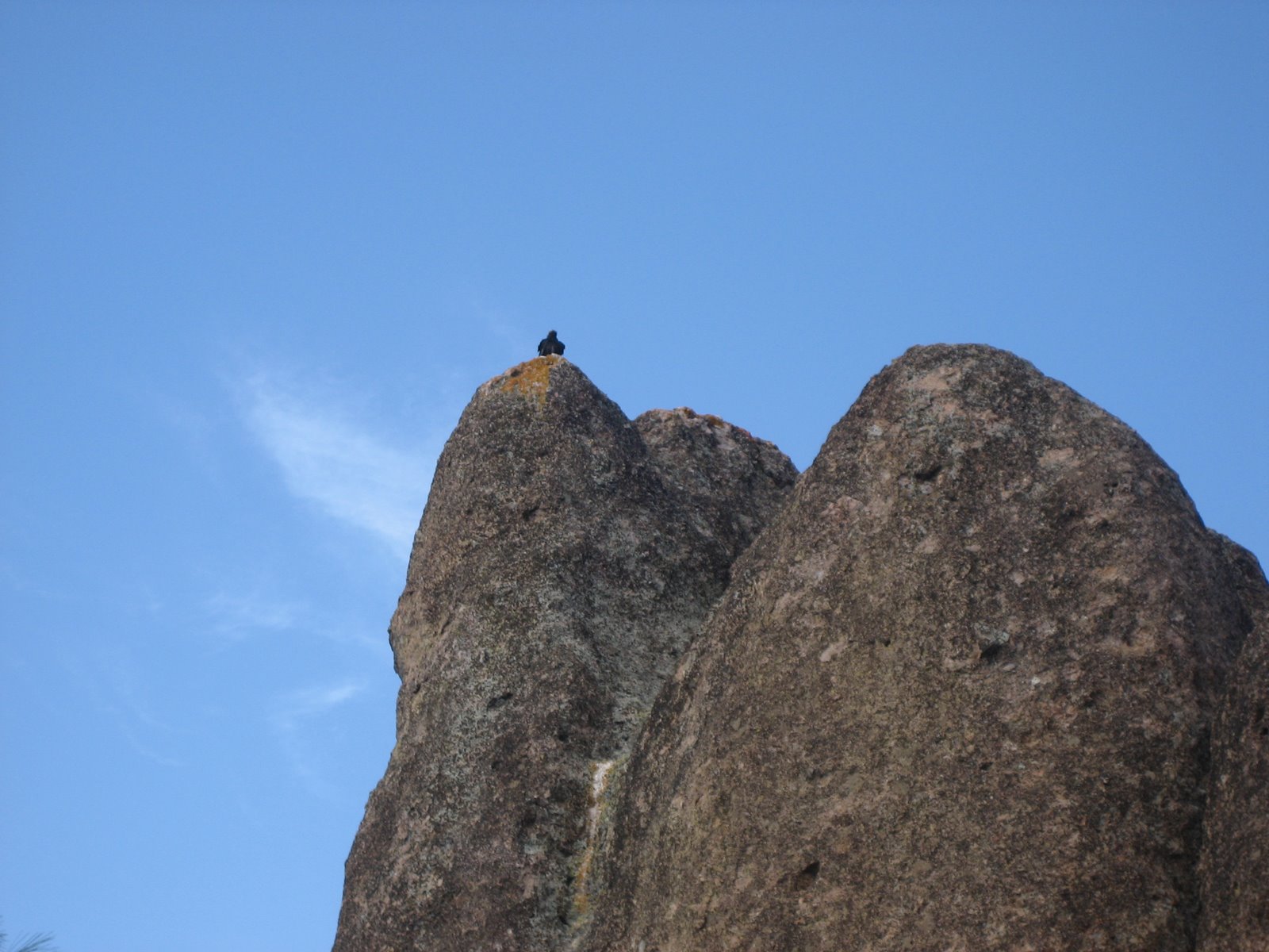
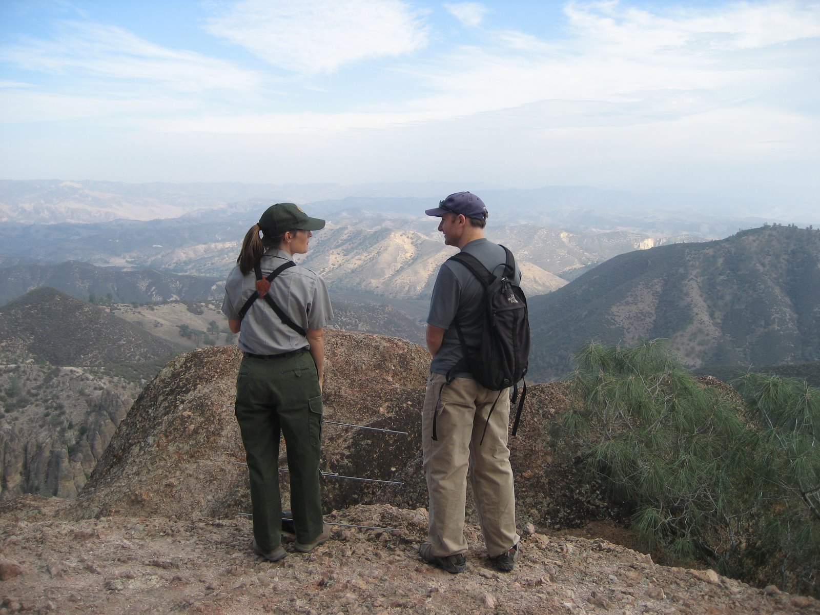
Fortunately for us, a park ranger was up at the peak when we arrived with her spotting scope. Brandon was able to take the picture below through the spotting scope which I thought was pretty awesome. This particular condor is “condor 306”. All of the condors released into the wild are fitted with radio tags and some are fitted with GPS units. Condor 306 is a female and is the oldest condor in the Pinnacles National Monument. Even though she is the oldest, she is still not fully grown which is demonstrative of how new the condors are to the area and how fragile the recovery program is:
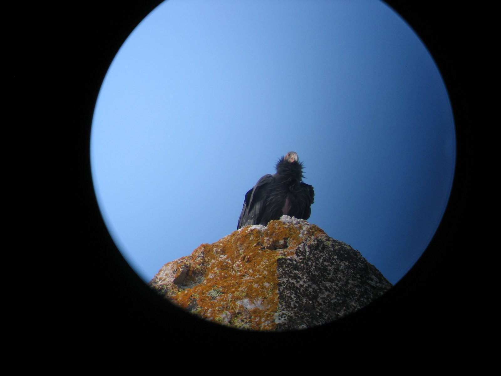
After a few moments, condor 306 glided into a thermal and circled into obscurity. She didn’t need to flap her wings once!
The park ranger was named Alacia and happened to be quite cute. So, if you summit the High Peaks, you’ll get an awesome view, you may get to see a condor and you may get to hang out with an attractive park ranger… Not a bad deal:
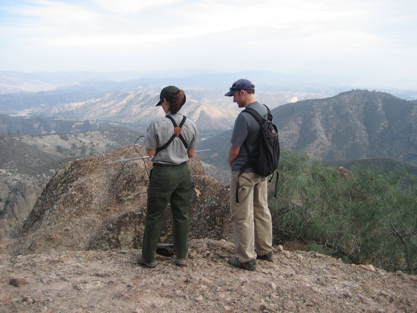
Alacia demonstrated the radio receiver she had which is quite sophisticated. She can tune into individual frequencies for each bird and tell how far away they are and which direction they are in up to 30 miles away. Obviously, the GPS units provide a much greater range. Alacia informed me that the condors can make it out to Big Sur in under two hours and that one of the more adventurous condors has flown all the way down to Ventura. She advised me that the number one threat the condors still face is from lead poisoning. They are scavengers and when a hunter or poacher kills an animal with a lead bullet and leaves the carcass behind, the condors can easily be poisoned by even the smallest of lead fragments remaining in the carcass:
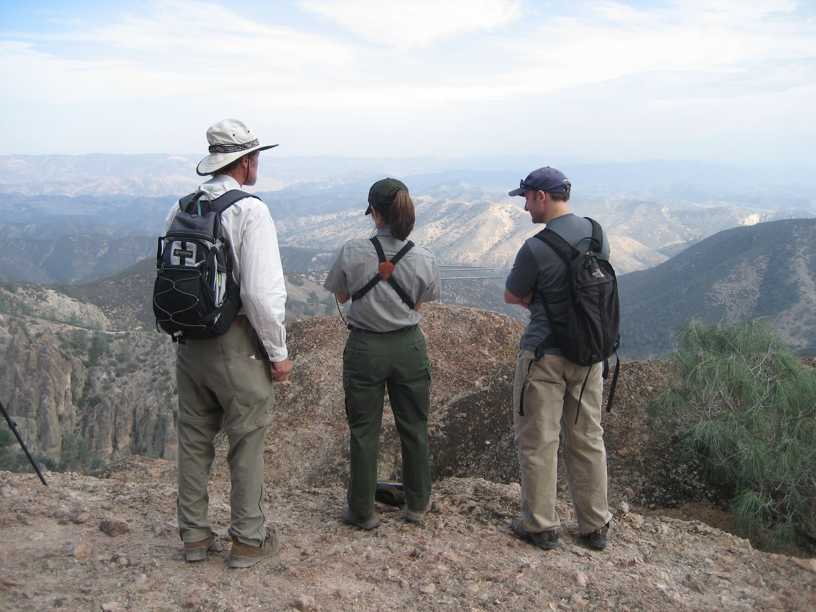
I didn’t notice any of this while it was going on, but Brandon documented the interaction quite well and insisted I include the picture below with an explanation… And once I saw the pictures, I had to agree that it was pretty funny. The guy in the picture showed up after us and kept trying to muscle into the conversation I was having with Alacia and hit on her. I think her body language says it all:
Day 3 took us up Condor Gulch Trail, where even though it is almost November, we felt like we were walking through a blast furnace. Carry plenty of water no matter what time of year you visit:
We hiked up to the Overlook which offered more climbing opportunities and then headed out of the park for home:

I woulda gone to Pinnacles with you!!!!
I would have gone with you as well, Justin.
Time to update your profile on the right!