It is often said that California’s Feather Falls is the 6th highest waterfall in the United States. Regardless of its ranking, it is a gorgeous waterfall and well worth the hike. And the hike itself offers plenty worth seeing along the way…
If you just look at a map, it looks like a bitch to drive there, but in actuality it is easy as there are plenty of signs and few actual turns.
Two trails now exist: an easier, less strenuous one that meanders for about 4.5 miles and the original, shorter version of about 3.5 miles to Feather Falls. Most people hike the lower loop into the falls and the upper loop on the return. However, some suggest taking the longer 4.5 mile loop to the falls (which is mostly all downhill), and the shorter 3.5 mile loop on the return. If you do it this way, you will have 6.5 miles of downhill hiking, and only 1.5 miles of uphill hiking on the return. The last 1.5 miles will be steep, but is not really all that bad, and is not any steeper than if you had gone in the other direction.
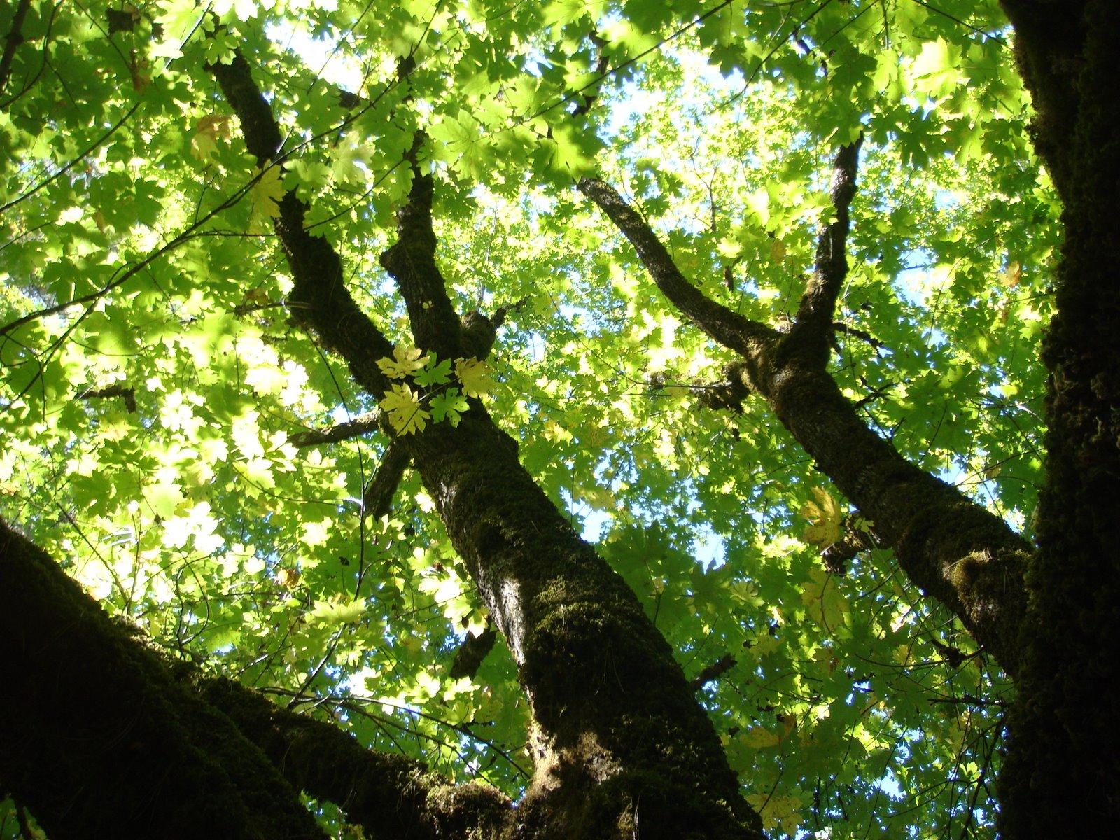
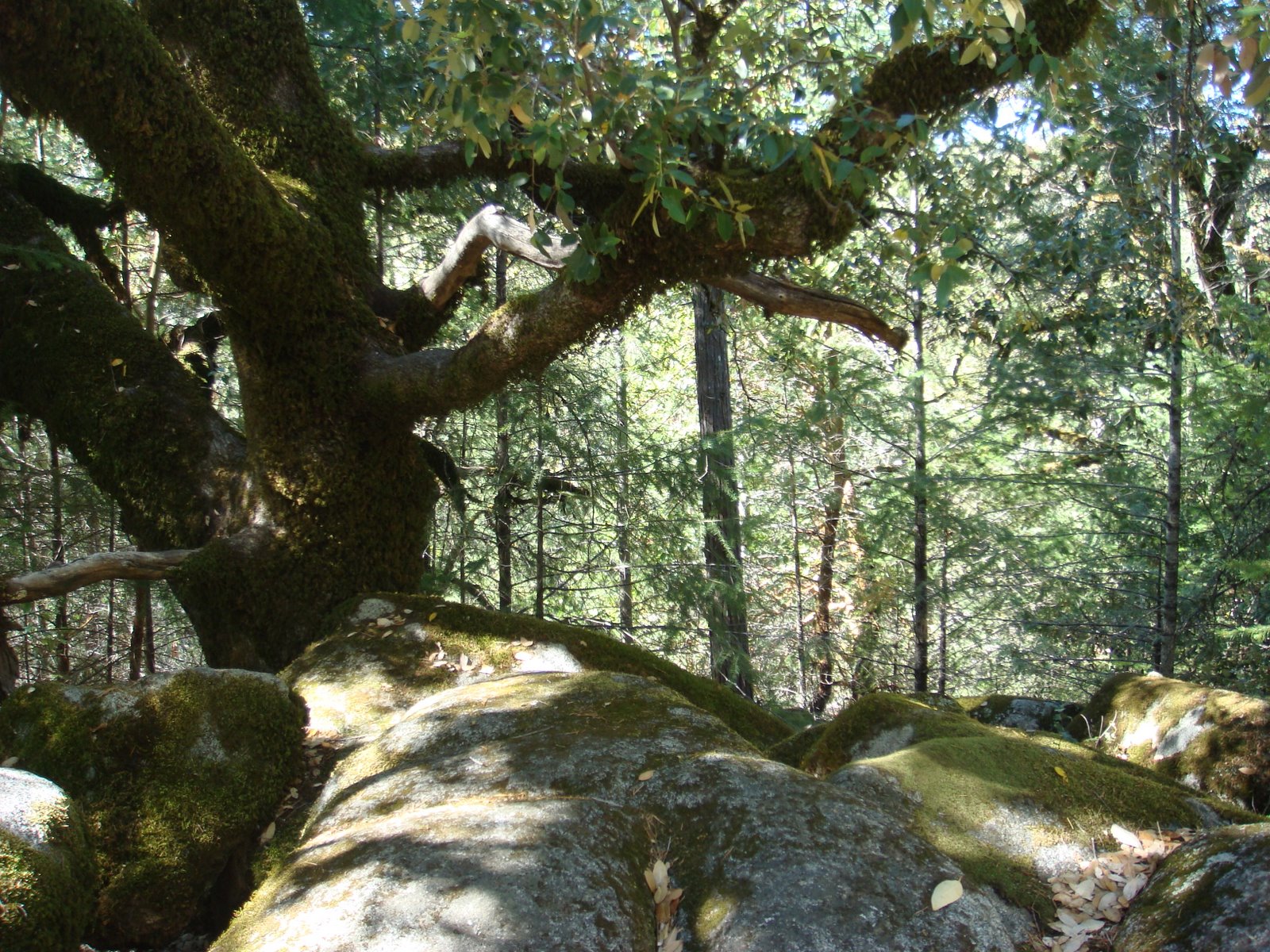
Some of the sights on the way out to Feather Falls:

Frey Creek:

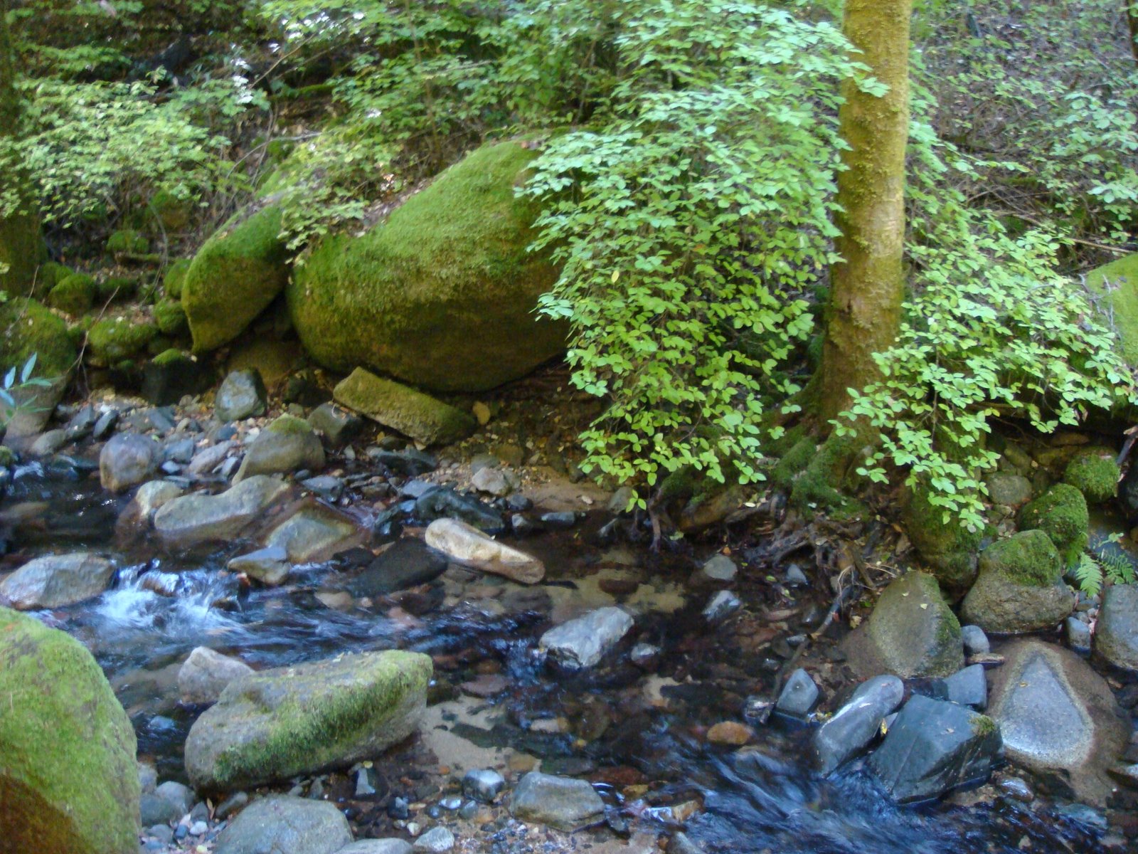
This area receives about 60 inches of rain a year, keeping the area cool and moist even during the hottest summer months. Wildlife and plants depend on the cool environment and the water for survival throughout the year:

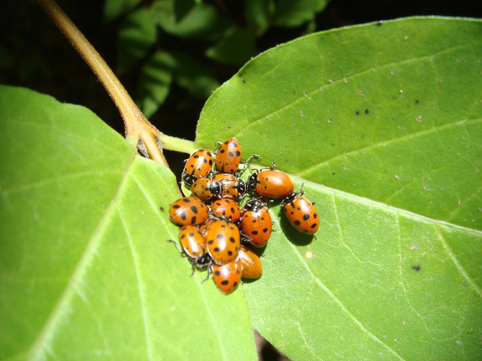
If you go at the right time of the year, you will see the clusters of ladybugs that congregate around the Frey Creek Bridge:
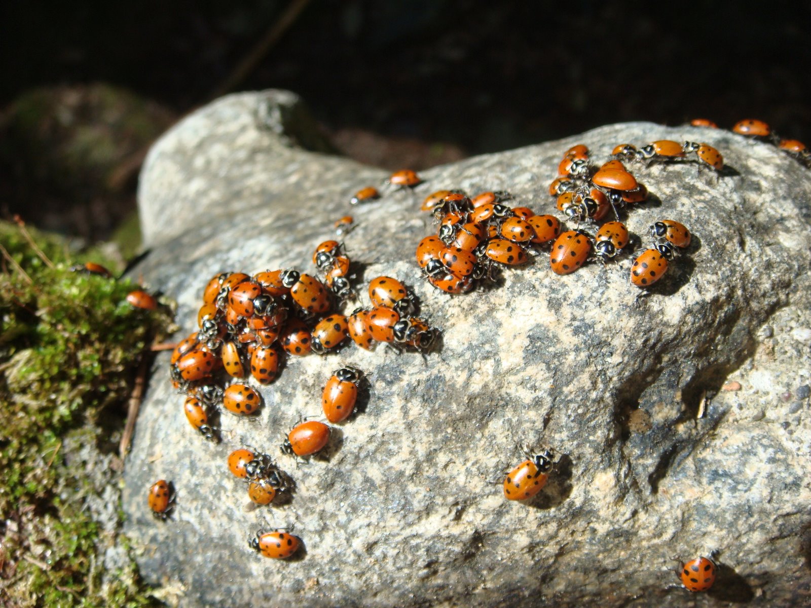
Each year the ladybugs migrate to this area to spend the winter. In spring they disperse, and travel back to the valley floor to feed:
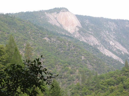
Reminiscent of Yosemite, Bald Rock Dome presents an impressive sight on the way to Feather Falls… The dome rises nearly 2,000 feet above the Middle Fork of the Feather River and Bald Rock Canyon to an elevation of 3,509 feet above sea level:

The view down the Middle Fork of the Feather River just before one starts descending the cliff down to Feather Falls:

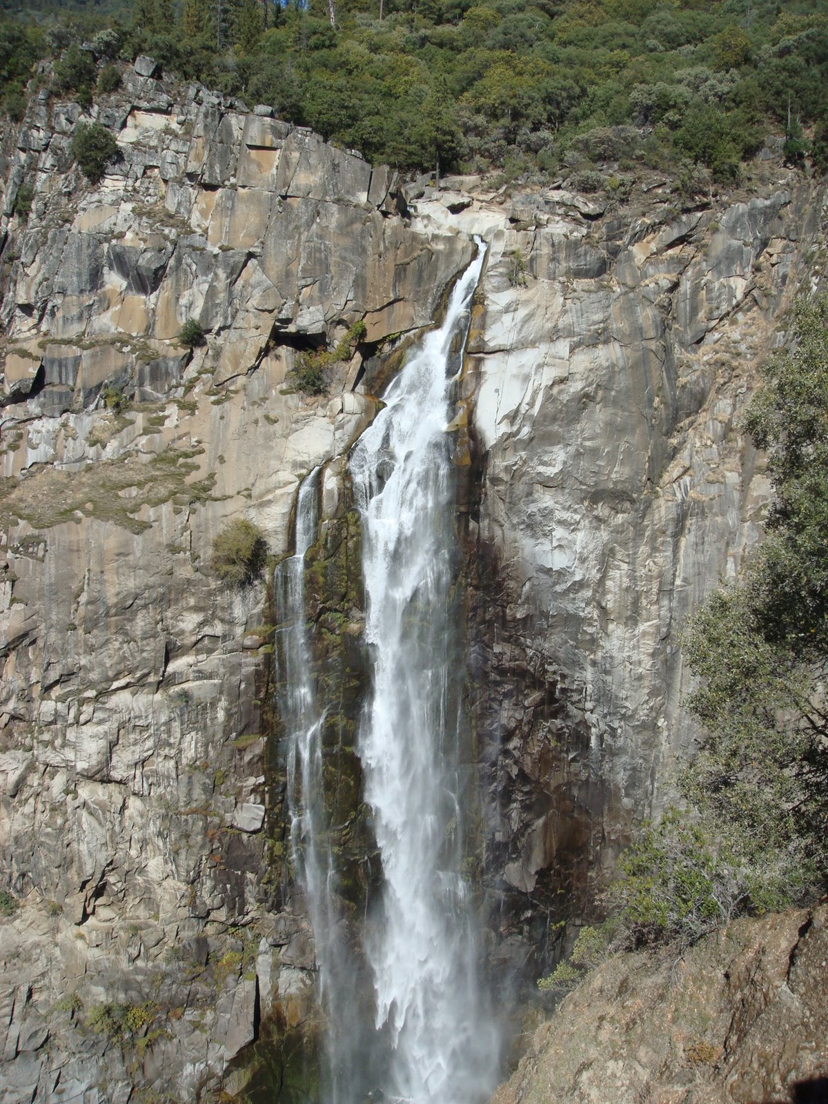
One’s first glimpse of Feather Falls will reveal just the top of the waterfall through the trees:

However, another minute or so down the trail and Feather Falls is revealed in all its glory:

Here is a video I shot of Feather Falls so you can hear just how loud the waterfall is and get a sense of how massive it is:
*
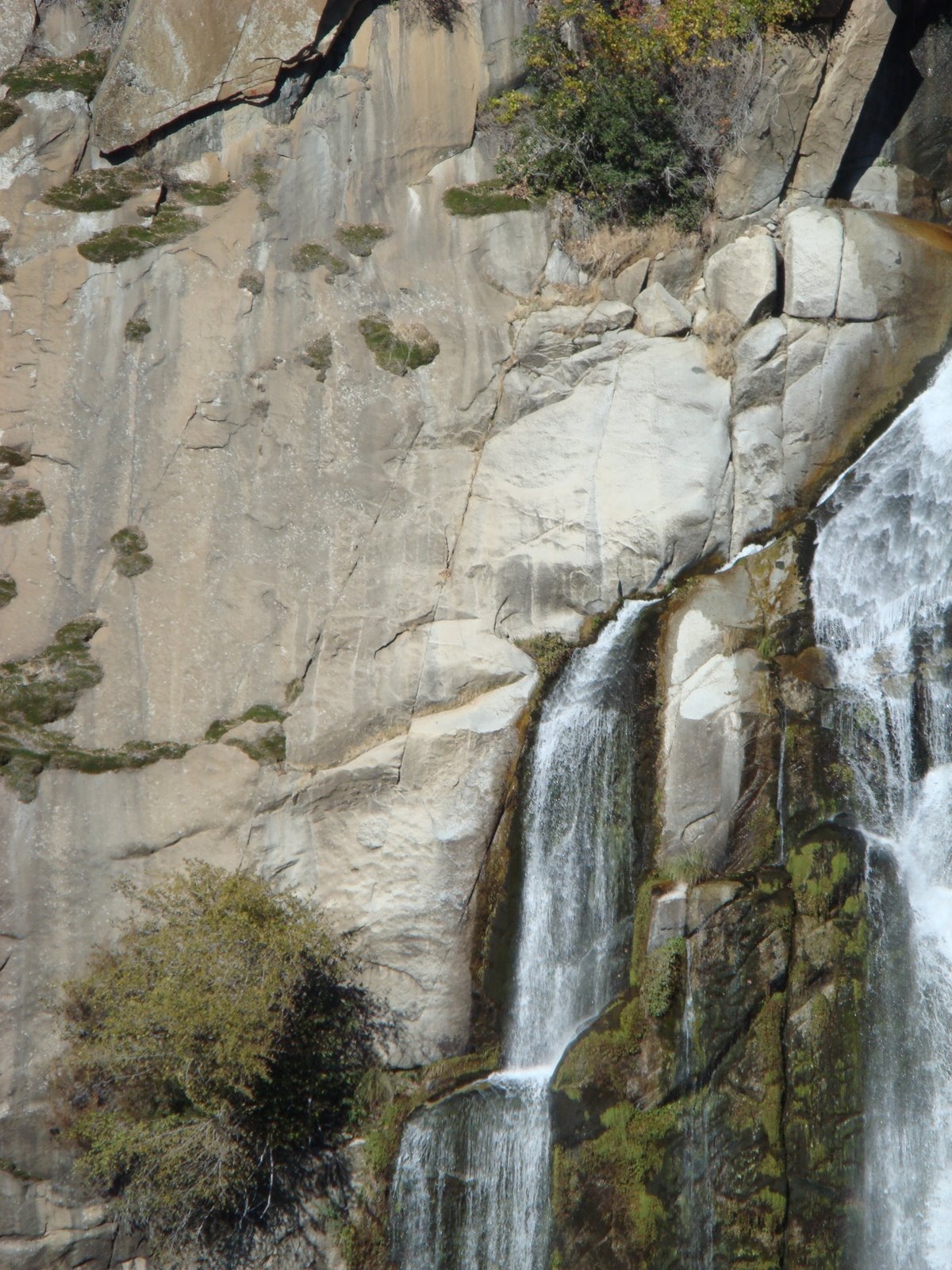
On the climb down the hillside that leads to the main Feather Falls viewing area, one will notice another trail branching off to the right. This trail wraps around the edge of the canyon and will take one to the top of Feather Falls:

At the top of the falls:
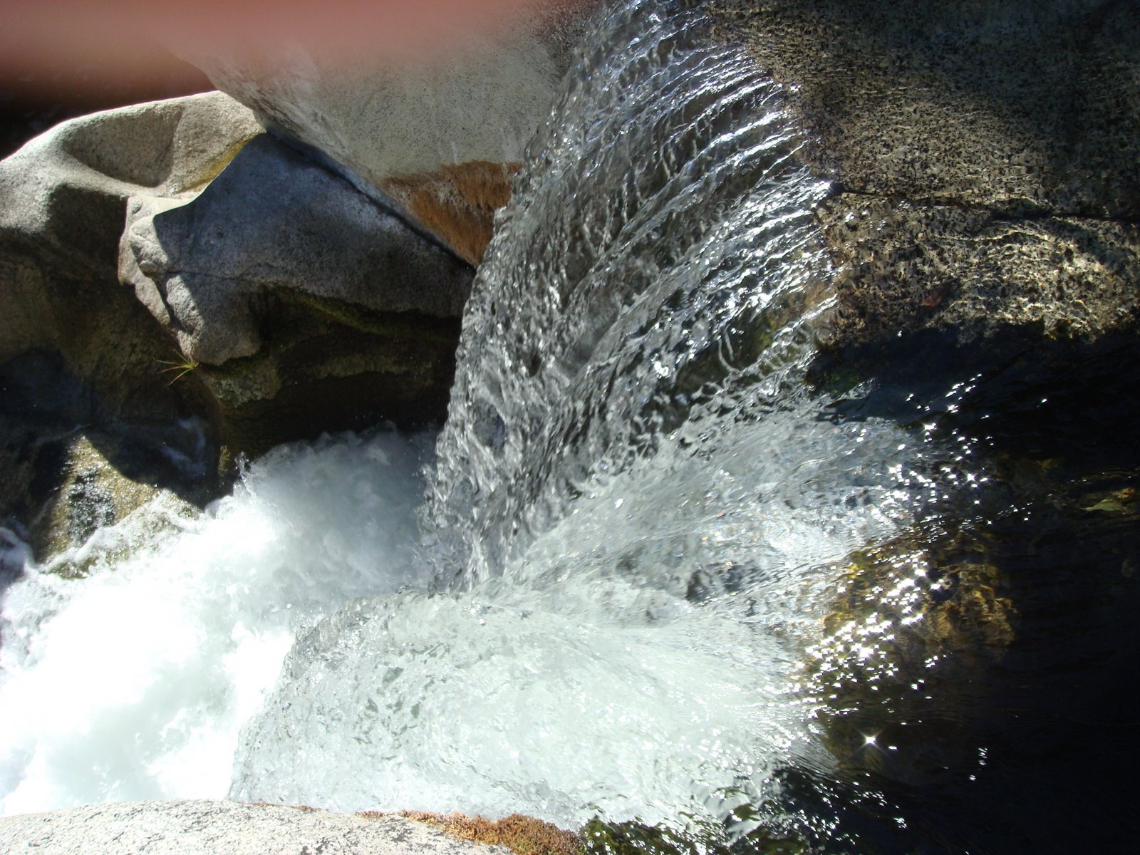

Peering over the abyss – that’s 640 feet straight down (Taking this picture made my family nervous, but I’ve got an obligation to my readers):

The video I shot at the top of Feather Falls:

Great pics! I especially like the clusters of lady bugs and the movement you captured in the waterfall.
It really is a great hike and worth seeing
Pingback: Tel Dan, The Dan River And The Largest Karst Spring In The Middle East… « The Velvet Rocket